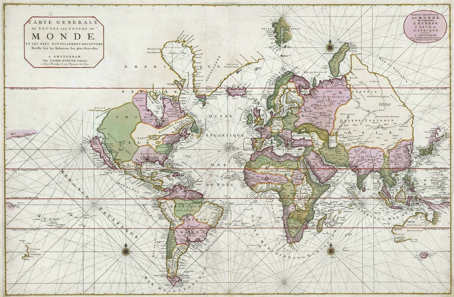
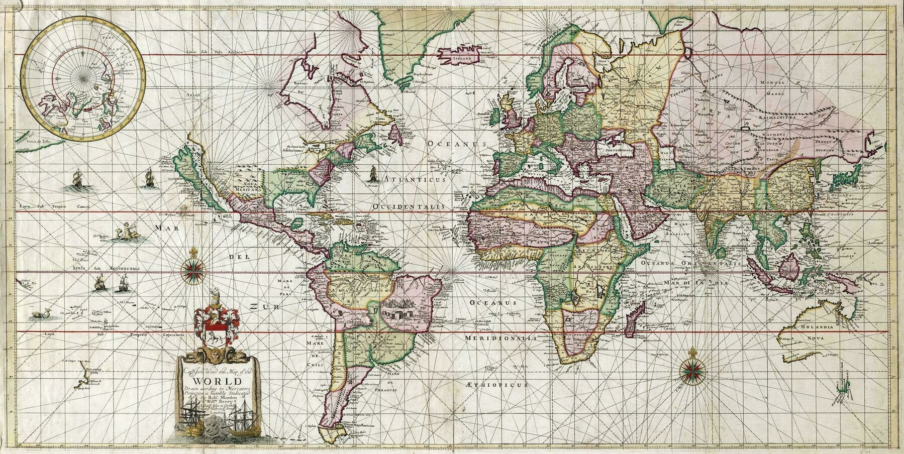
World Empires in 1900
World Empires in 1900
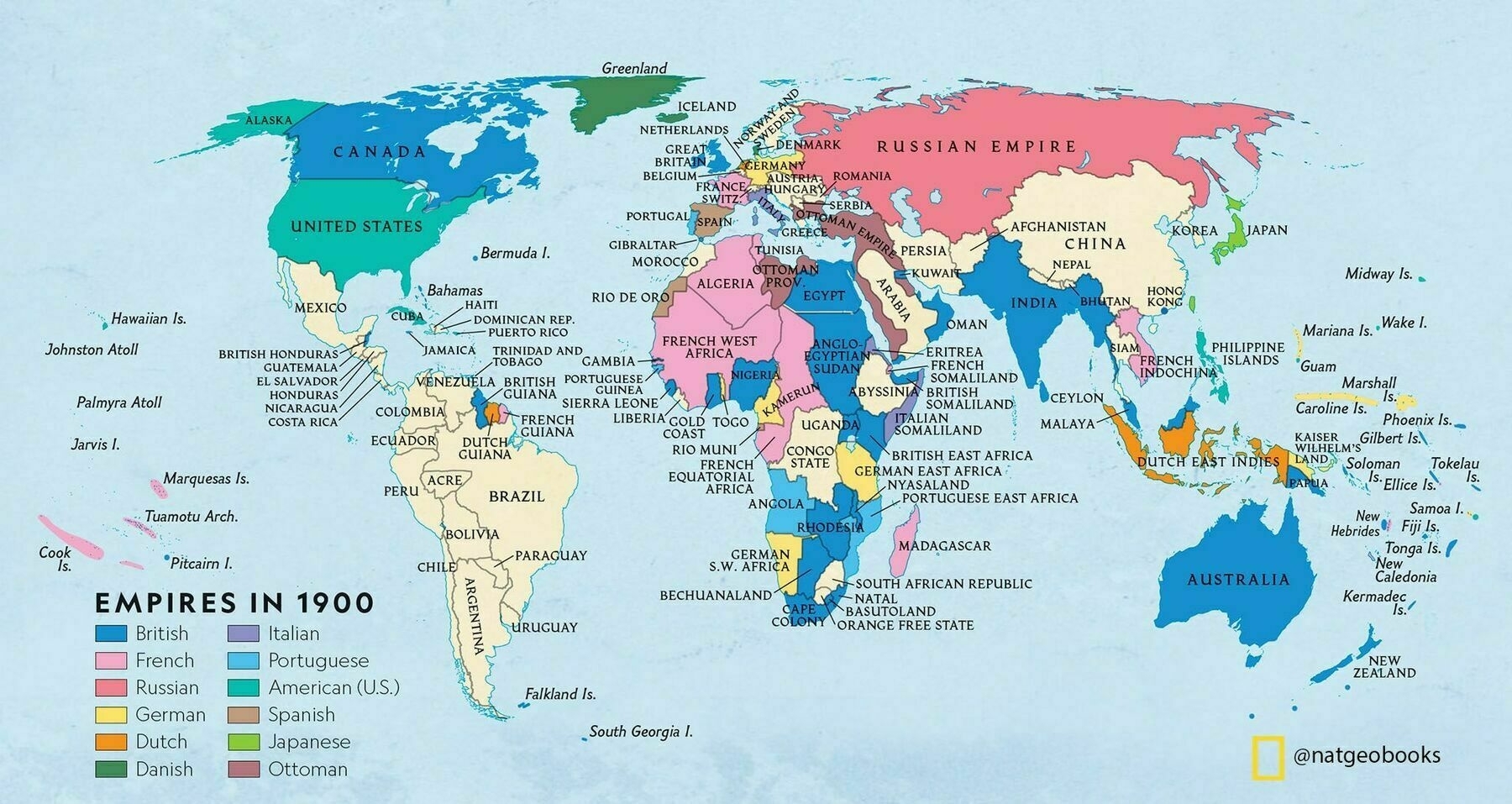
‘British in blue and France in pink is an unexpected color scheme
You’re an unexpected color scheme’
1921 map of the world - showing world leaders of the time
1921 map of the world - showing world leaders of the time
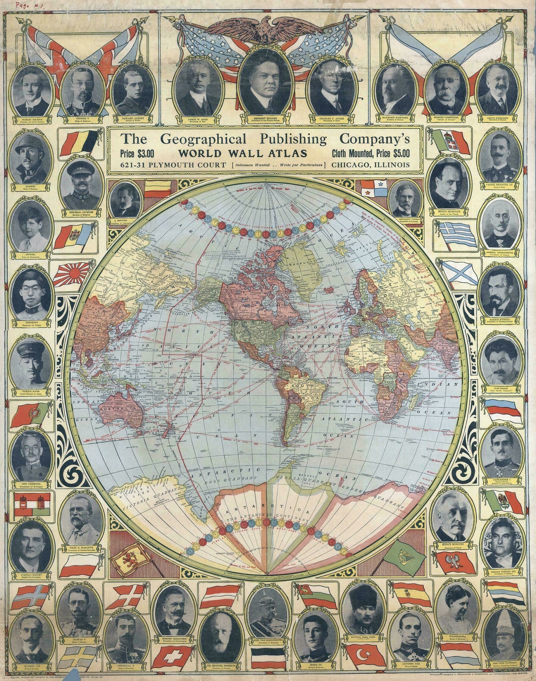
‘Fascinating to see it has a couple of phantom island groups: Nimrod Group, Emerald Island… never found!’
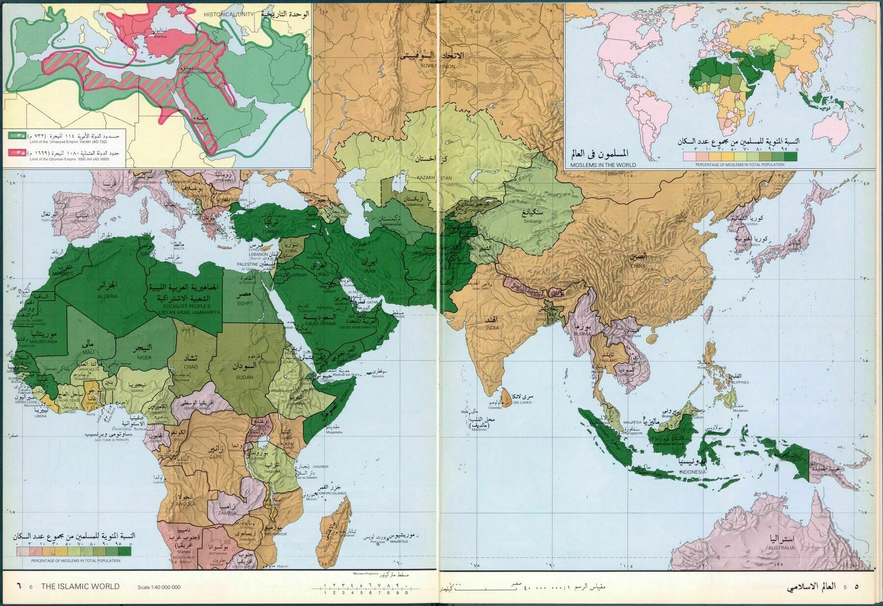
Map of the Islamic World (1978)
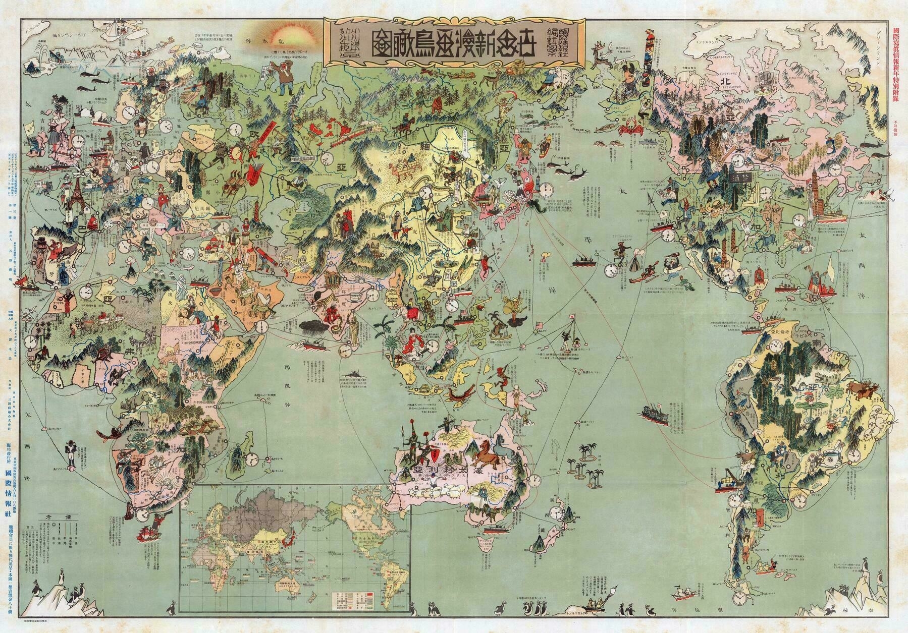
World Cartoon Bird View Map (1924)
Bacon's Map of the World in 1910
Bacon’s Map of the World in 1910
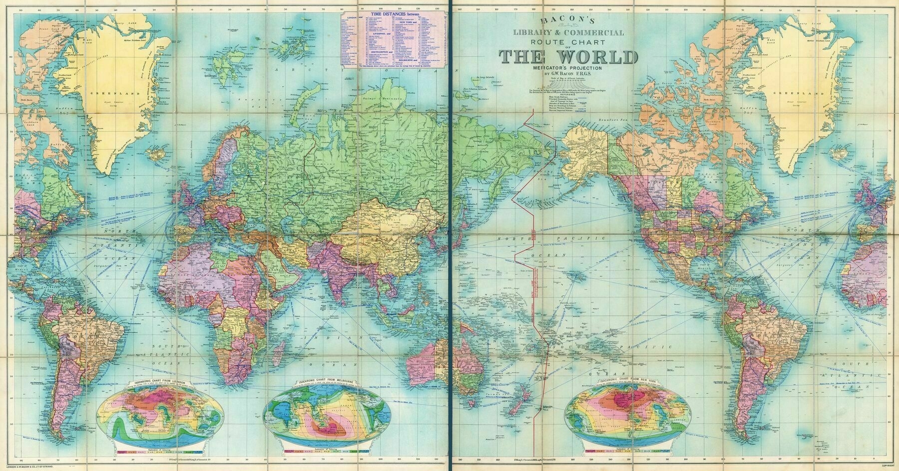
‘I love the isochronic charts on the bottom
Yea that’s crazy 40 days’
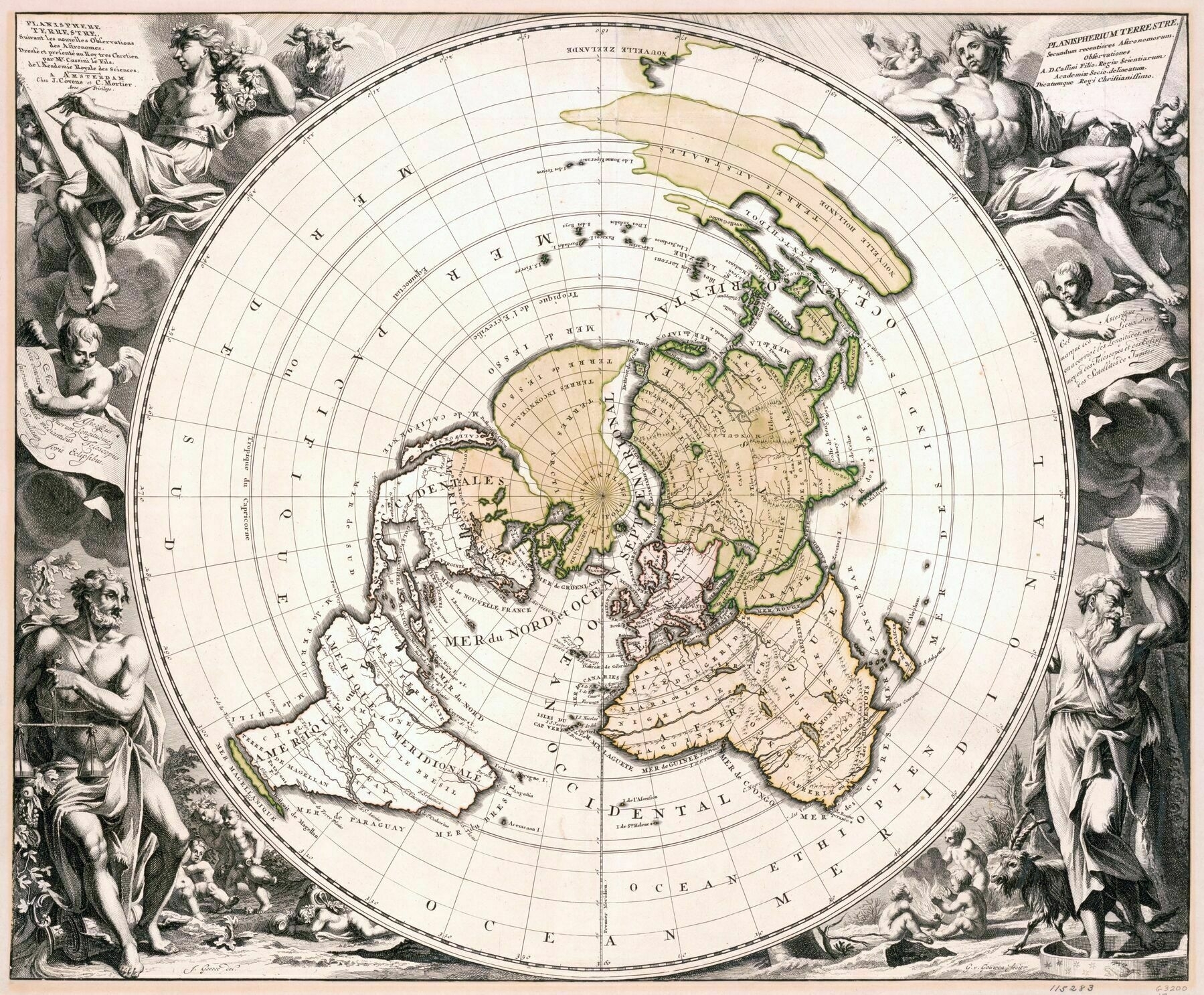
1702 map of the world, centred from the North Pole - by Heinrich Scherer
1702 map of the world, centred from the North Pole - by Heinrich Scherer
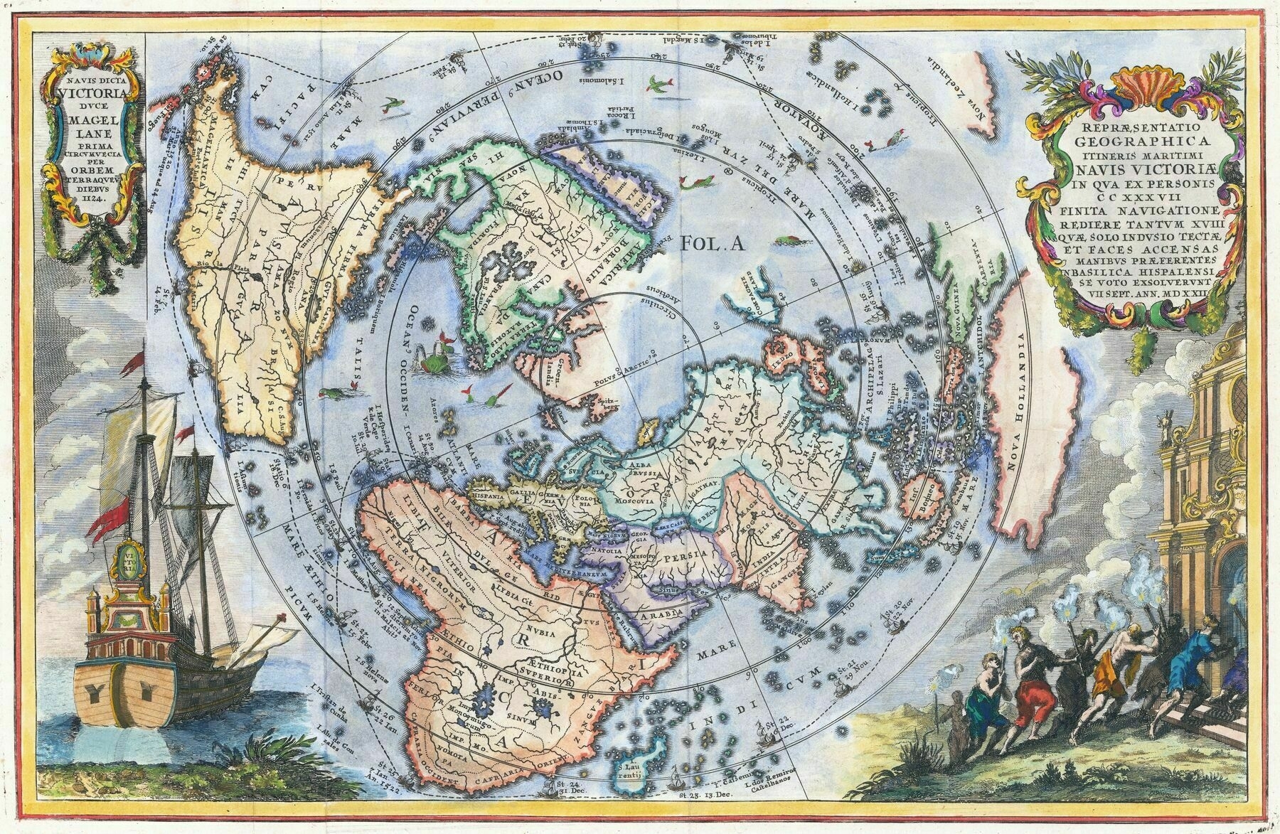
“Celebrating Magellan’s Circumnavigation in 1522. A striking map of the world on Cassini’s projection by Heinrich Scherer.
California is shown as an Island. Nova Hollandia is now clearly separated from Nova Guinea, although without a Southern Coastline”
Map showing the voyage of the 'Nippon', the first Japanese aircraft to circumnavigate the world in 1939
Map showing the voyage of the ‘Nippon’, the first Japanese aircraft to circumnavigate the world in 1939
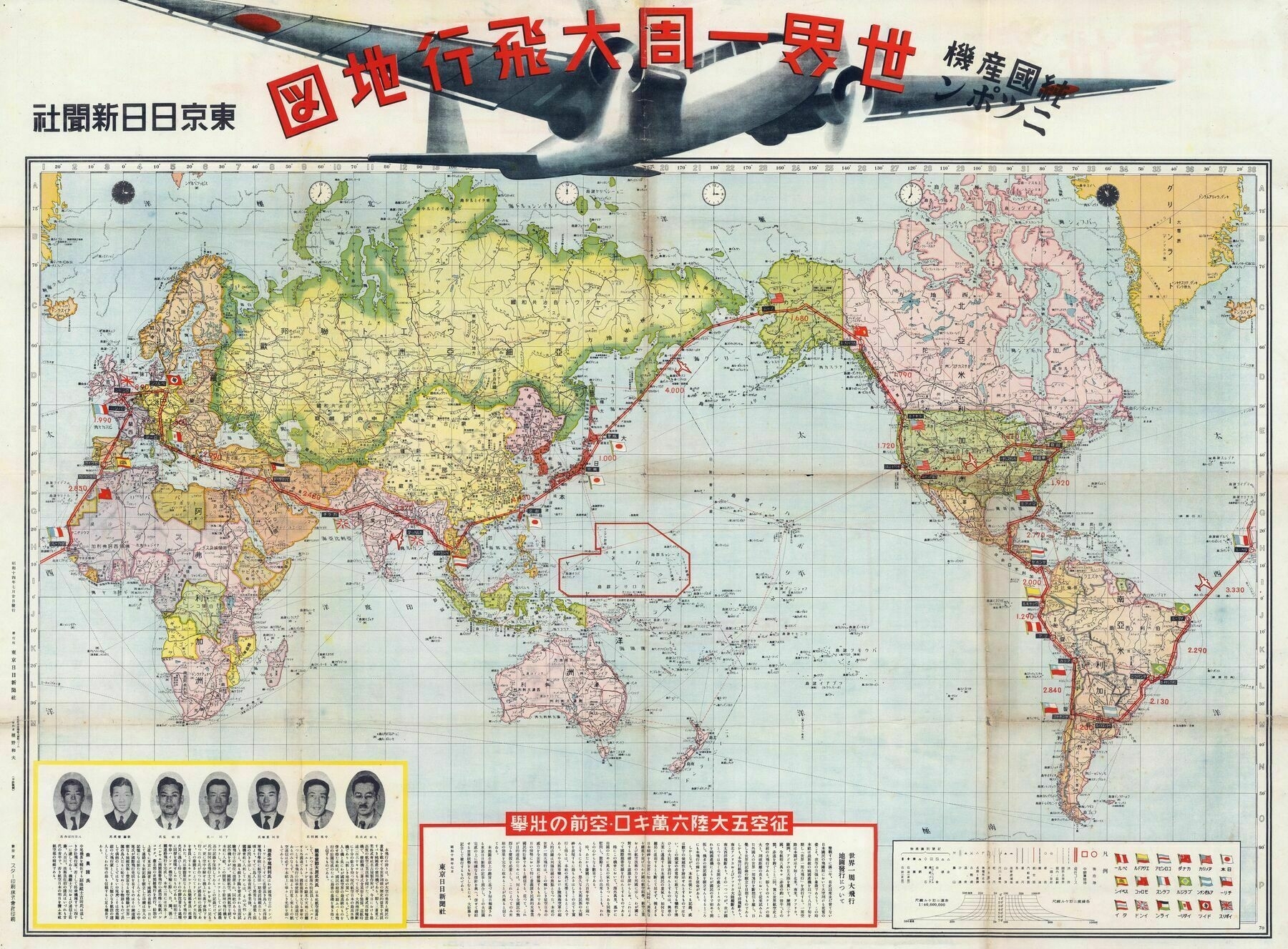
‘Wow this is so rich in Information, what local produce/resources are, where war and battle happened, Philippines is sent to be independent from the US in 1945, how many ethically Chinese are there in SEA, how many ethically Japanese in Hawaii, how many Jewish in North America etc. So cool’
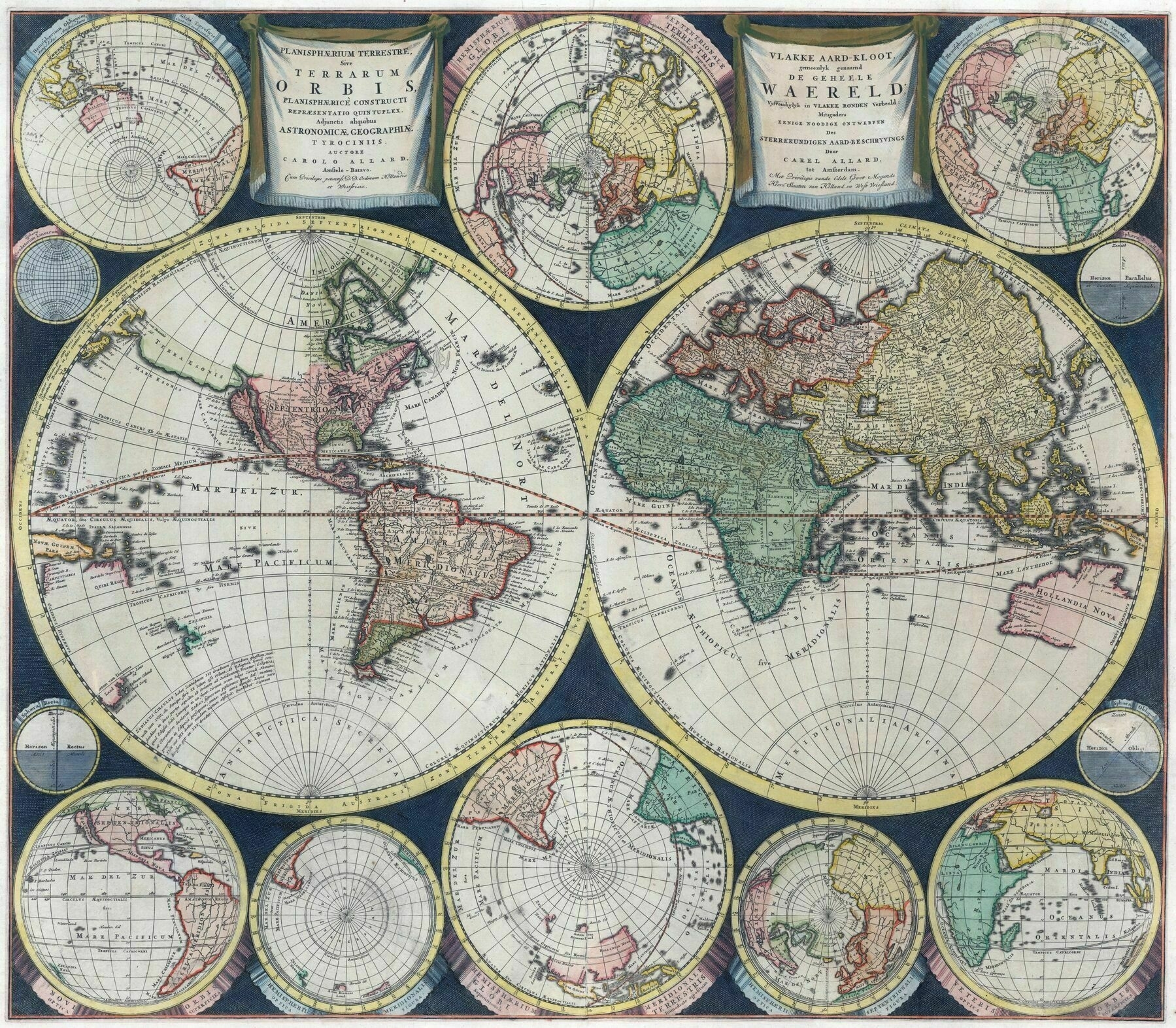
1696 multi hemispheric maps of the world - by Carel Allard
1693 world map - by Pierre Mortier
1688 map of the world - by French cartographer Pierre Du Val
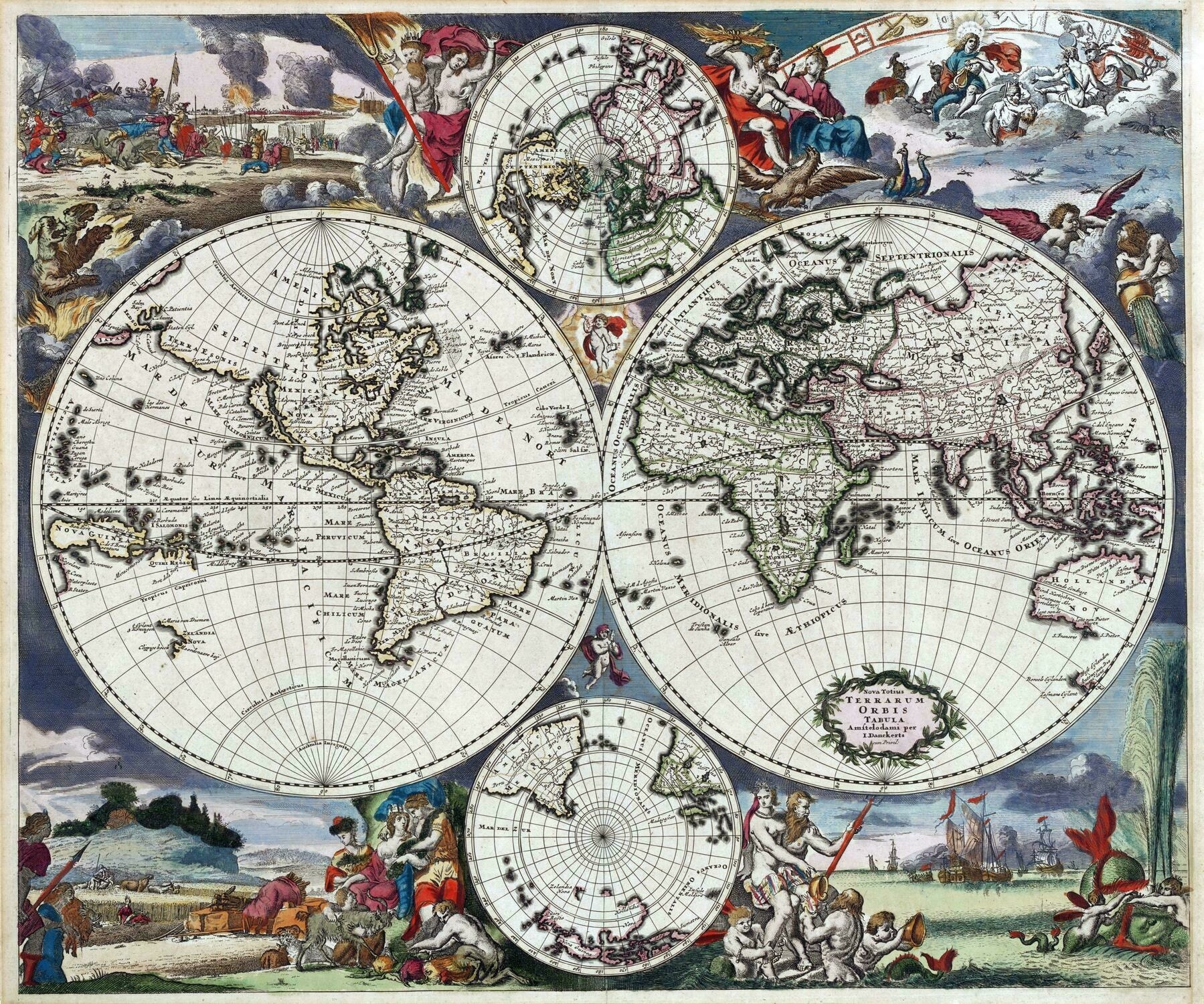
1685 double hemispherical world map, with two polar circles - by Justus Danckerts
1685 double hemispherical world map, with two polar circles - by Justus Danckerts
1828 world map showing temperature regions, and the optimal temperature zones of various vegetables
1828 world map showing temperature regions, and the optimal temperature zones of various vegetables
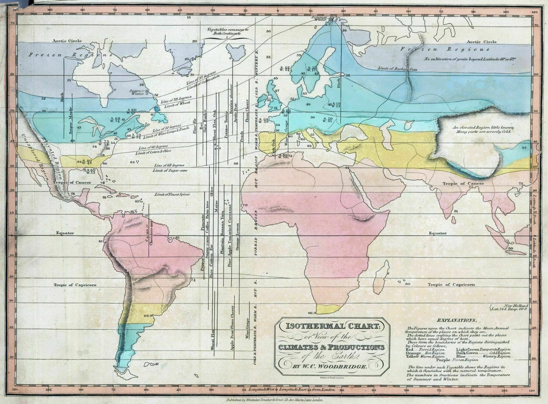
‘Part of me longs to live in a time when unknown territories like “Frozen Region” and “Unexplored Region” are a thing. Oh yeah, and also “an elevated Region little known. Many parts are severely cold.”’
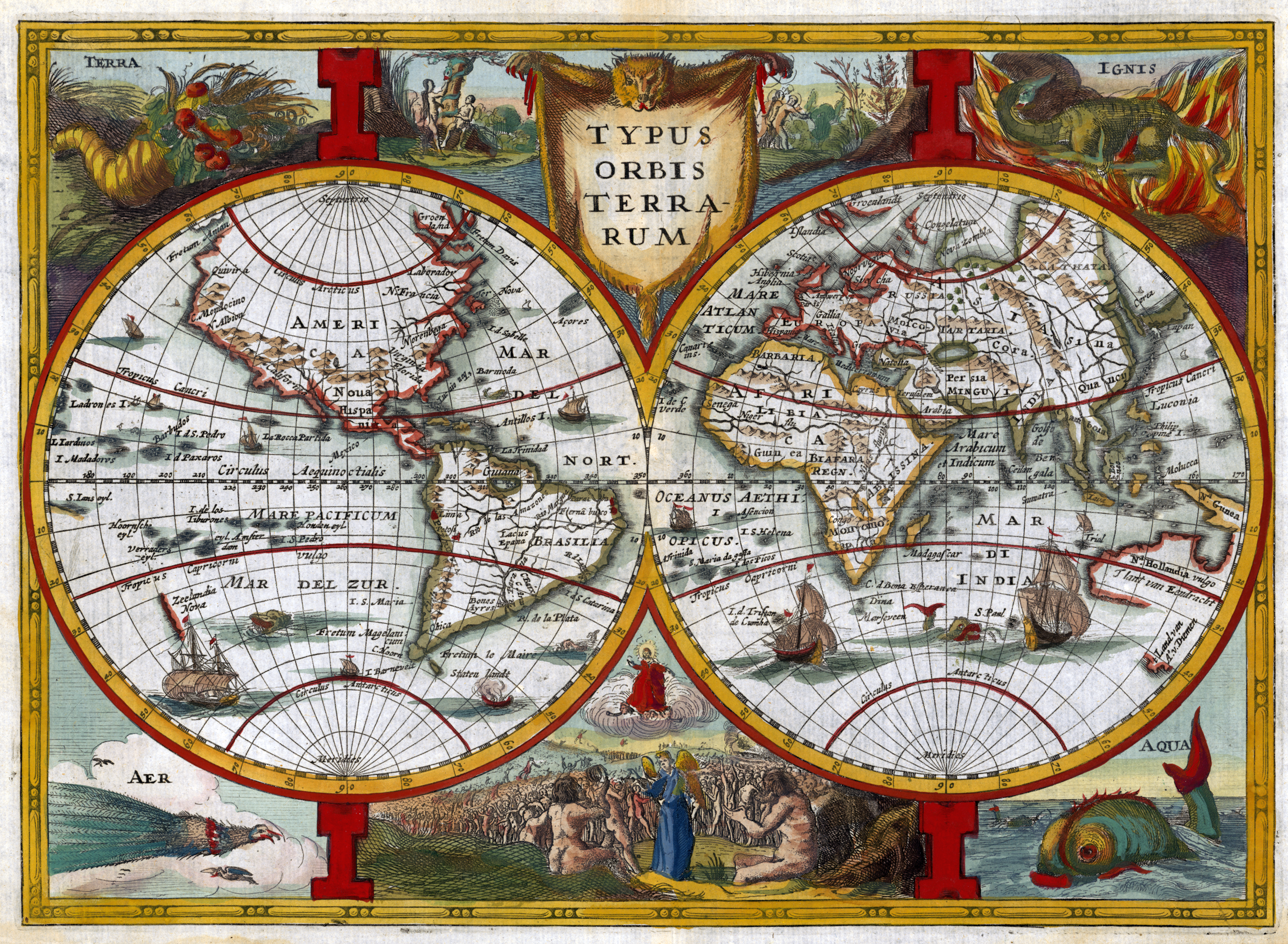
1673 highly decorative double hemispherical map of the world
1673 highly decorative double hemispherical map of the world with the four elements depicted in each corner of the map
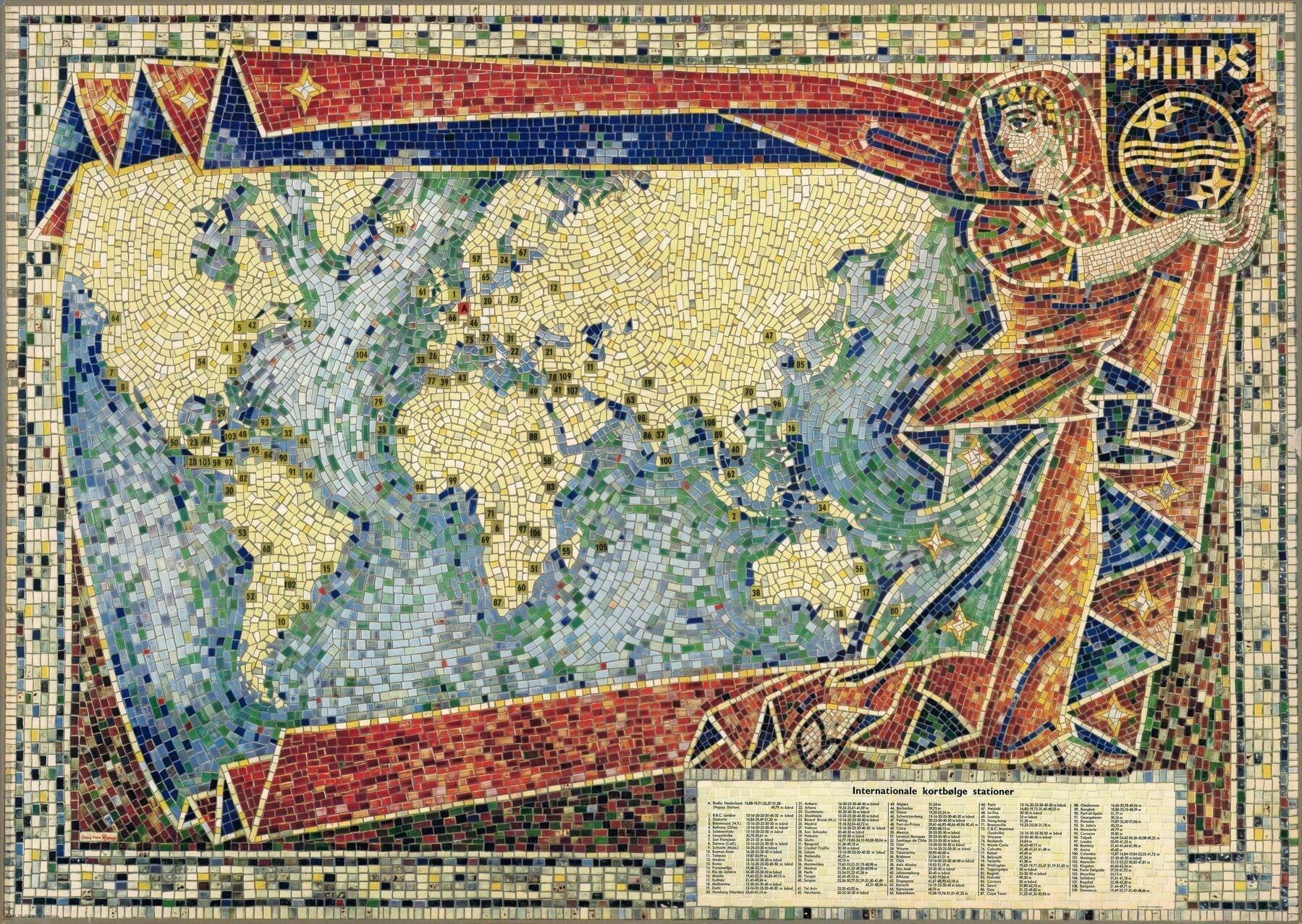
1953 world map showing the locations of international short wave stations - by Louis van Roode
1953 world map showing the locations of international short wave stations - by Louis van Roode
1849 map of the world
1849 map of the world
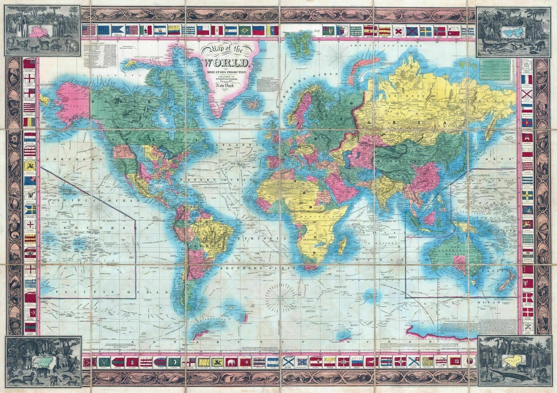
‘This is incredible. Fascinating to see what’s right and wrong’
Seaports in the World
Seaports in the World
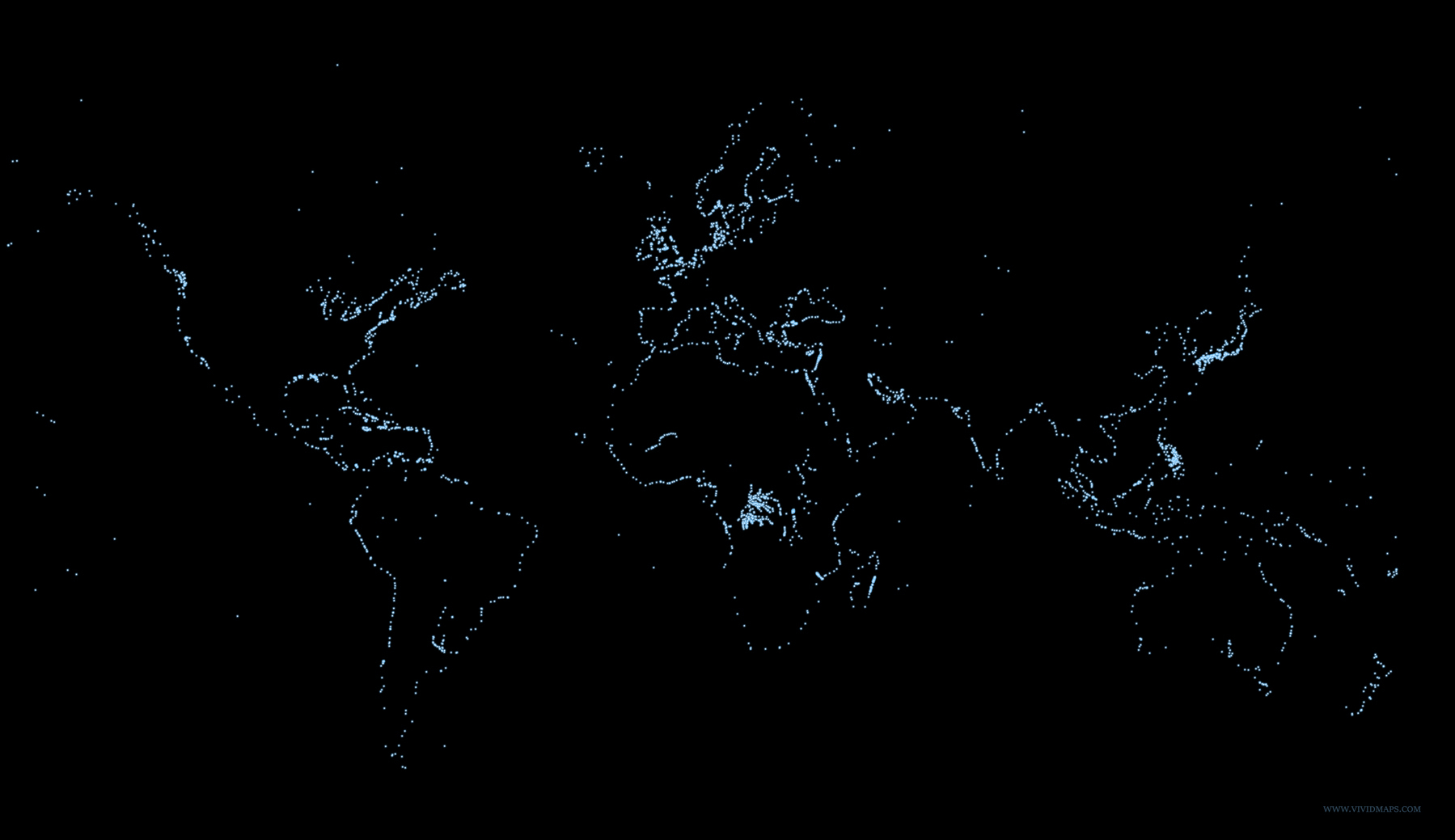
‘It’s fascinating that the ports are between land and the ocean’
The World in proportion to Trump Tweets
The World in proportion to Trump Tweets
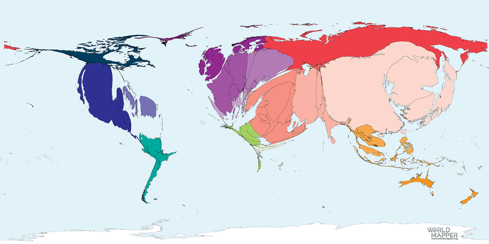
‘I love how New Zealand just looks the same as normal’
Dogs and cats of the world (1973)
Dogs and cats of the world (1973)
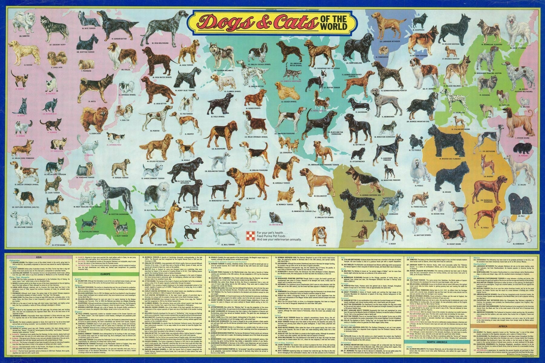
‘Angora is a Turkish cat, origined from Ankara.
It looks like Van Cat which is also Turkish cat but kinda different’
1754 Terrestrial Globe (with cover) - by Nathaniel Hill
1754 Terrestrial Globe (with cover) - by Nathaniel Hill
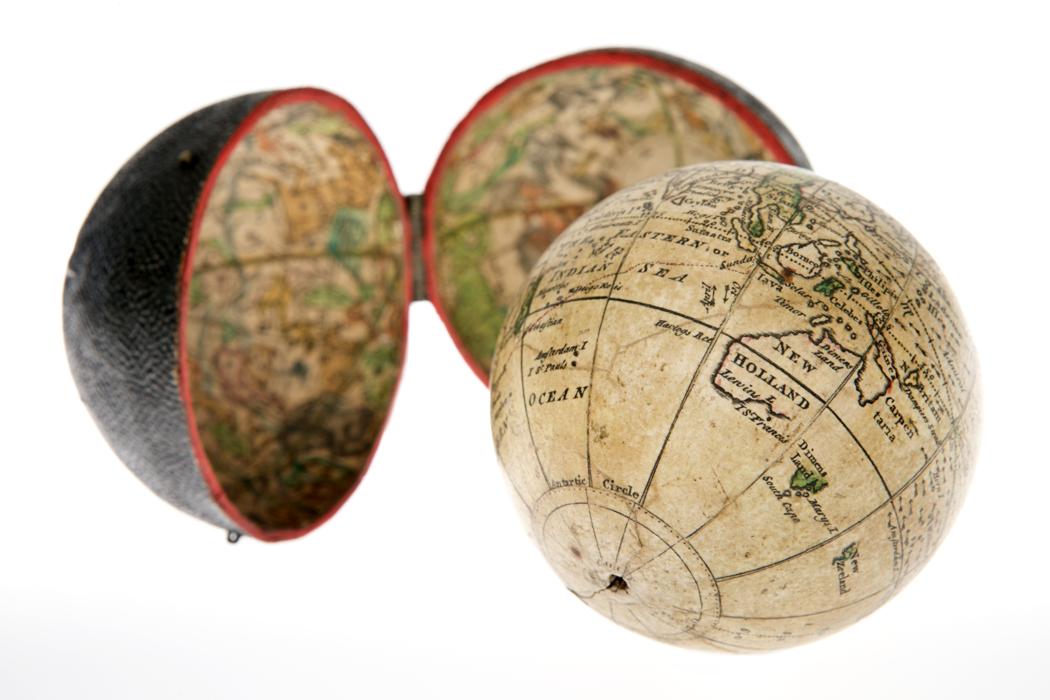
‘World in a nutshell’–Mercadi
Double hemispherical world map from 1750
Double hemispherical world map from 1750
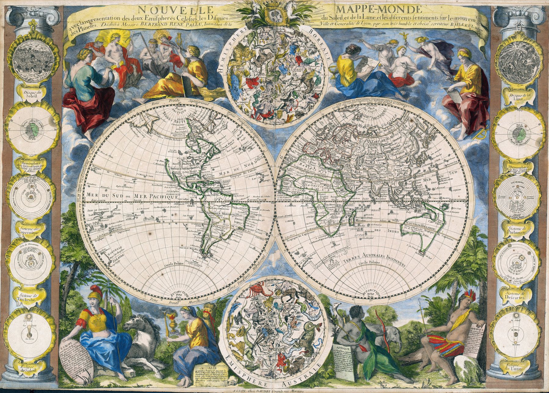
‘Maps from the first colonial era are fun. This one struggling a bit with Australia - it’s like it has an elephant’s trunk. I also like that the northwest corner of North America just fades into the sea’–chapeauetrange
A Hippies interpretation of the World from 1969
A Hippies interpretation of the World from 1969 - most likely while being in an altered state of consciousness
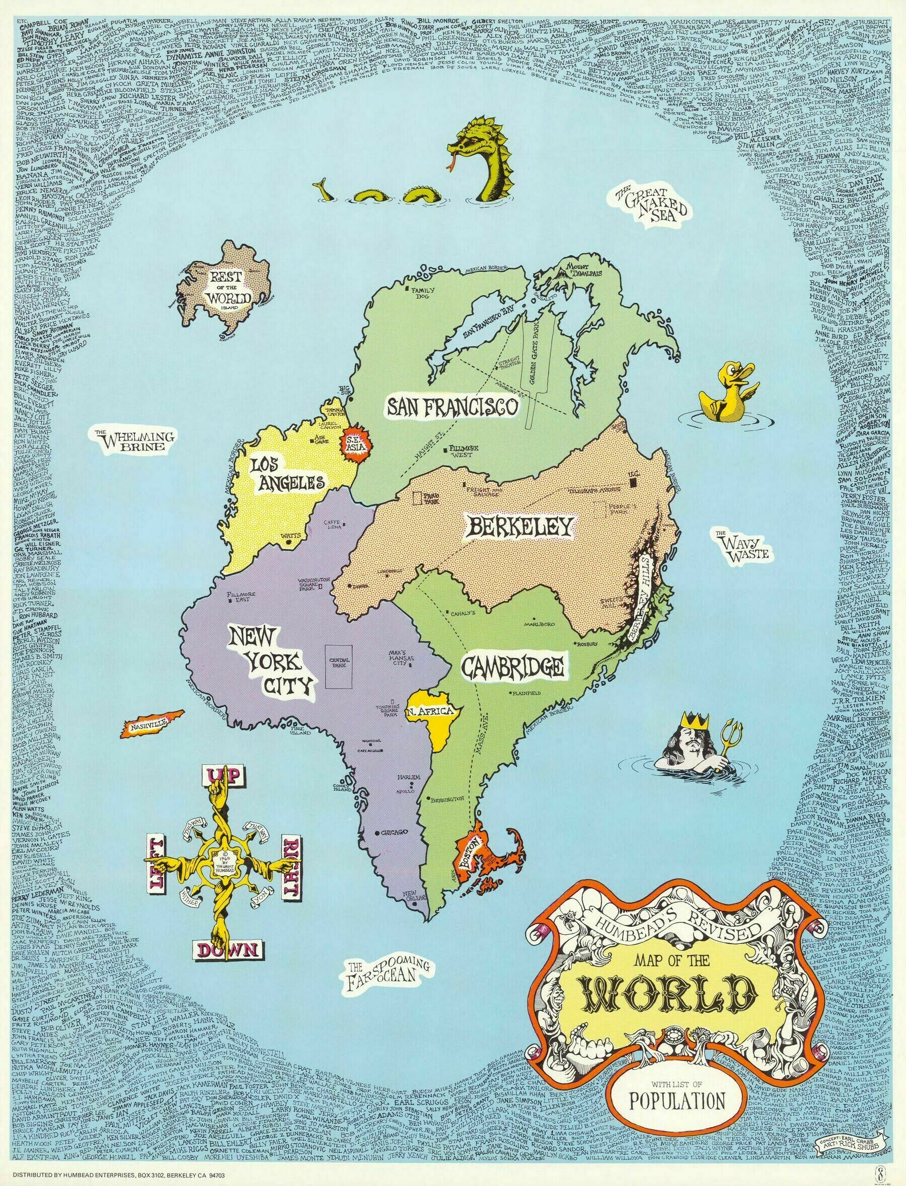
‘sigh … a world too perfect …’–tomatojamsalad
1854 map of the world on Mercator's projection showing the routes of Cook's fateful 3rd voyage
1854 map of the world on Mercator’s projection showing the routes of Cook’s fateful 3rd voyage ; also with comparative tables of the heights of mountains and waterfalls, and other illustrations
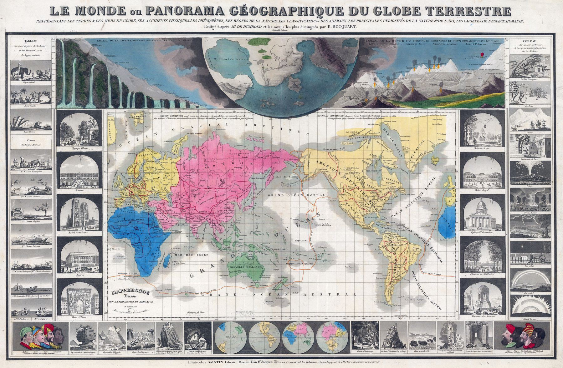
‘Interesting seeing that they considered the Indian and Pacific to be one mega ocean’–KolonelJoe
Thematic maps of the world from 1874
Thematic maps of the world from 1874
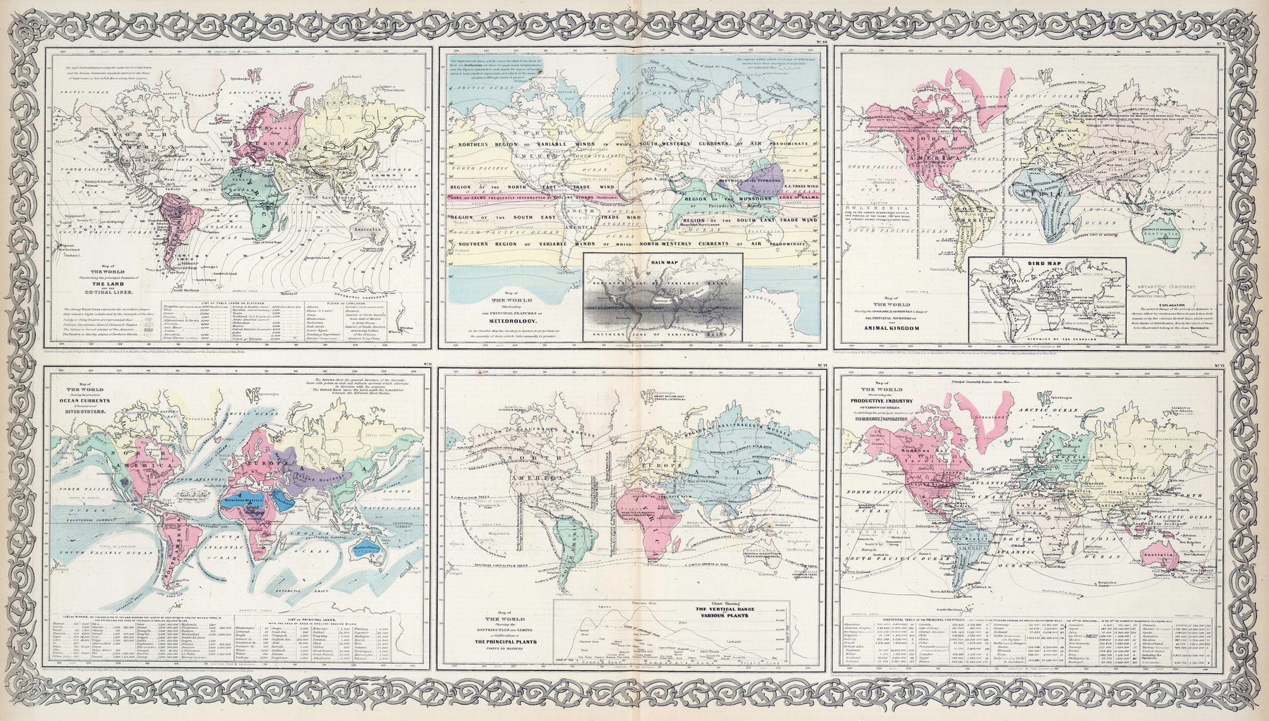
‘I have to say, seeing a collection of thematic maps from the late-19th where none is about race is actually quite refreshing’–lycheesmakemehappy
Locations straight across the ocean from the coasts of all the continents
Locations straight across the ocean from the coasts of all the continents
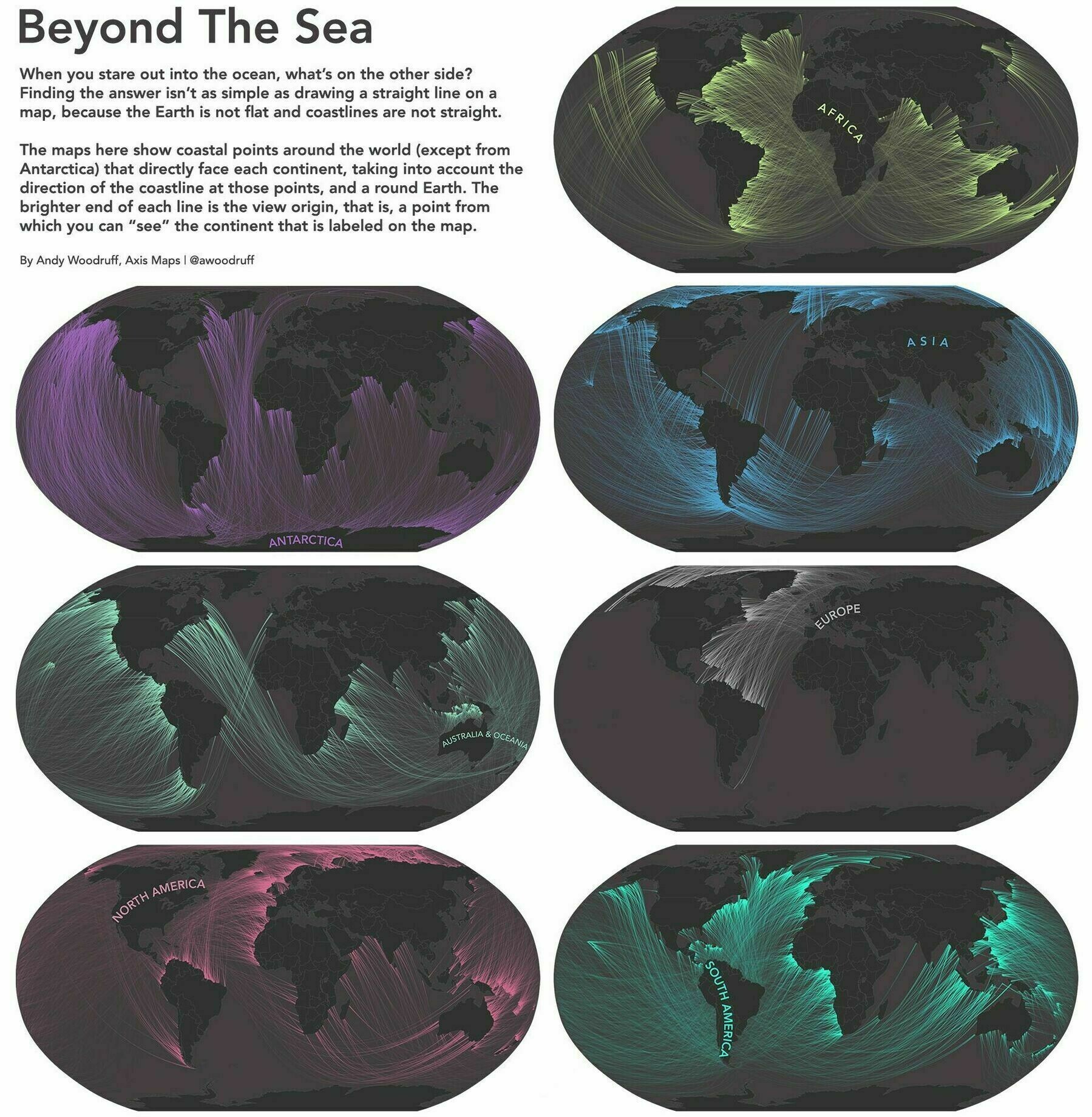
‘Mind-boggling. Imagine standing on the beaches of southern Madagascar and knowing across the water are the Aleutian islands of Alaska’–idlikebab

