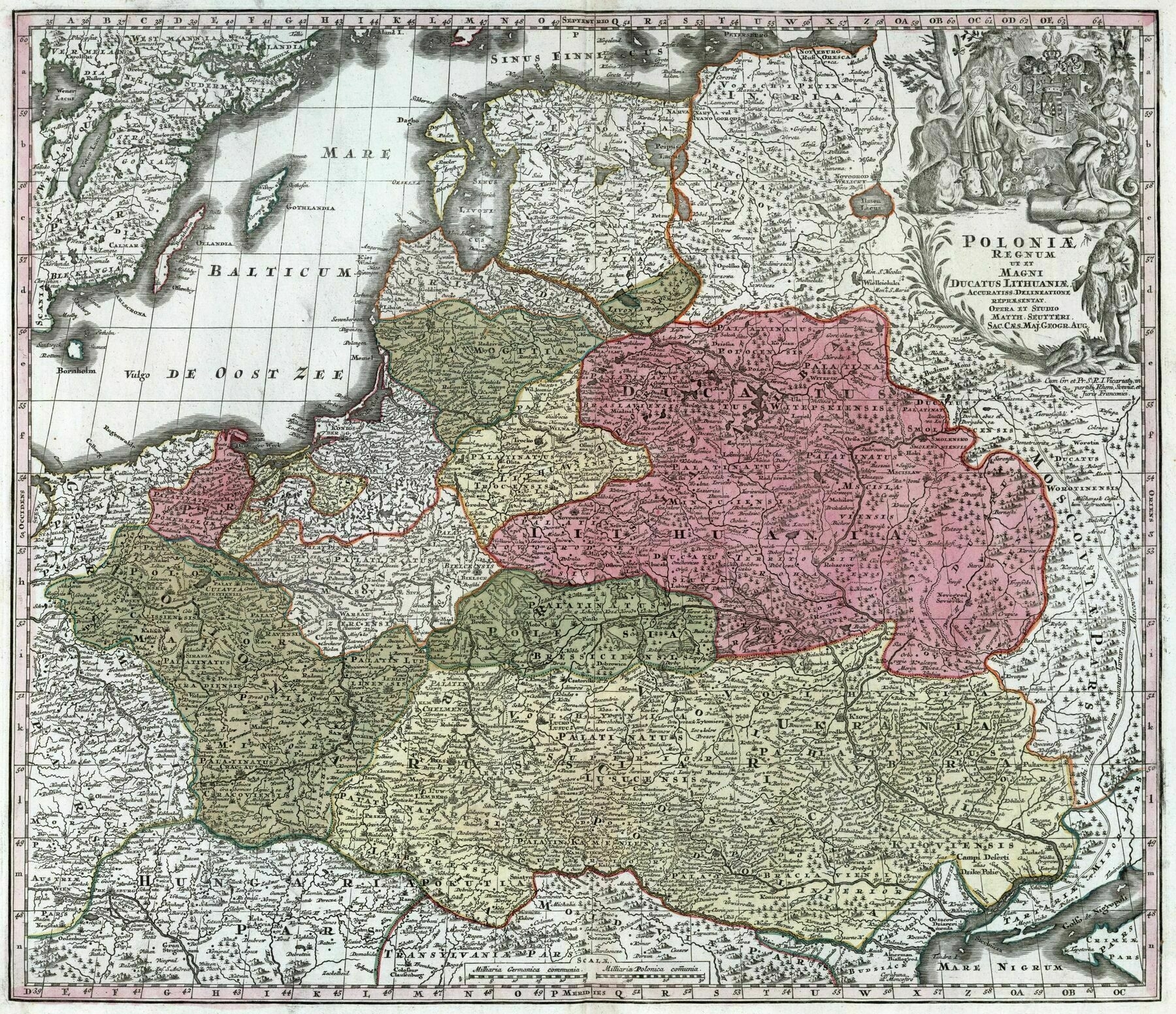
1939 map of Russia in Europe and its border states [6827 x 8101]
1939 map of Russia in Europe and its border states
‘This is super interesting. Thanks for posting!’
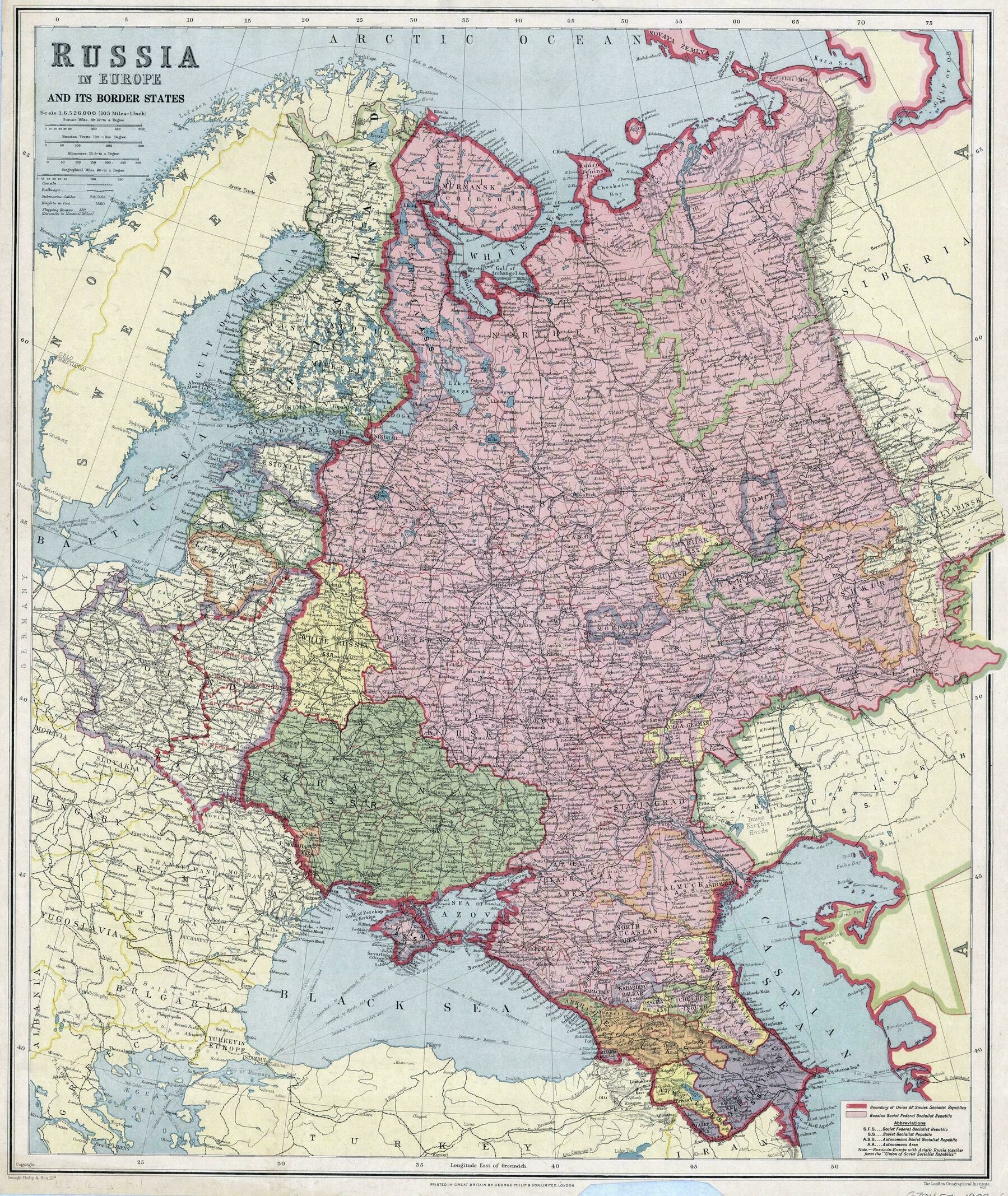
1834 map of Russia and Poland - by John Arrowsmith
1834 map of Russia and Poland - by John Arrowsmith
‘Interesting seeing Nowy Targ as Neumarkt
Also worth noting that Poland wasn’t entirely under Tsarist rule, but also Habsburg and German states’
Ethnicity map of Ukraine (2016)
Ethnicity map of Ukraine (2016)
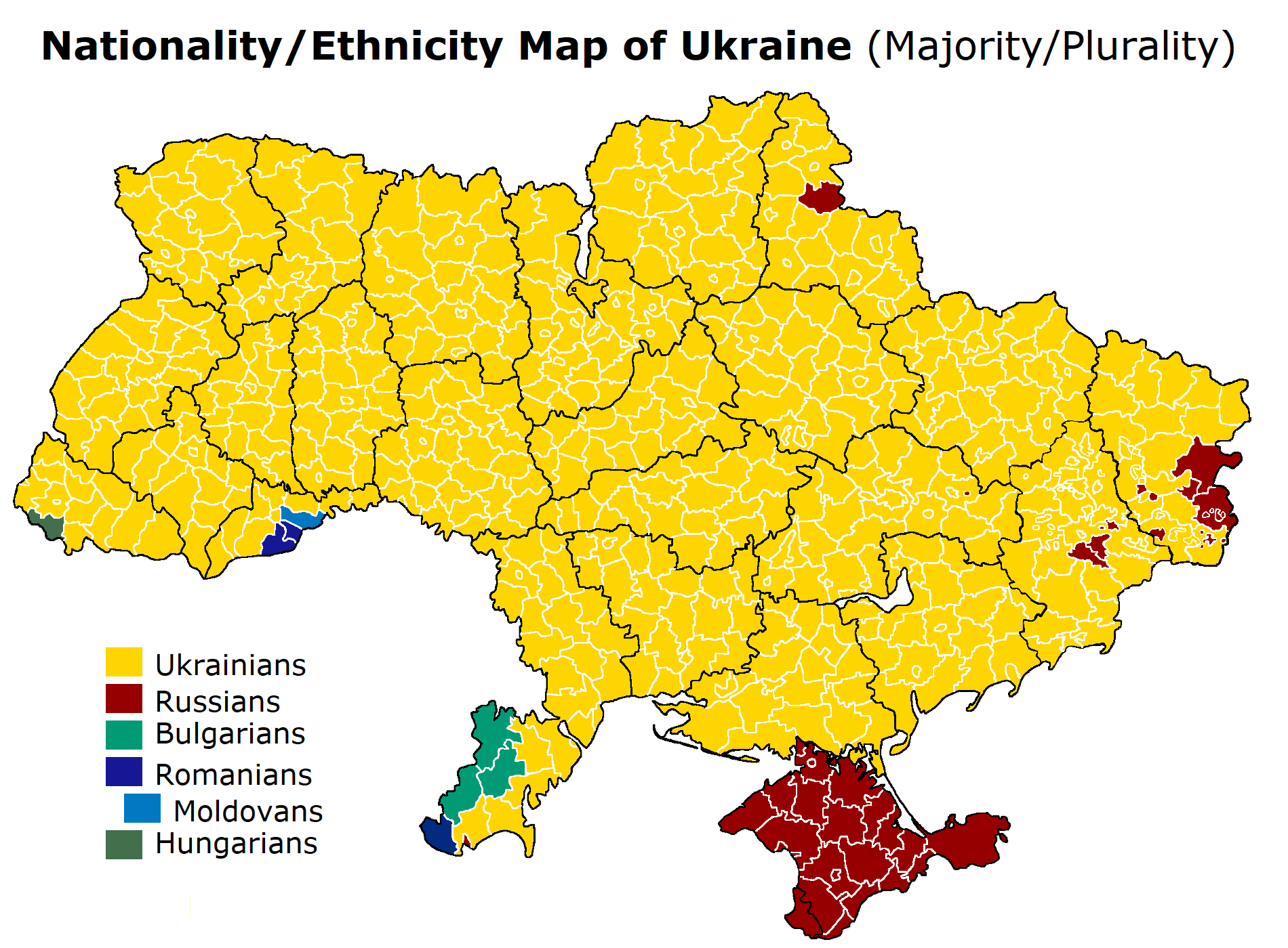
‘It is really controversial. In Ukraine there is no official definition as nationality in any state-issued documents. So when somebody gets a citizenship they automatically become “Ukrainian” for the government. The question to implement the nationality is widely spoken but blocked from the above. I personally had a chance to face the government on that question when I needed at least some official paper which would admit my wife’s German ancestry. All her ancestors were ethnic Germans and in the USSR they had clearly stated nationality in all their documents. But in Ukraine, my wife just became Ukrainian citizen. No nationality anywhere. So I am very sceptical about any map about ethnic groups in Ukraine made by any gagency based on state data
While spoken community language does not equal to ethnicity 1:1, there is a correlation. And there are way more Russian speaker plurality rayons than indicated above. The “truth”, if there is any, might be between the two
I’m the opposite example. I was born in Russia, but ethnically ukranian. I don’t speak ukranian language and don’t have ukranian citizenship. So I’m ukranian for russians and russian for ukranians’
Map of Carpatho-Ukraine, an independent republic lasting only one day (March 15, 1939)
Map of Carpatho-Ukraine, an independent republic lasting only one day (March 15, 1939)
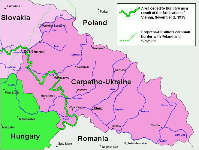
“It arguably holds the record for shortest-lasting (de facto) independent nation, in close (and undetermined) competition with the Republic of Benin, proclaimed by Biafran rebels having successfully breached into Nigeria and already on the retreat on 19 September 1967. The area was overrun by Nigerian forces later the same day”–PisseGuri82
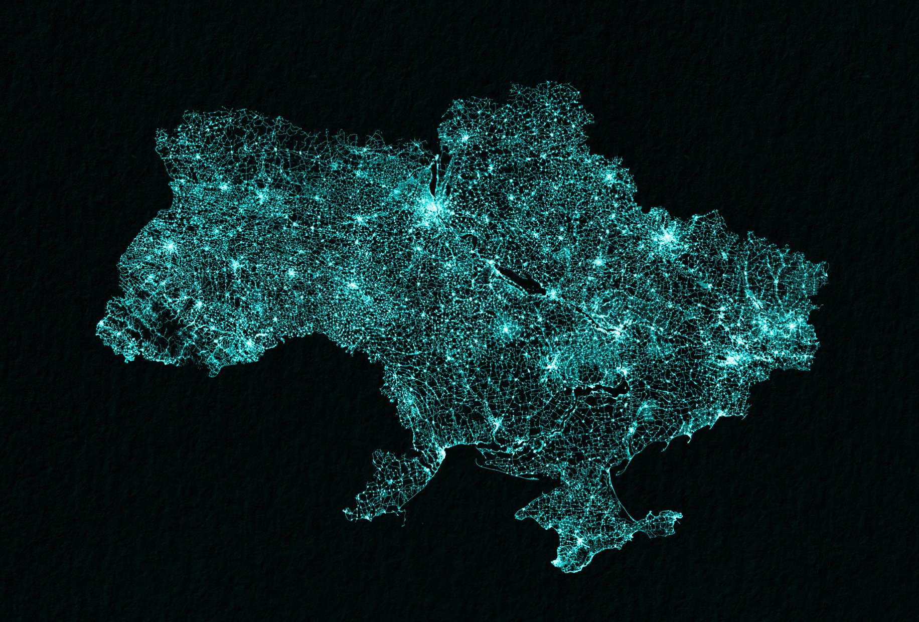
Ukraine drawn up by roads
Ukraine drawn up by roads
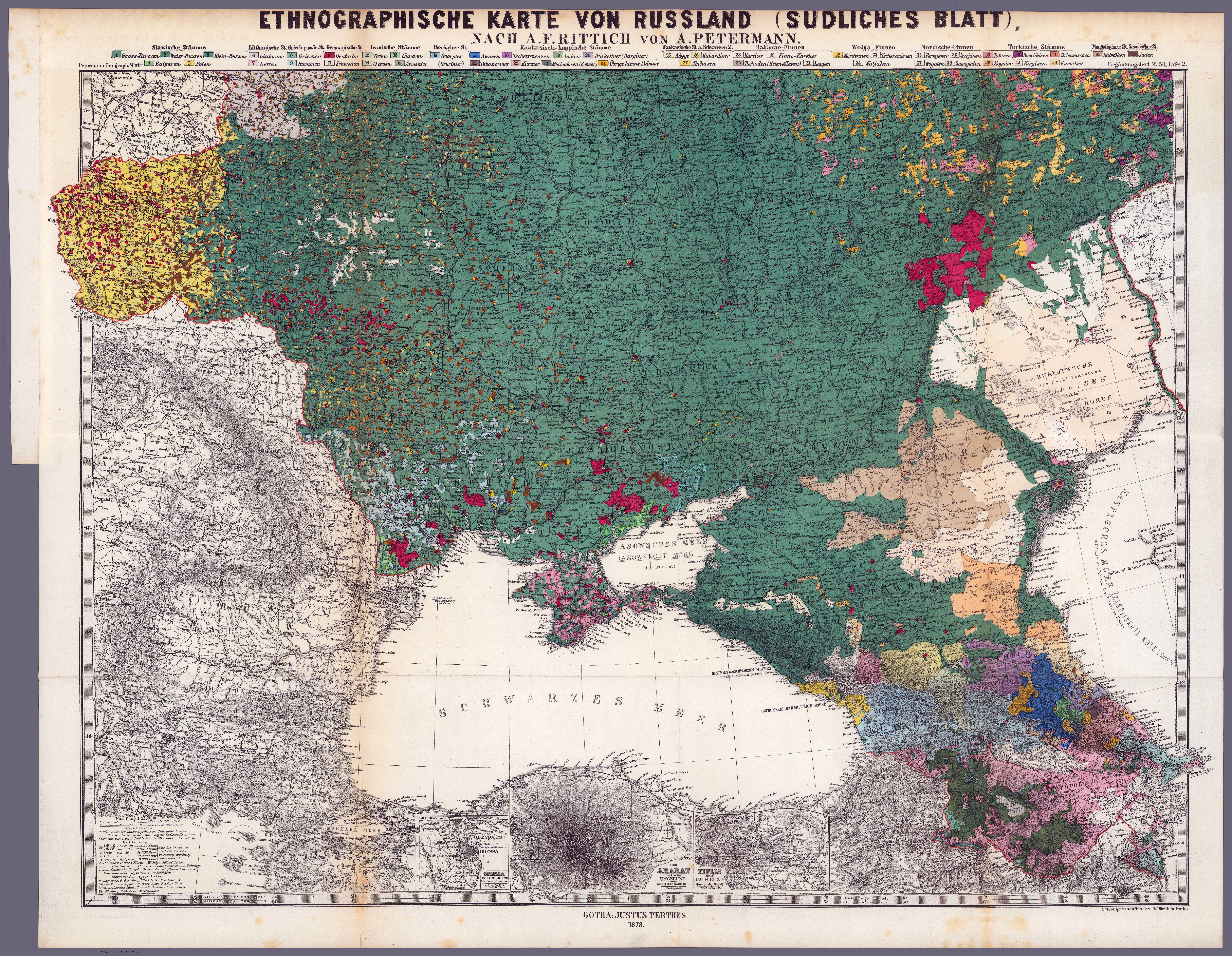
1878 Ethnographic map of Ukraine, southern Russia and the Caucasus
1878 Ethnographic map of Ukraine, southern Russia and the Caucasus - by Lieutenant Aleksandr Fyodorovich Rittikh
Map of Ukraine from the Paris Peace Conference in 1919
Map of Ukraine from the Paris Peace Conference in 1919
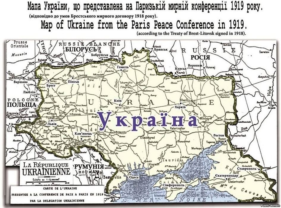
“Ah ok - so this is just a proposed map. I was very doubtful that that region south of Rostov down to the Caucusus was ever realistically part of Ukraina (or even the Polish-Lithuanian Commonwealth”–gattomeow
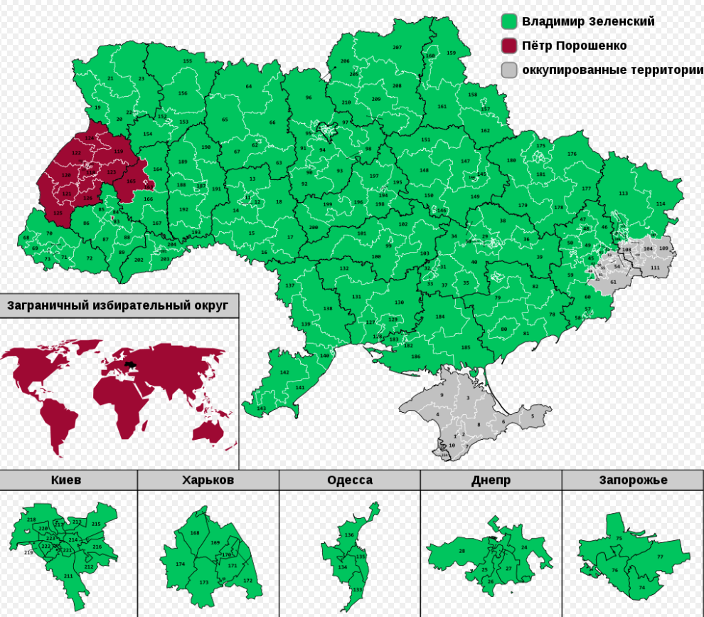
Ukraine Election 2019 map
Ukraine Election 2019 map (Green -> Selenskyj, Red -> Poroshenko, Grey -> not participated in election)
Ethnographic map of the Russian population in the Kingdom of Galicia
Ethnographic map of the Russian population in the Kingdom of Galicia (today - Western Ukraine) / / 1878 Borders of Kingdom of Galicia & Lodomeria by Yakov Fedorovich Golovatsky
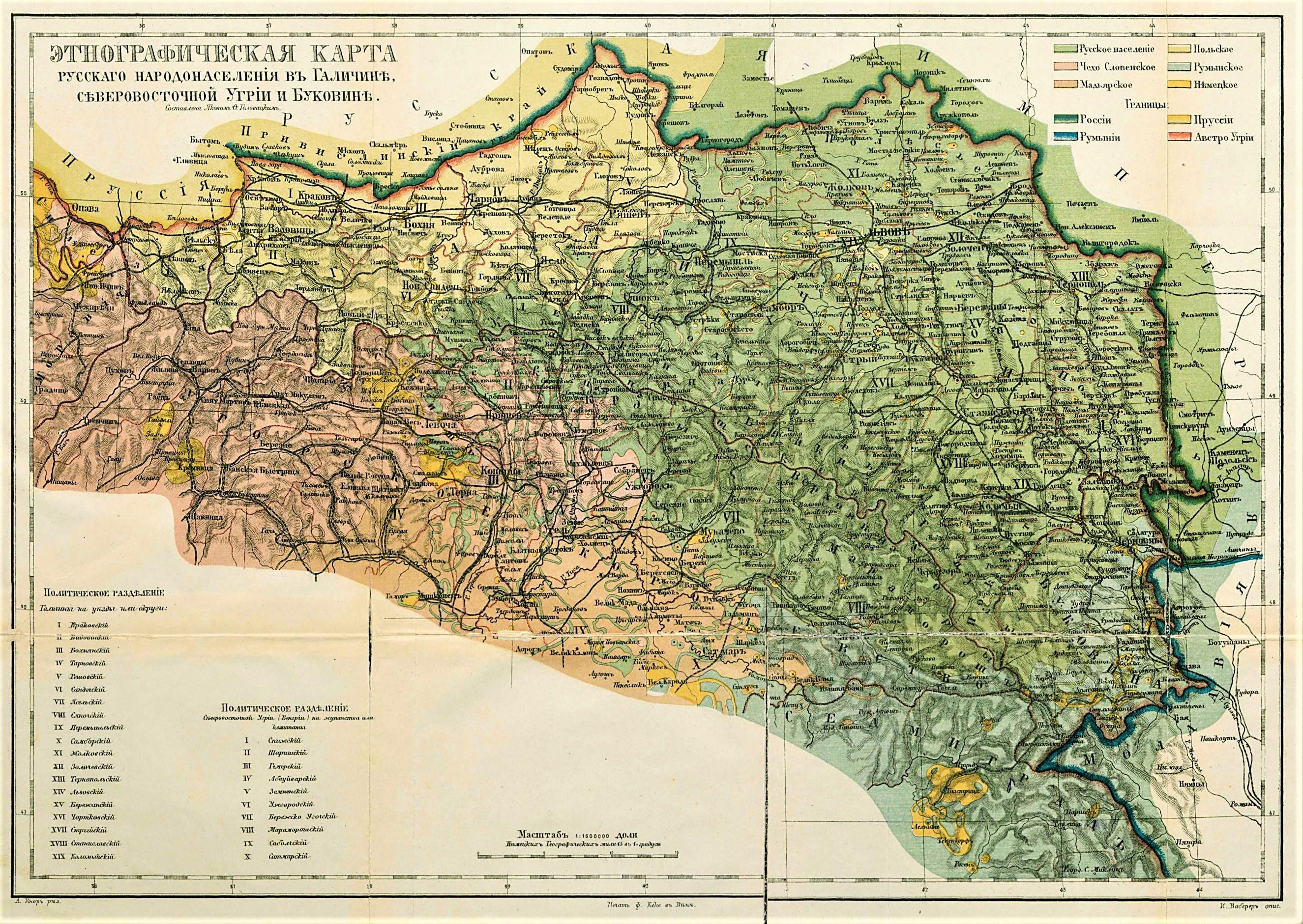
“This map covers what is today the western Ukraine north of Romania”–japaget

