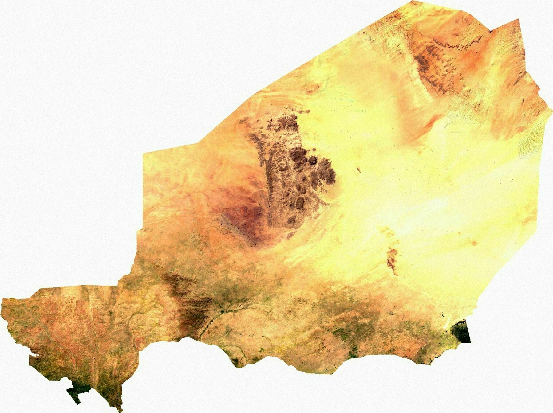
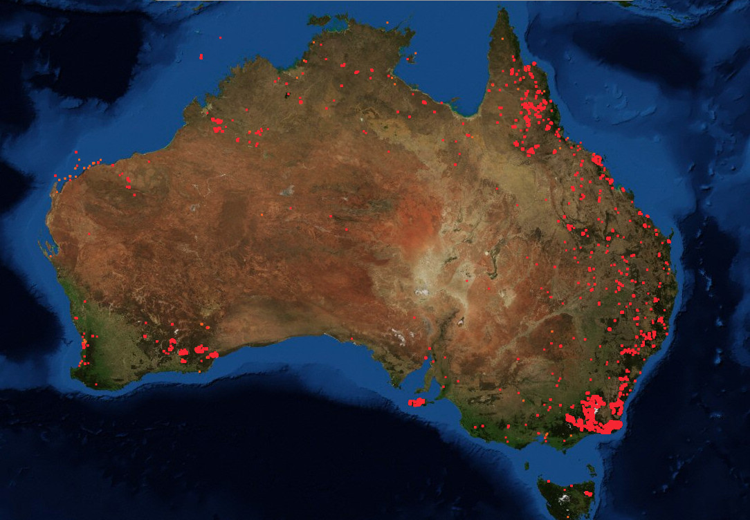
Satellite map of Niger
Satellite map of the Netherlands
Satellite map of the Netherlands
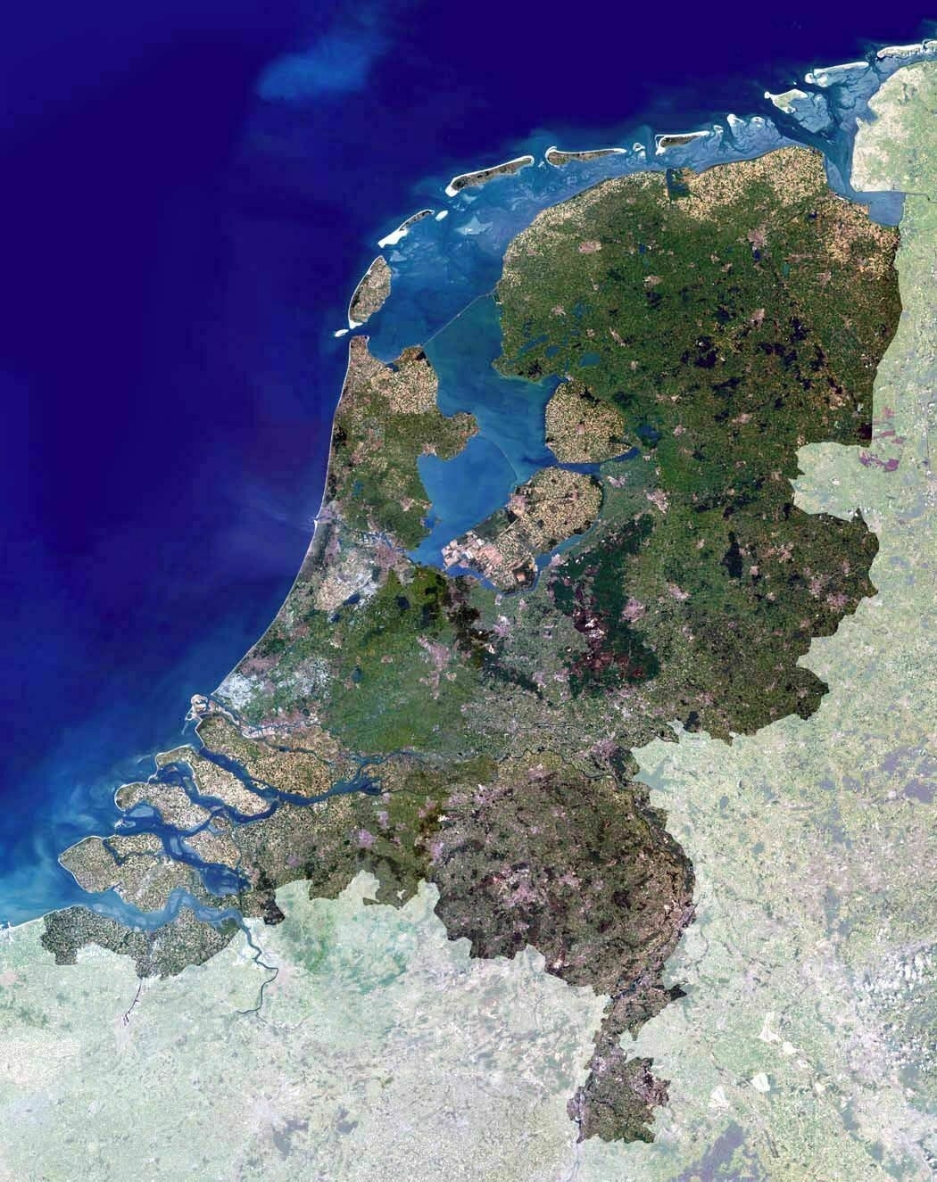
‘I see a lot of water here, dutchies. Start filling that up like the beavers you are
Actually we decided not to fill up the remaining water bodies because we have turned them into fresh lakes which we use for our drinkwater/irrigation supply in the dry summer months
Your country looks beautiful, compact and comfortable. I’d like to visit it one day’
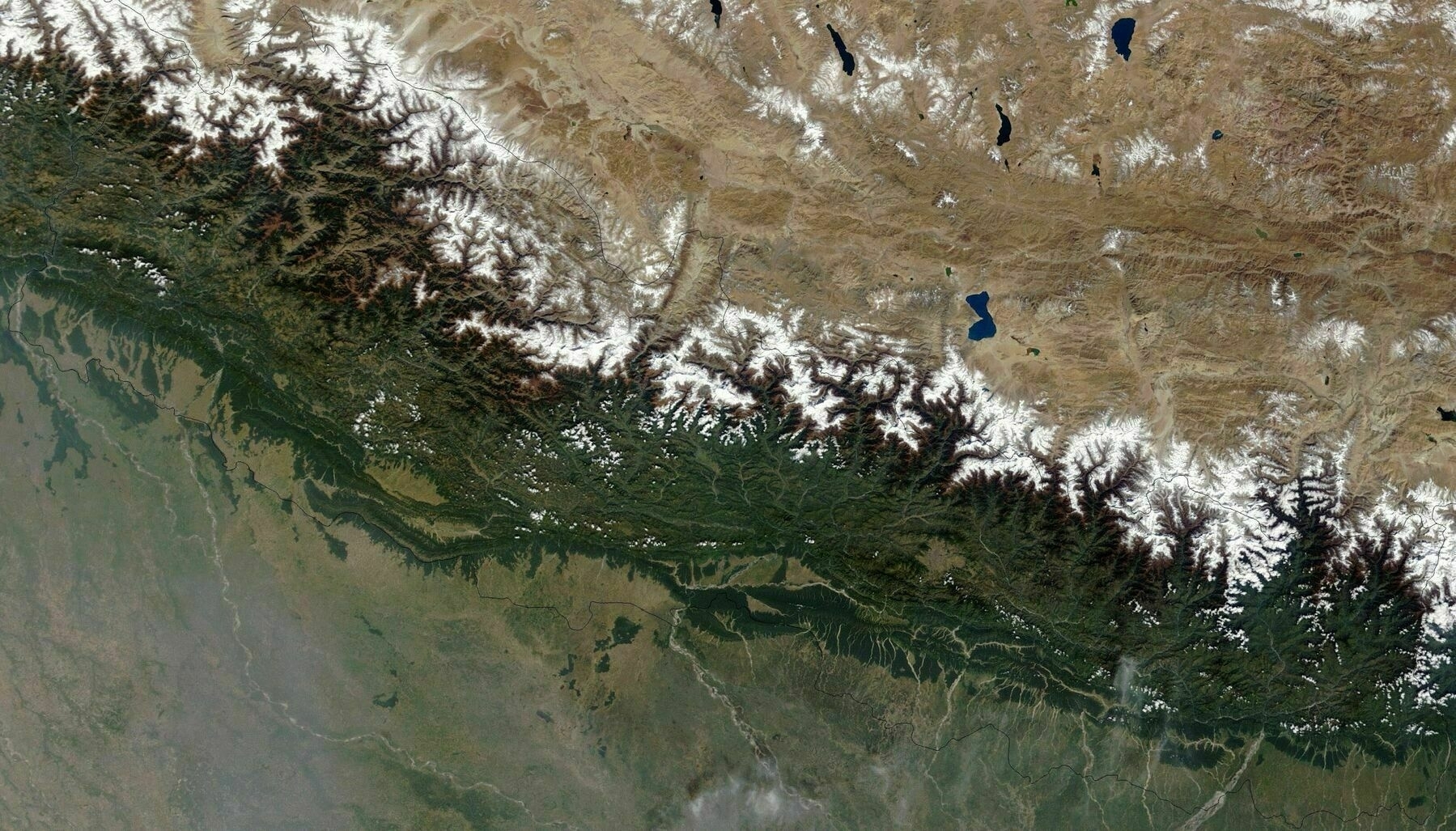
Satellite map of Nepal
Satellite map of Monaco
Satellite map of Monaco
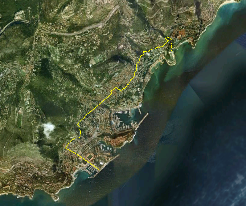
‘Was there multiple times this year,what a weird and beautiful place’
Satellite Map of Mauritania
Satellite Map of Mauritania
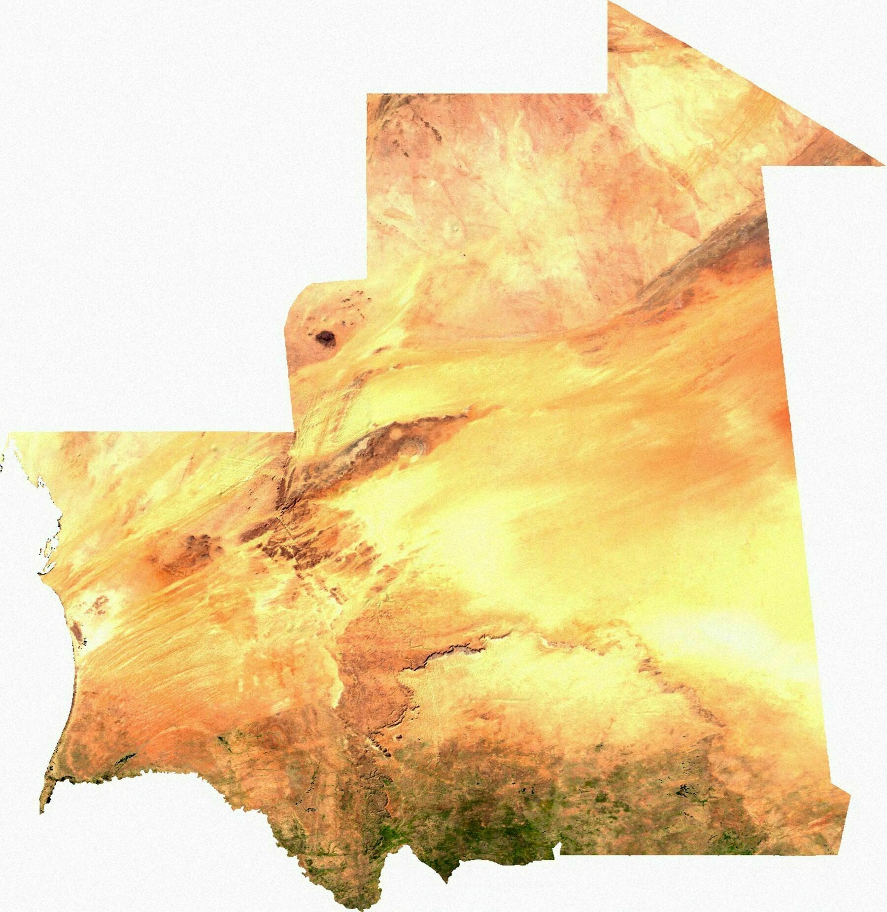
‘do they have border posts in the middle of sahara?..
Yes and no.
So, Mauritania is on the southern side of the Sahara. There is one “road”, in the Western sense, which enters Mauritania from the North - it’s on the coast. This has a border post, customs checks, a little shack selling compulsory vehicle insurance to travellers &c. Once you get out of the minefield, there’s a good surfaced road heading towards Nouadhibou and Nouakchott.
It is possible to enter Mauritania from the North at other points - there are tracks which might be passable by a 4x4 - but it is not easy, and traffic volumes are very low. Mostly smugglers and terrorists and military and “freedom fighters” (these categories can be a bit blurry)’
Satellite map of Mali
Satellite map of Mali
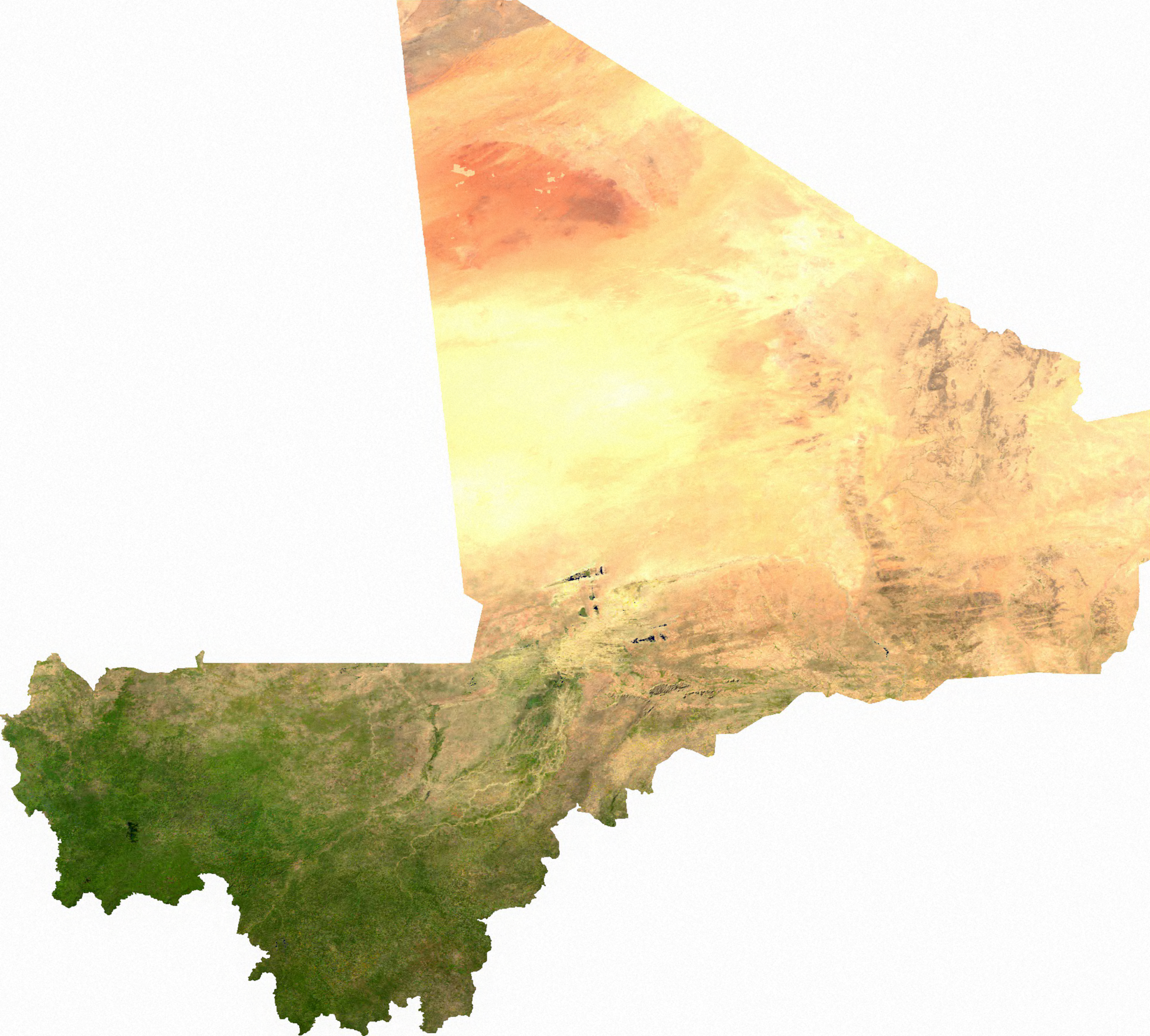
‘Mali might be the best example of Europeans drawing borders. It just doesn’t look real, especially in a satellite image. Straight lines through the sand, two completely different climates, landlocked. It just looks fake
Lo and behold, that massive desert chunk in the North is completely ethnically and functionally politically distinct from the densely inhabited, green southern portion
Who could have guessed that people who live in very very different conditions, with very different lifestyles, mostly isolated from one another would be politically distinct’
Satellite image of the Maldives
Satellite image of the Maldives
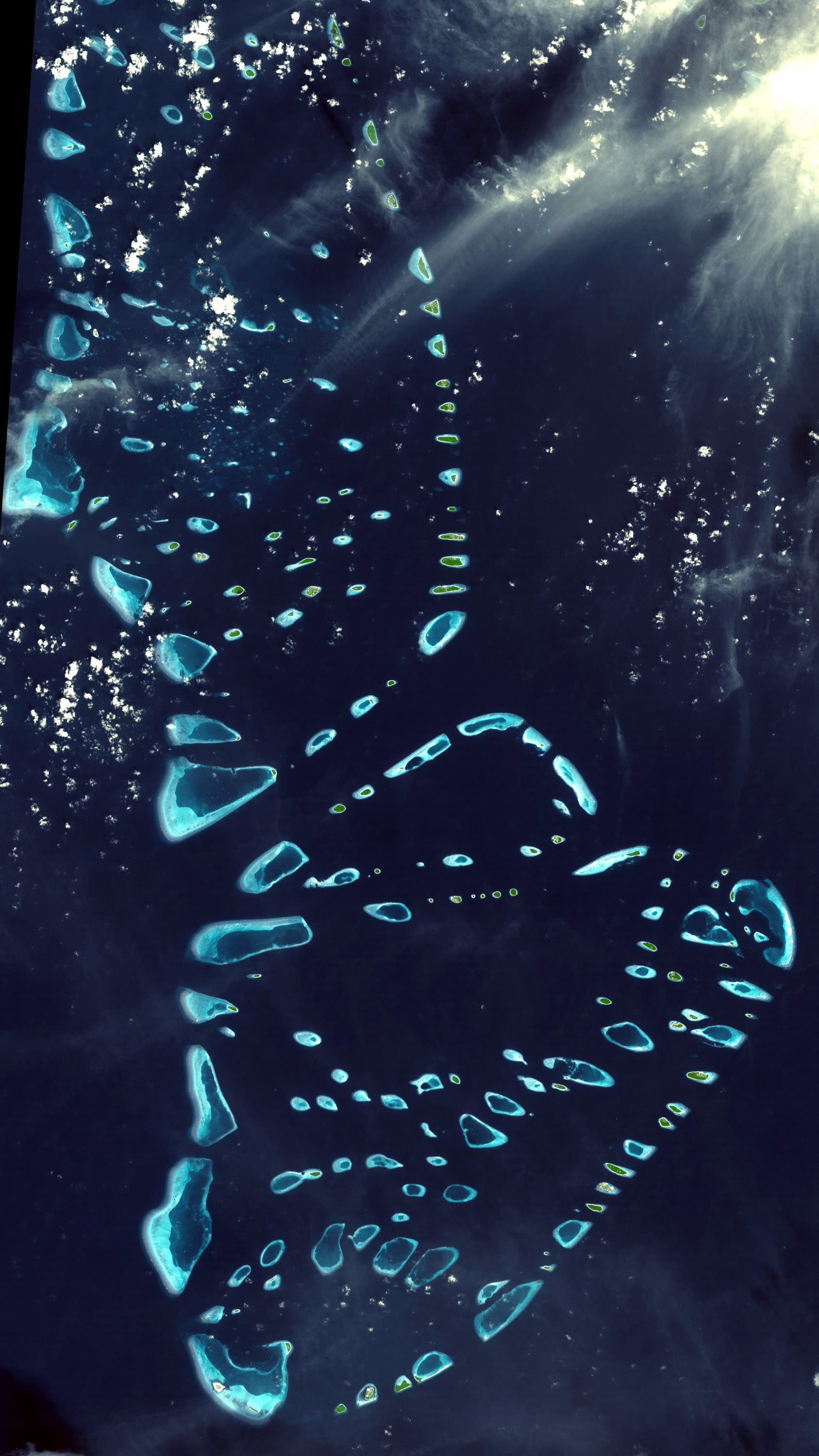
‘Known as the “pearls of the Indian Ocean”. They look even more spectacular from a small plane’
South America satellite map
South America satellite map
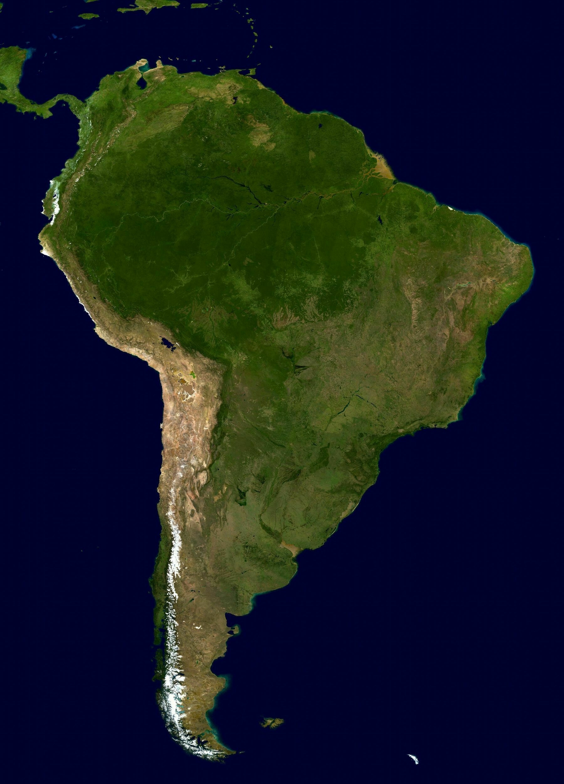
‘South America is my favorite Google maps exploration location. Cant wait to go there one day’
Satellite map of Chile
Satellite map of Lord Howe Island
Satellite map of Lord Howe Island
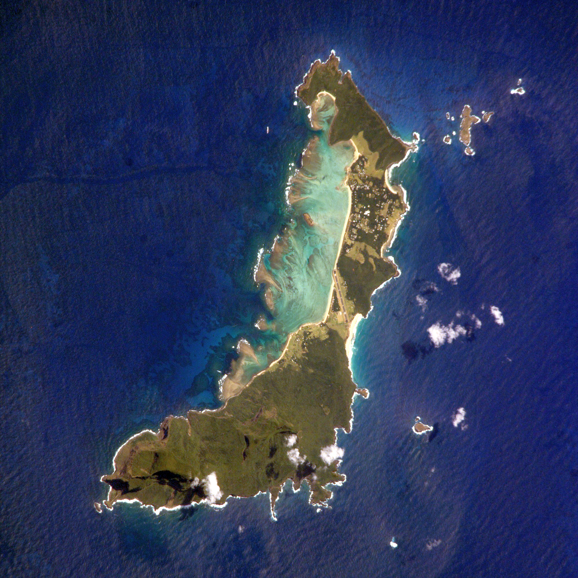
‘More satellite maps please! Maybe of the Snowies/Tasmania in winter?’
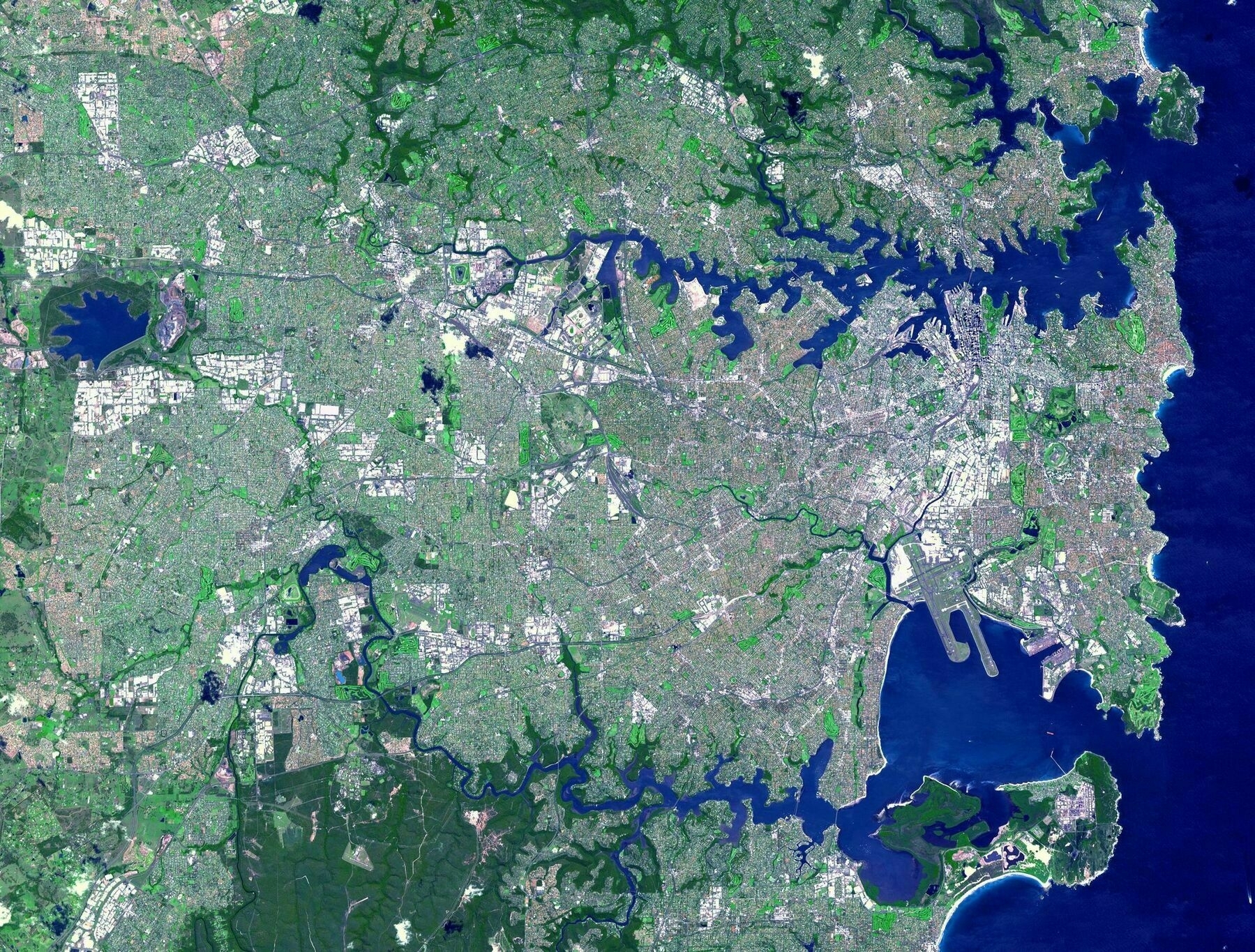
Satellite map of Sydney
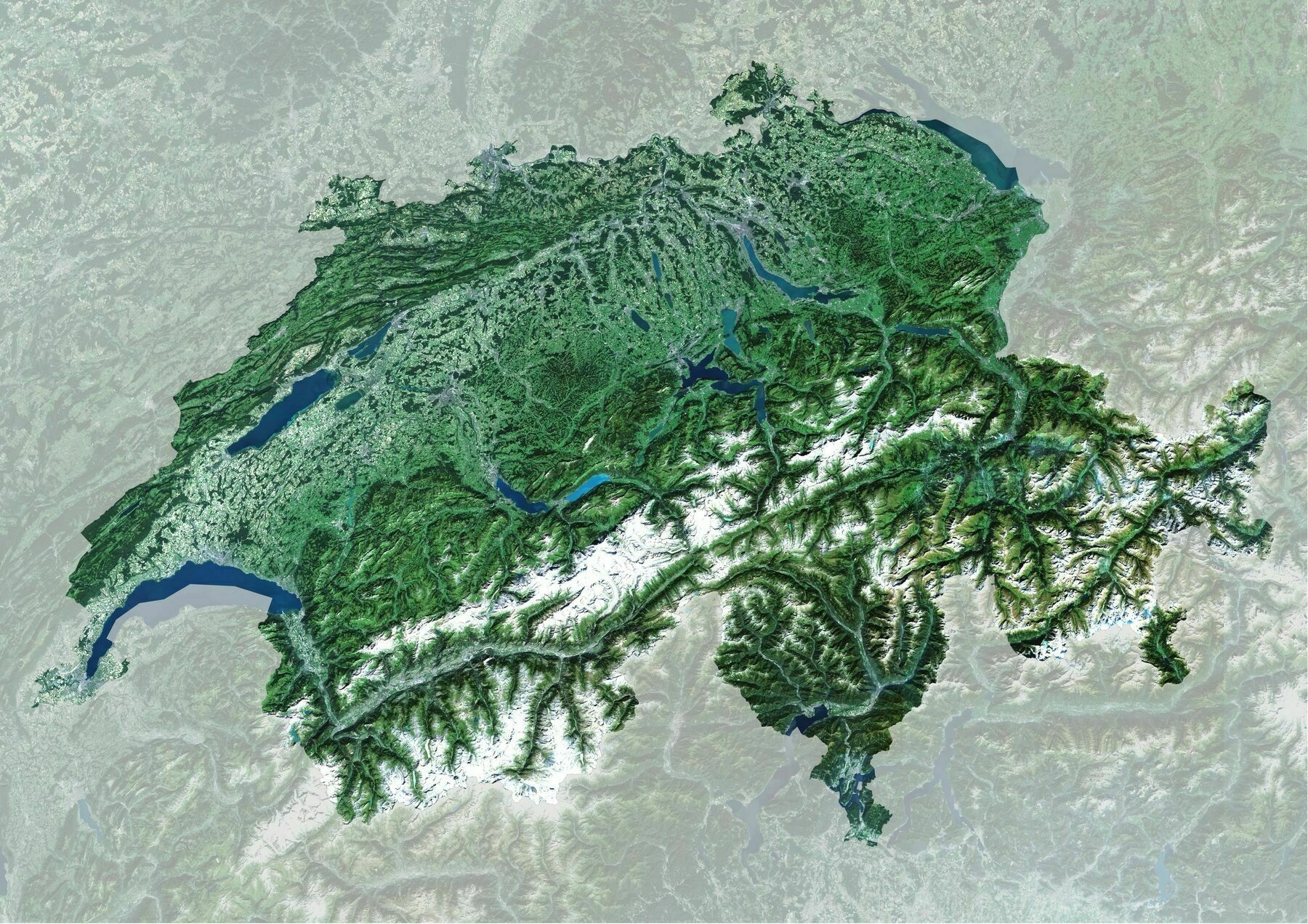
Satellite map of Switzerland
Satellite map of Switzerland
- bit.ly3uDO3CL
‘Too coarse, can’t figure out my house as an individual pixel ;)’
‘Such a convenient and clean partition between plains and mountains’
Satellite map of New Guinea
Satellite map of New Guinea
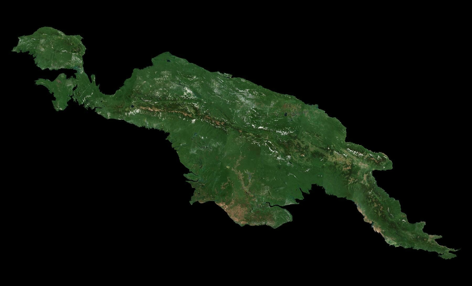
‘New Guinea is the neglected island we will have to move to after a apocalypse’
Satellite map of Vatican City
Satellite map of Vatican City
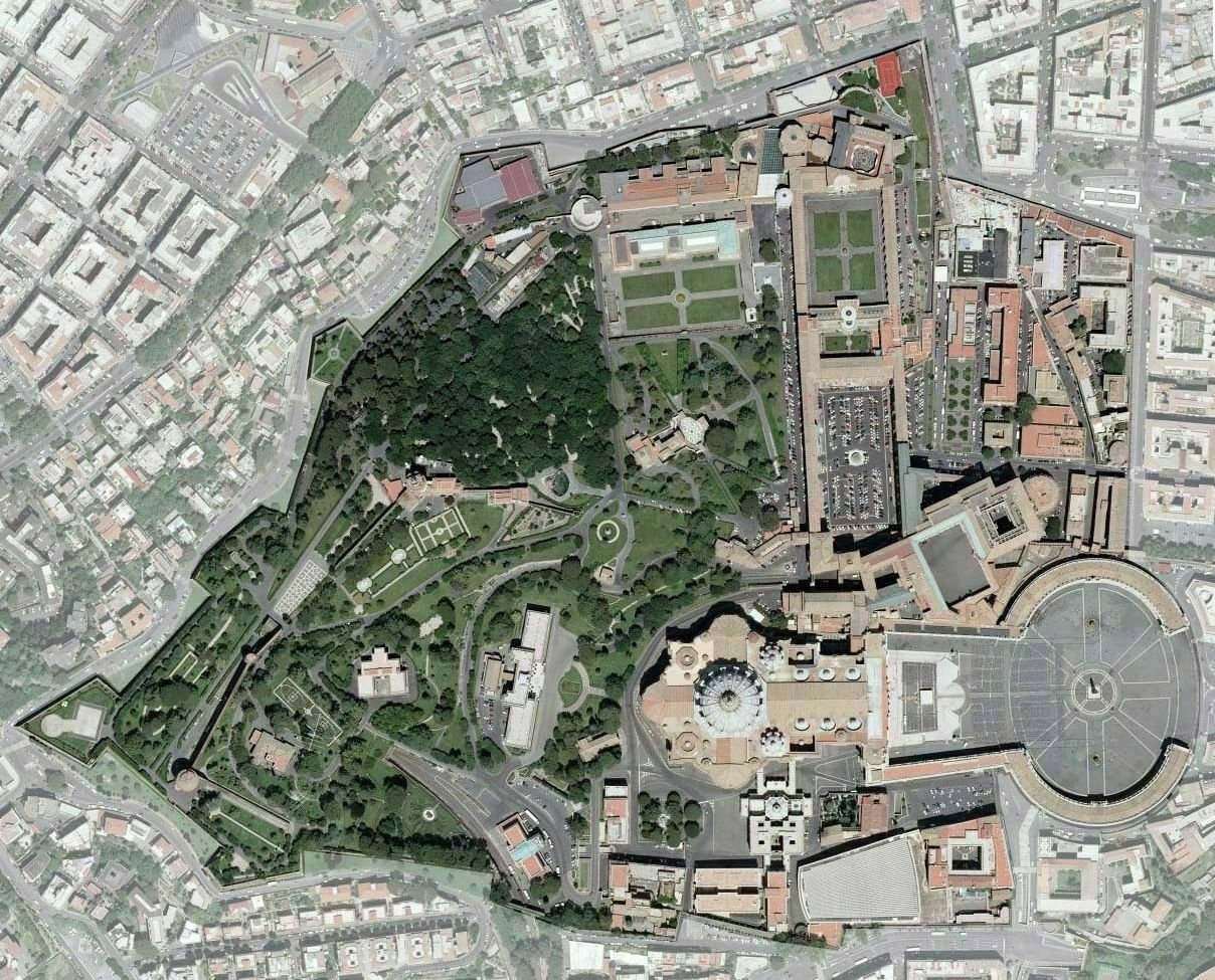
‘How many entrances does the Vatican city have tho
For what I know(I live really close of it) there are at least three car entrance for inner workers, walking entrance from the square and the basilica, walking entrance from the Vatican’s museums and walking entrance (or escape) from the neighboring Castel Sant’Angelo, even though the latter is now in disuse since the castle is Italian state property. So I would think 5, there is also a heliport you can see in the lower left* I don’t know if you want to count that to 6
And a train station’
Satellite map of Sudan
Satellite map of Sudan
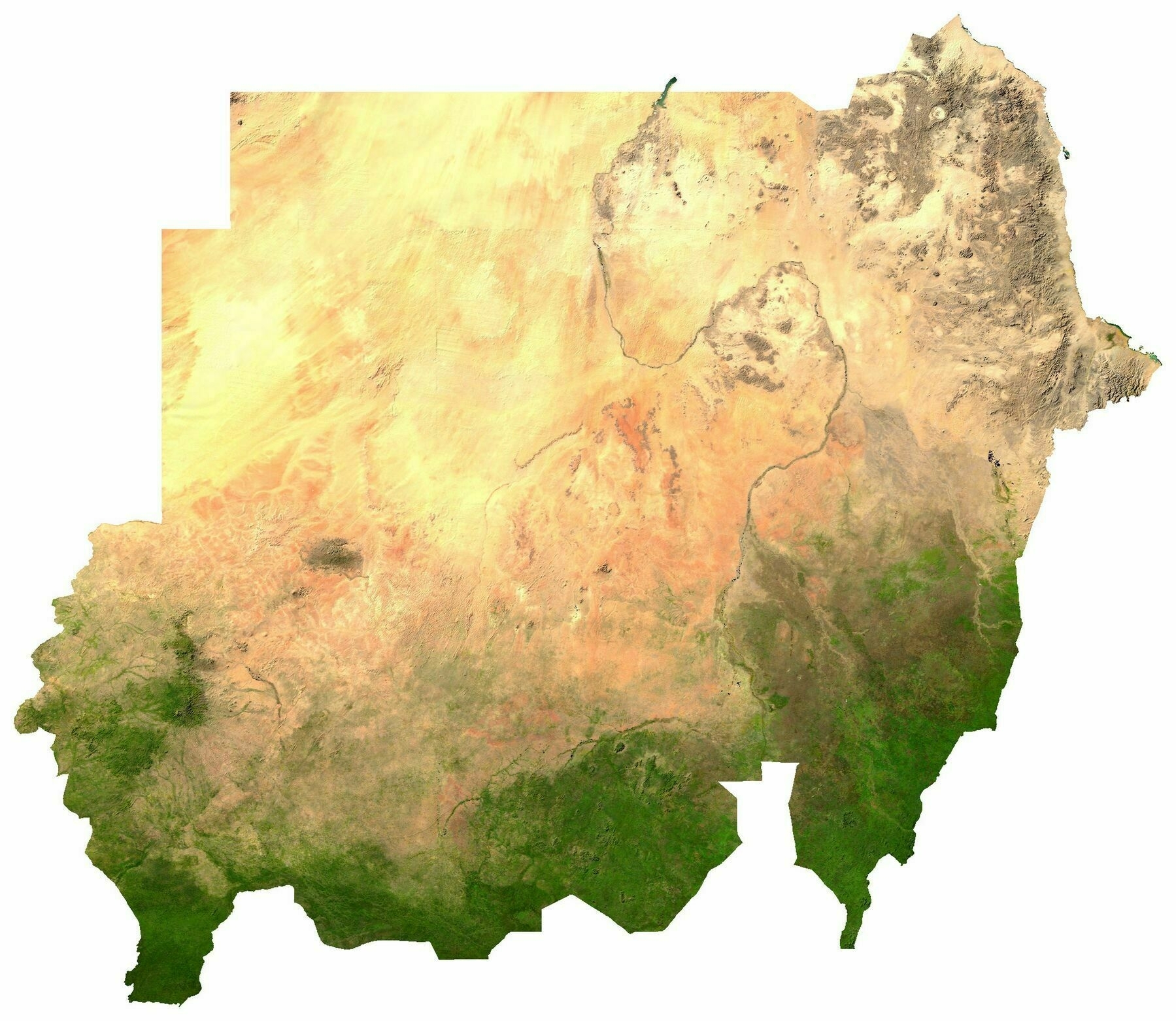
‘It’s not actually as lush in the southern part of the country as this map makes it seem. It’s more savannah there than jungle’
Exaggerated relief map of the Iberian Peninsula
Exaggerated relief map of the Iberian Peninsula
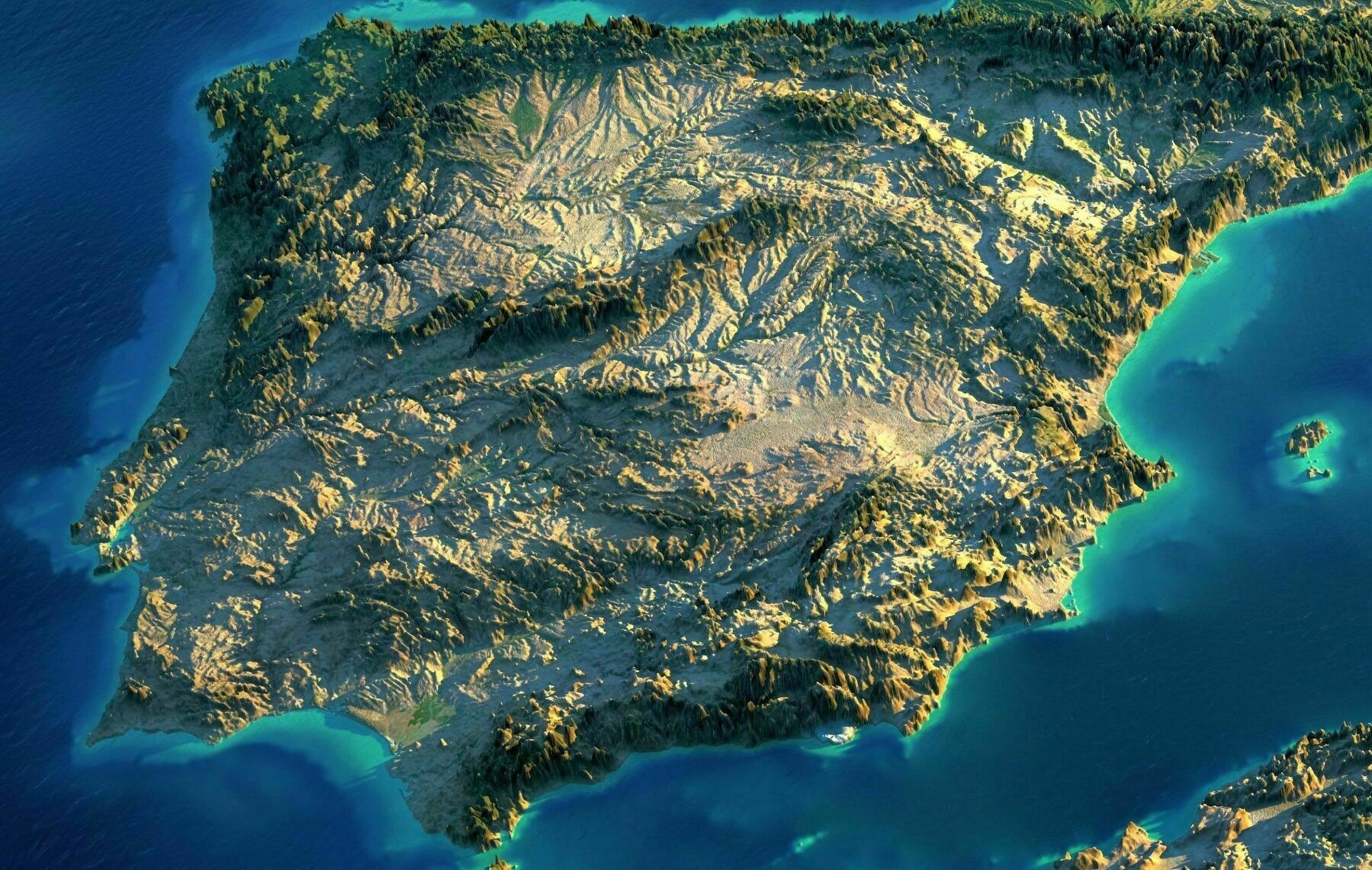
‘Love the relief but tbh the desert color is so exagerated haha. Spain is dry, but only the province of almería is that arid’–nanimo_97
Greater New York ... metropolis of mankind - by the National Geographic Society [1933]
Greater New York … metropolis of mankind - by the National Geographic Society [1933]
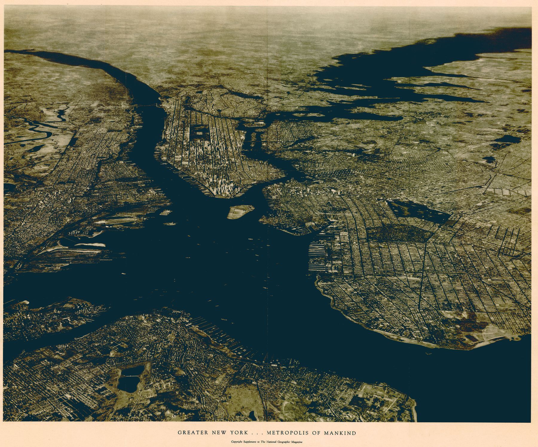
‘Kinda shocked me when I learned Hudson county NJ by itself is as large as the population of Seattle.
Wonder how they took this photo back then?
Edit: Surprised me that Hudson isn’t even the largest county by population in Jersey, Bergen is at 932,202 which would put it just under Austin Texas. Certainly doesn’t feel that way though as Bergen feels like many small towns and Hudson one large city (have heard some reports that Hudson county has really terrible census returns leading to undercounts)‘–Sybertron
Northern and Central Africa satellite imagery + 3D elevation - by Scott Reinhard
Northern and Central Africa satellite imagery + 3D elevation - by Scott Reinhard
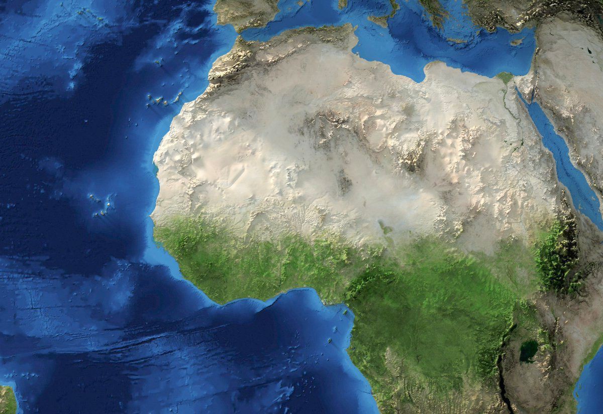
‘It looks like there is a meteor crater there in the Western Sahara … Good catch!…Earth’
Cairo at night
Cairo at night
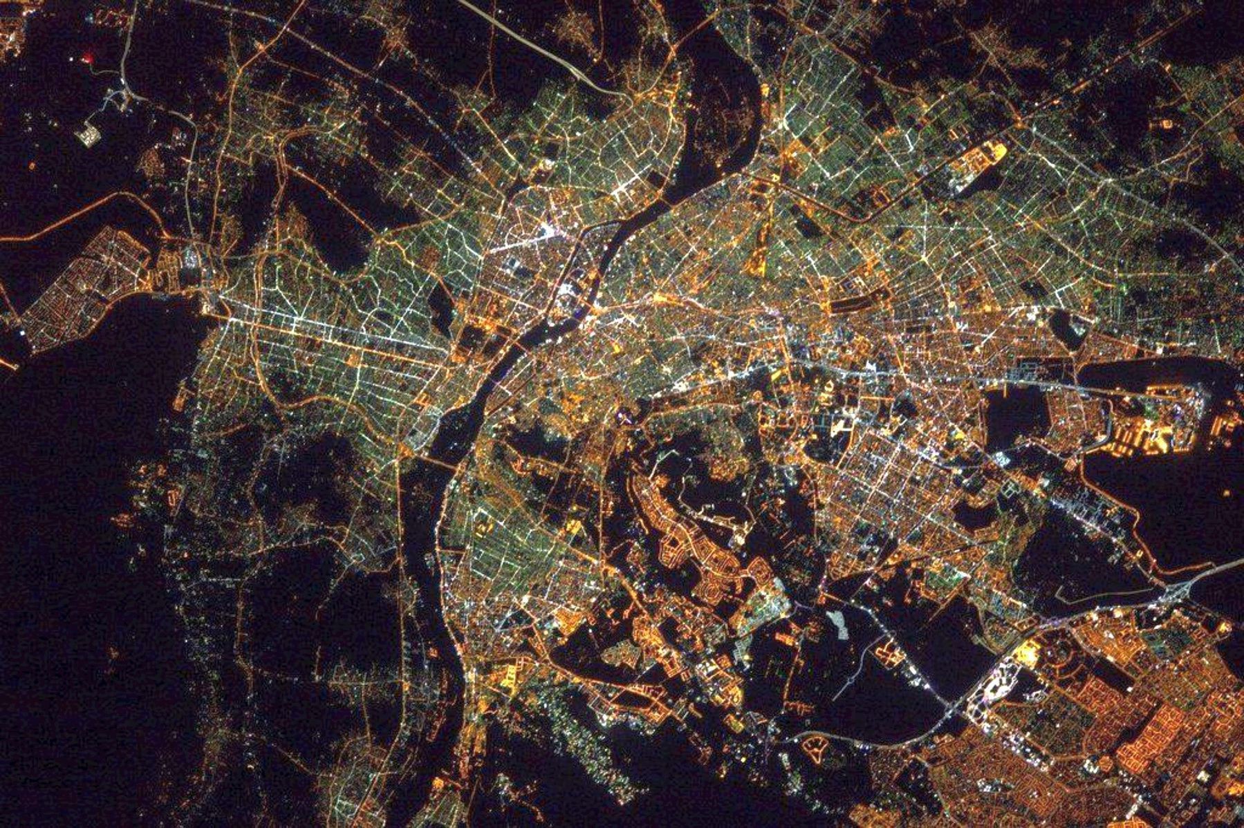
‘Beautiful, you can see the rich neighborhoods from the color of lights’–associationcortex
Exaggerated Relief Map of southeastern Brazil and the surrounding region
Exaggerated Relief Map of southeastern Brazil and the surrounding region
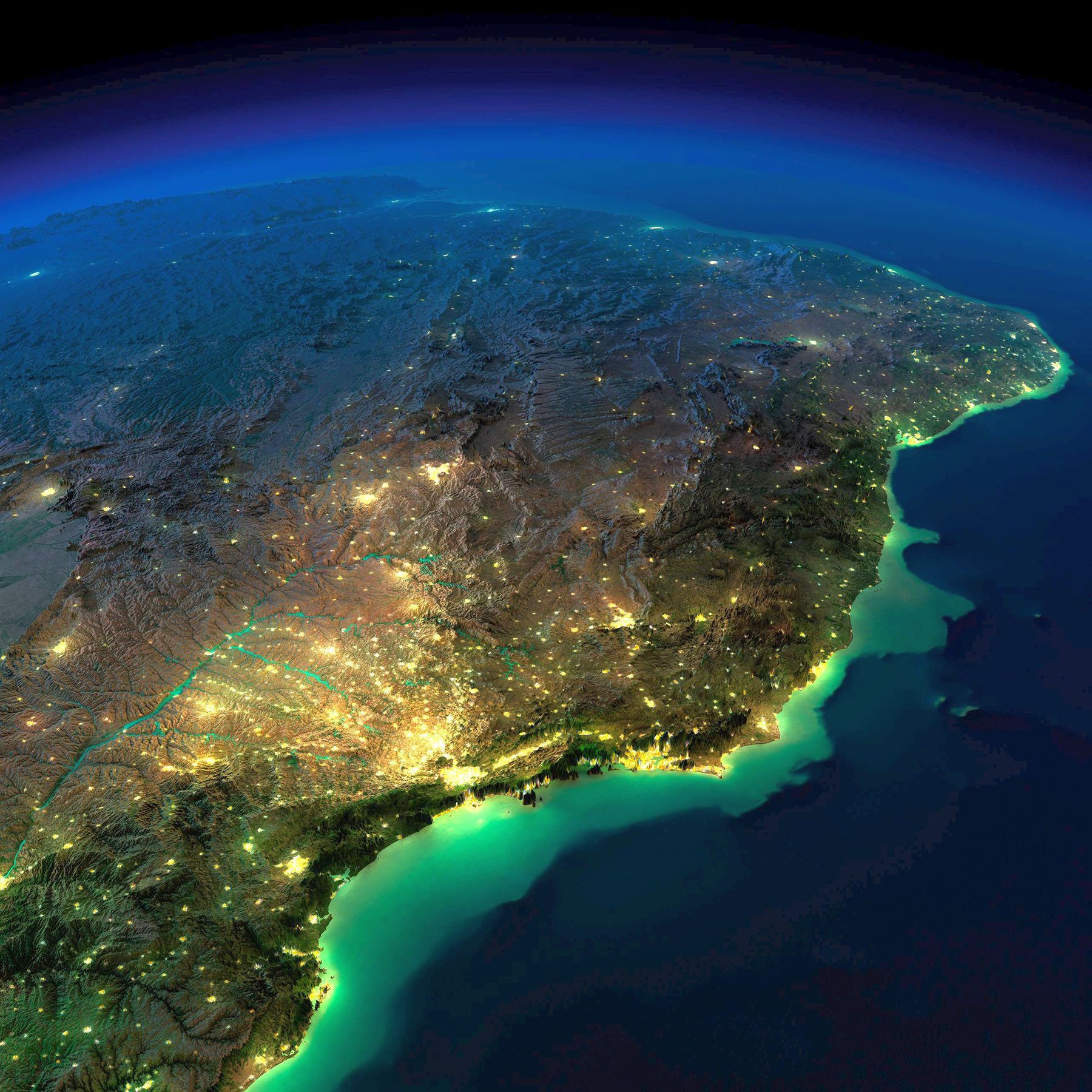
‘Wow best one yet, you can really see how geography shaped Brazil’–newmanstartover
A Mountain in the Sea : satellite terrain map of Corsica
A Mountain in the Sea : satellite terrain map of Corsica
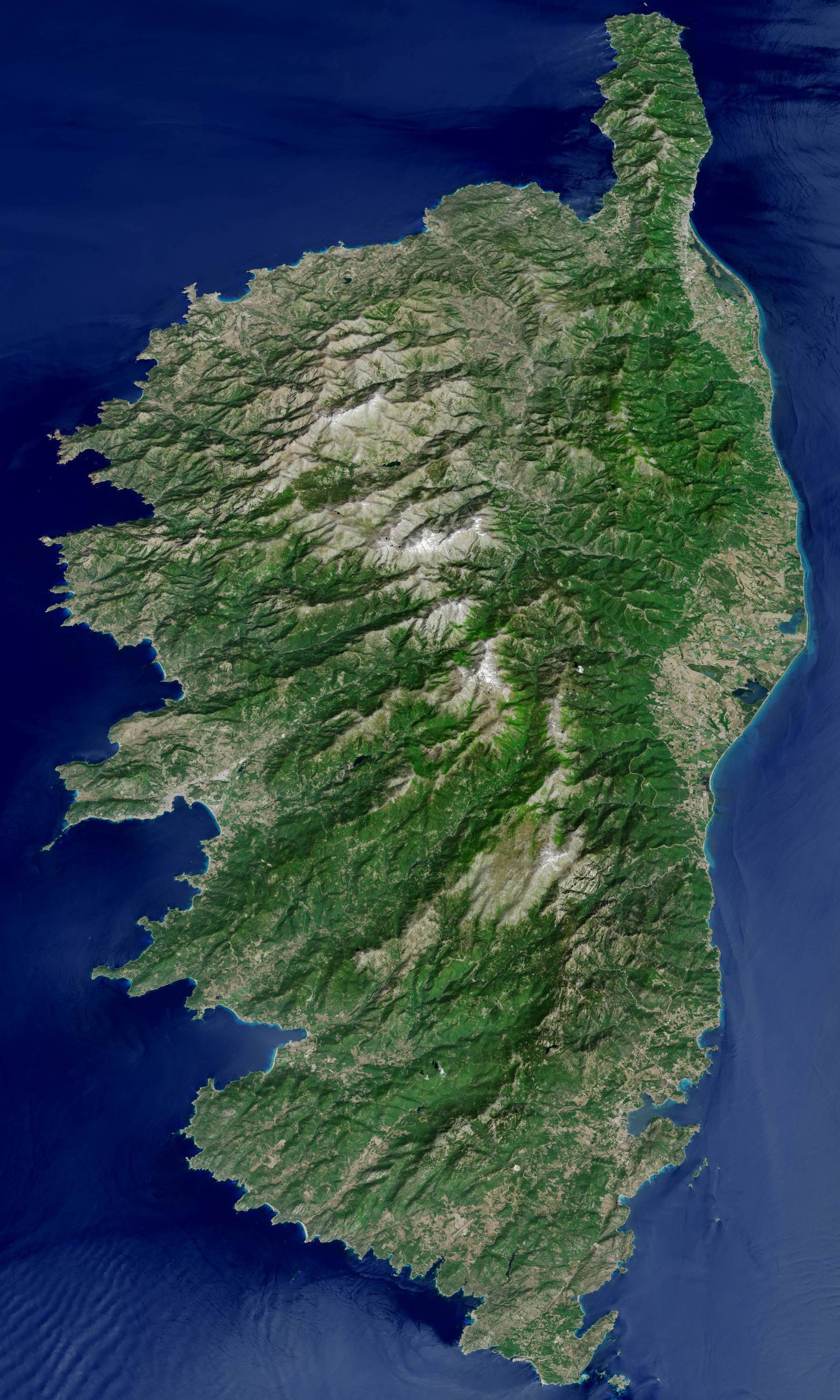
“looks kind of like upside down ireland … Yes, but with topography”
Exaggerated Relief Map of Southeastern Australia at Night
Exaggerated Relief Map of Southeastern Australia at Night
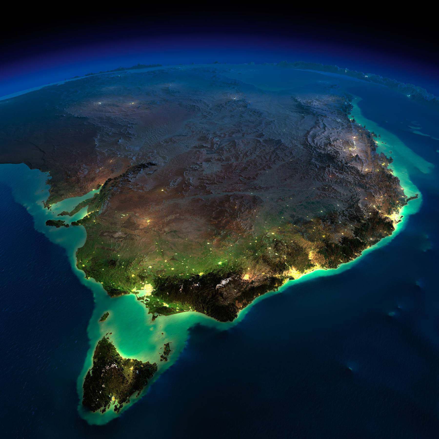
“Why isn’t Tasmania more populated than it currently is? … It’s traditionally been an agrarian economy with relatively limited industry outside the primary sector (although the service sector has taken off over the past few years). It’s also very mountainous which limited the extent of early colonial settlements”
Australia with city lights from space at night
Australia with city lights from space at night
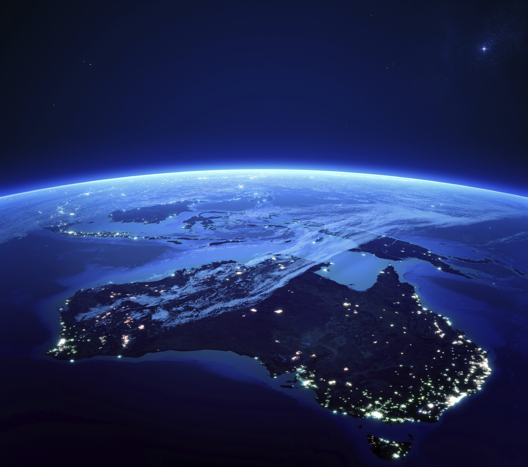
“Bullshit south Australia’s lights are on”–wlee1987

