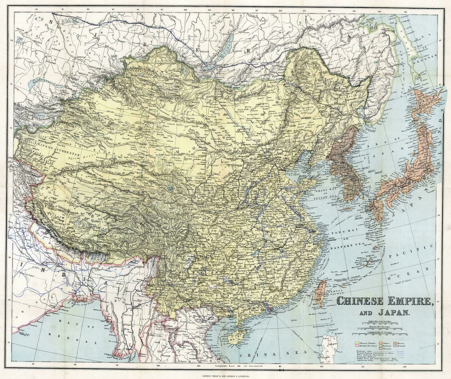
1910 map of China, Korea and Japan
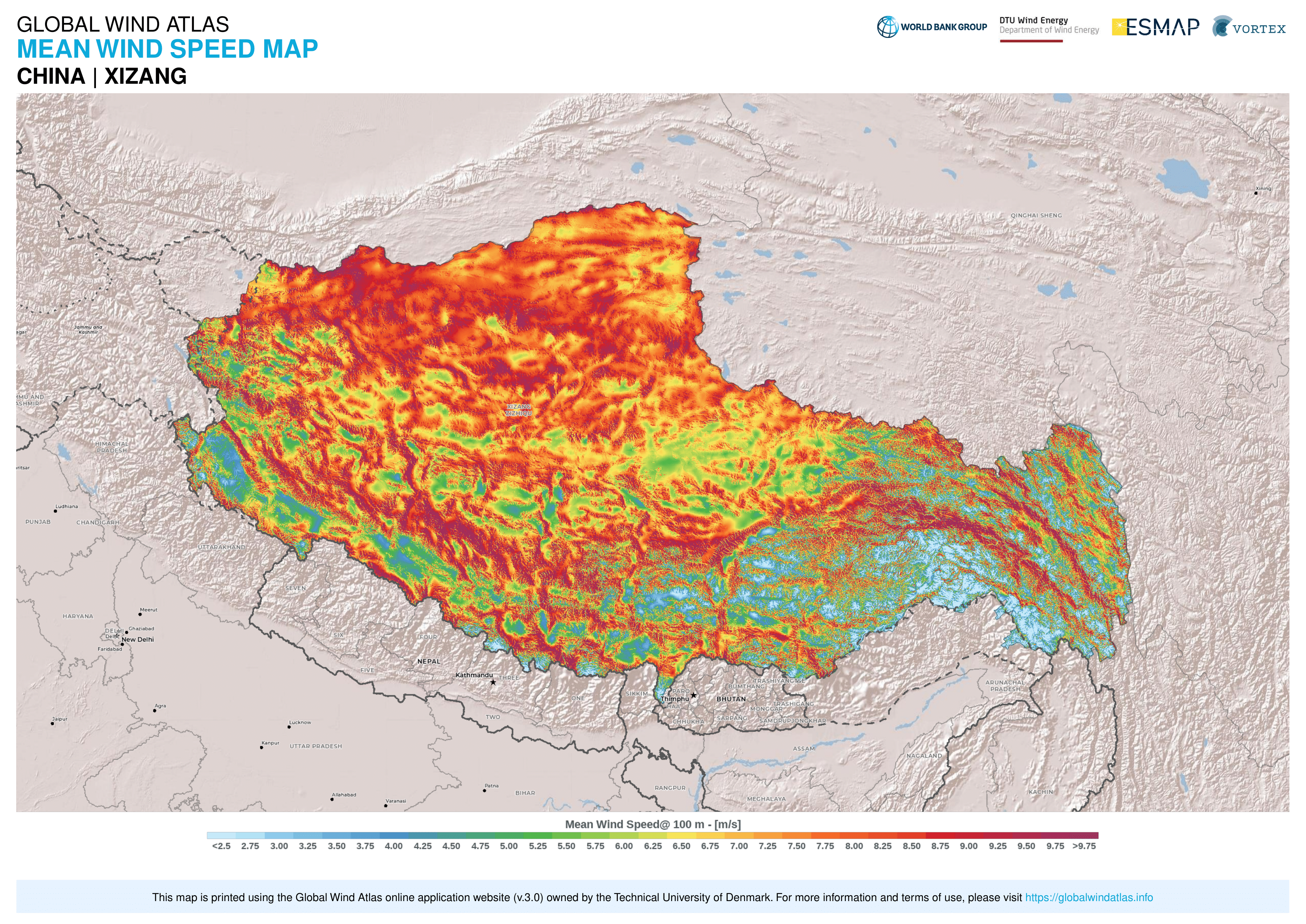
Tibet Wind Speed
Exaggerated Relief Map of China
Exaggerated Relief Map of China
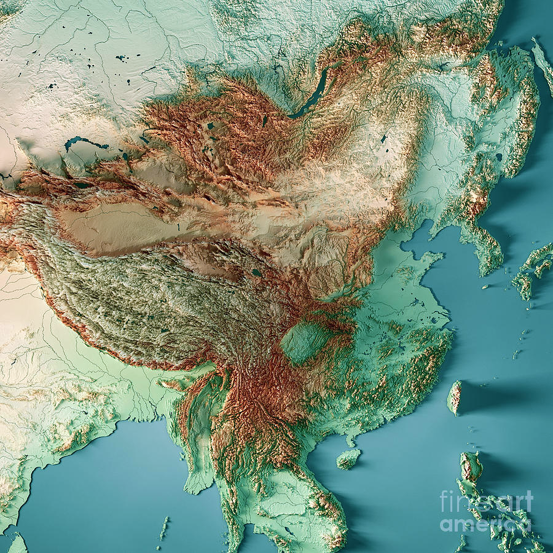
‘Live in Shanghai, can confirm - absolutely pancake flat around here.
Also love that you can see the hills that you can see from the HSR between Beijing and Shanghai just south of Jinan on this map even though they’re pretty insignificant - they just happen to stand out enough from the total flatness everywhere else in the area’
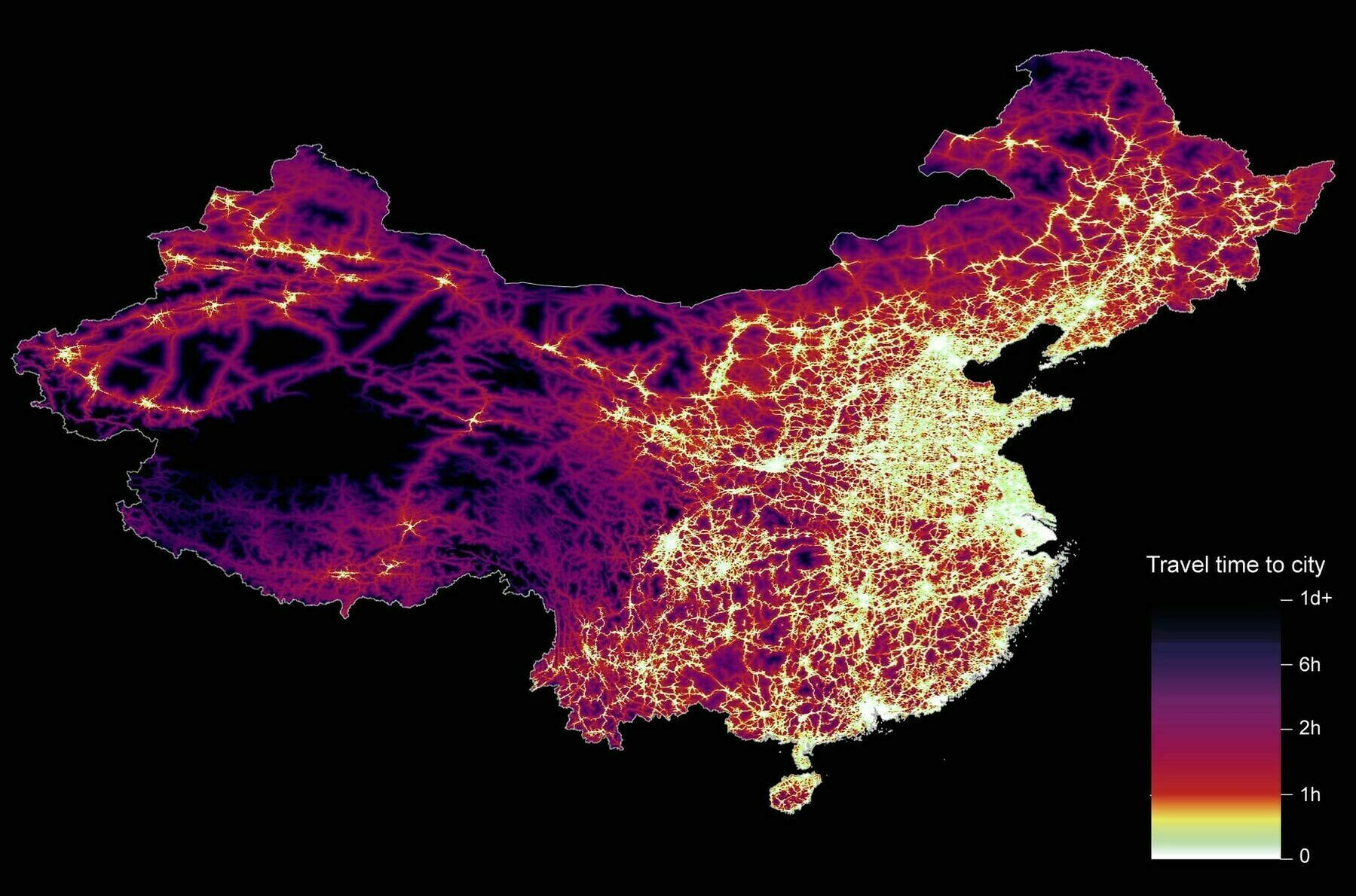
Travel time to cities in China
1940 hand drawn map of Macao, based on a 1650 map
1940 hand drawn map of Macao, based on a 1650 map
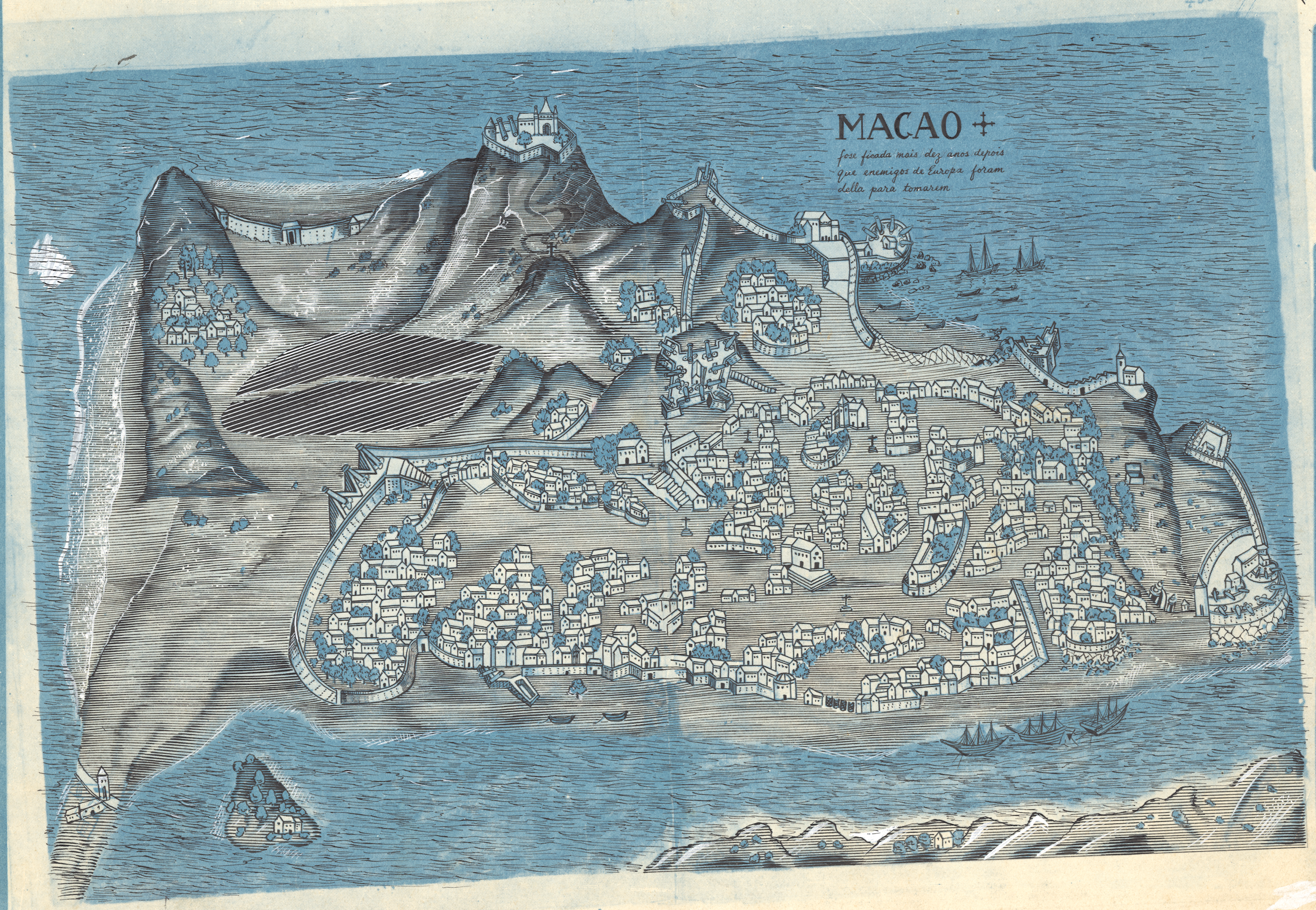
‘The elevation exaggeration is out of control! That tallest hill (Guia Hill) is only 91m/300ft high…
Was it common for the Portuguese to erect crosses everywhere in town? I see one on the plaza in front of St Paul’s Church and many others dotted around’–EconomicSanction
Shaded relief and transportation map of southern Manchuria and northern Korea (1904)
Shaded relief and transportation map of southern Manchuria and northern Korea (1904)
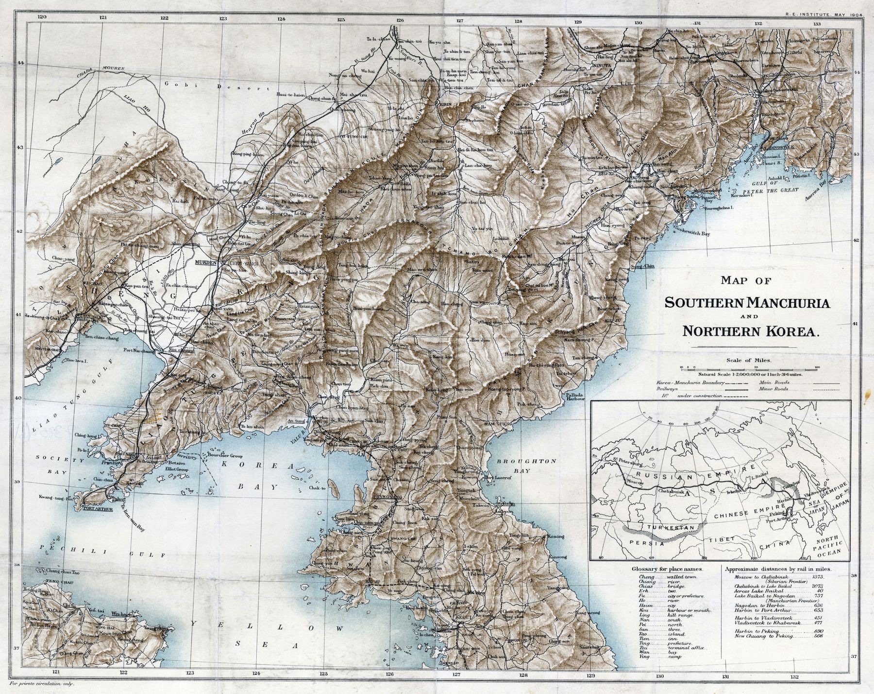
‘Who commissioned this? … The R.E. Institute’
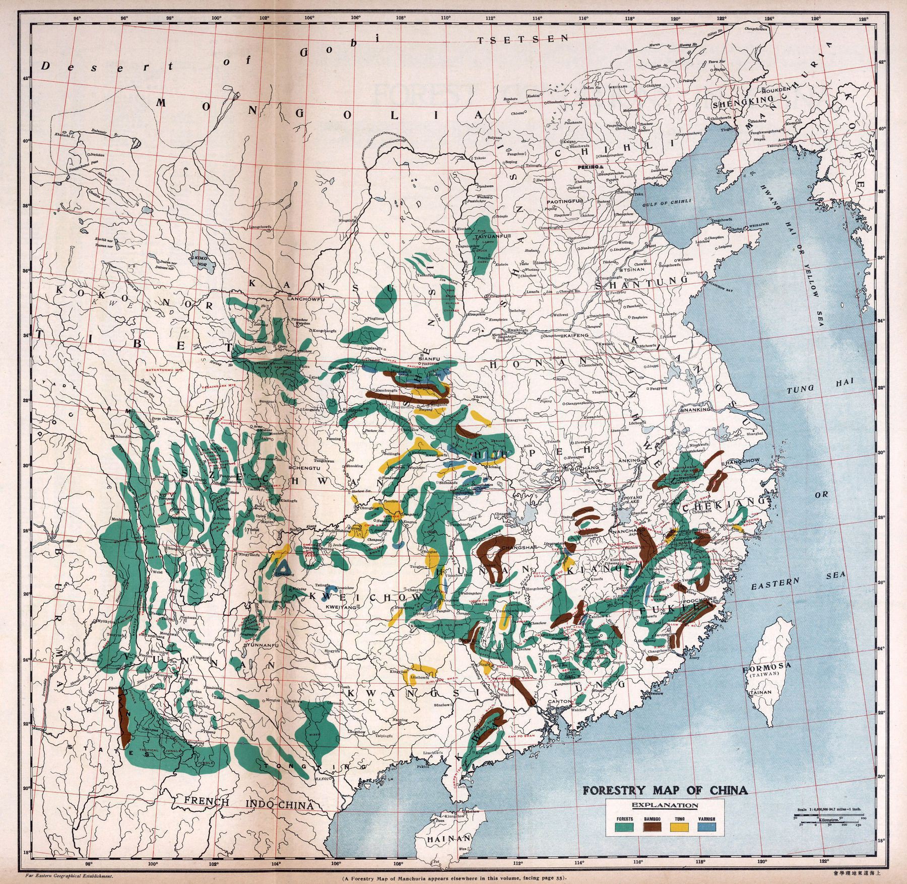
1917 Forests Map of China
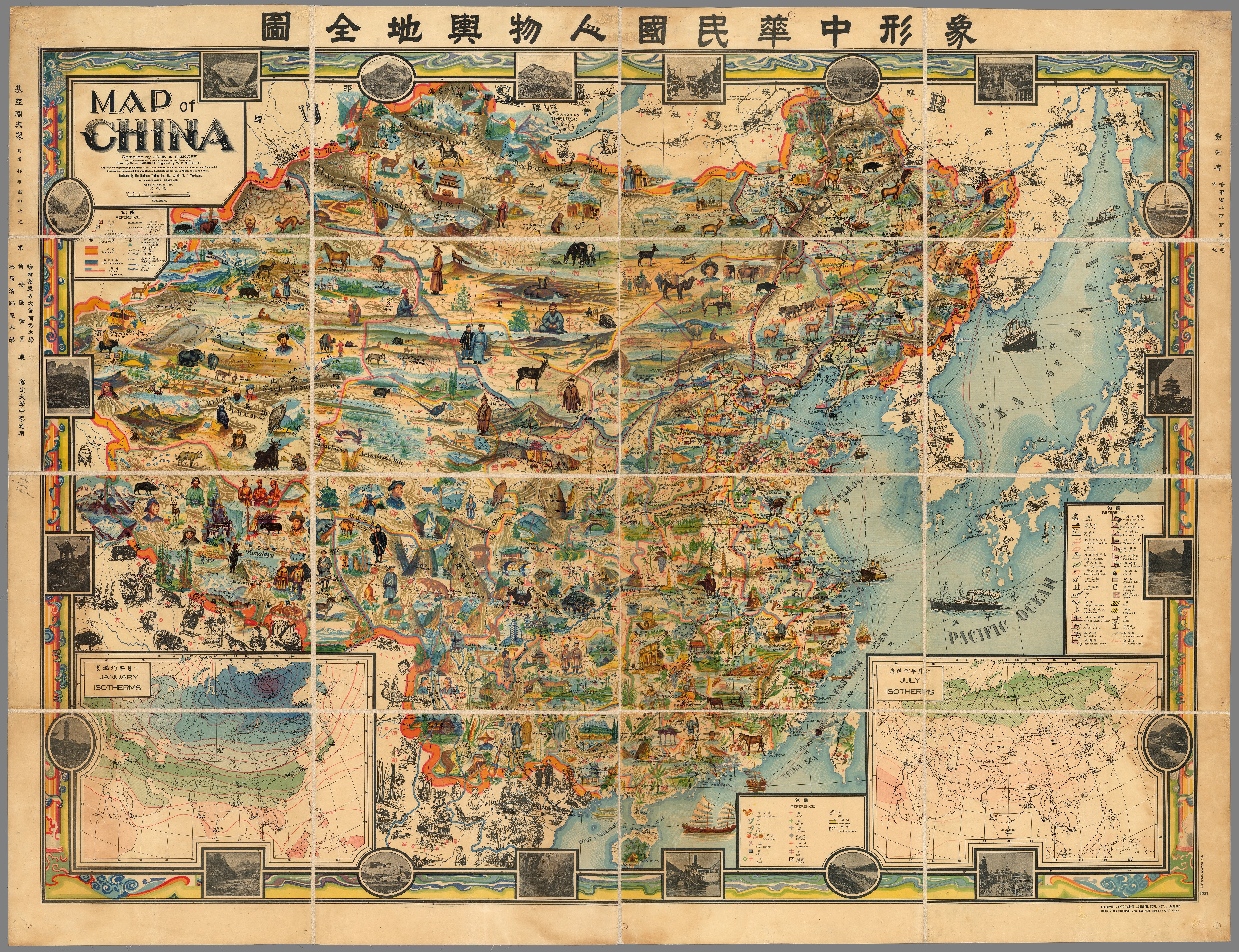
Friendship Map : pictorial map of China made the year before the Communist revolution led by Mao Zedong
Friendship Map : pictorial map of China made the year before the Communist revolution led by Mao Zedong
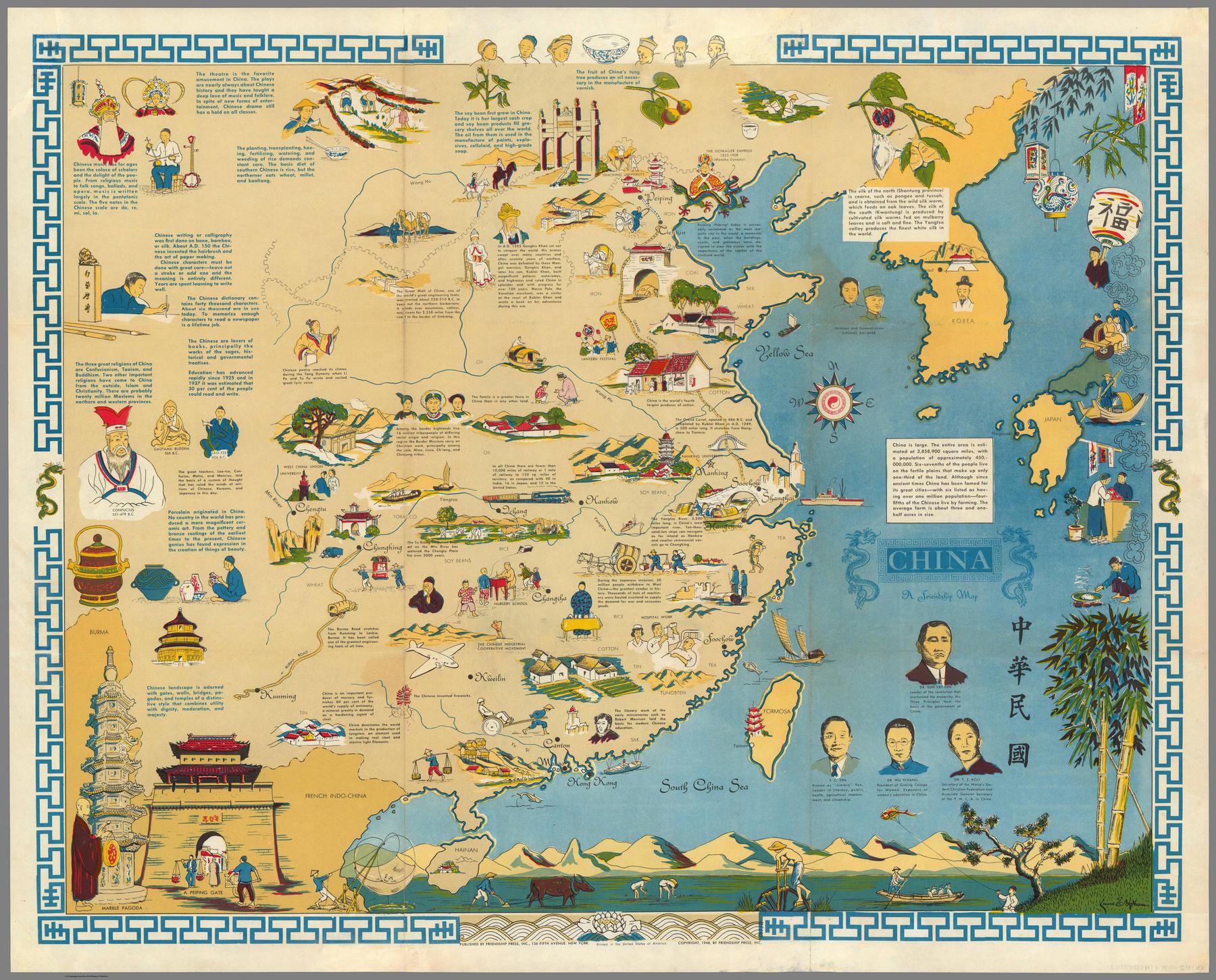
‘This just makes me sad. I wonder how much better off the world would be if Mao hadn’t ruined China… It’s such a lovely country with great people and culture, just a shit government’–Generic__Eric
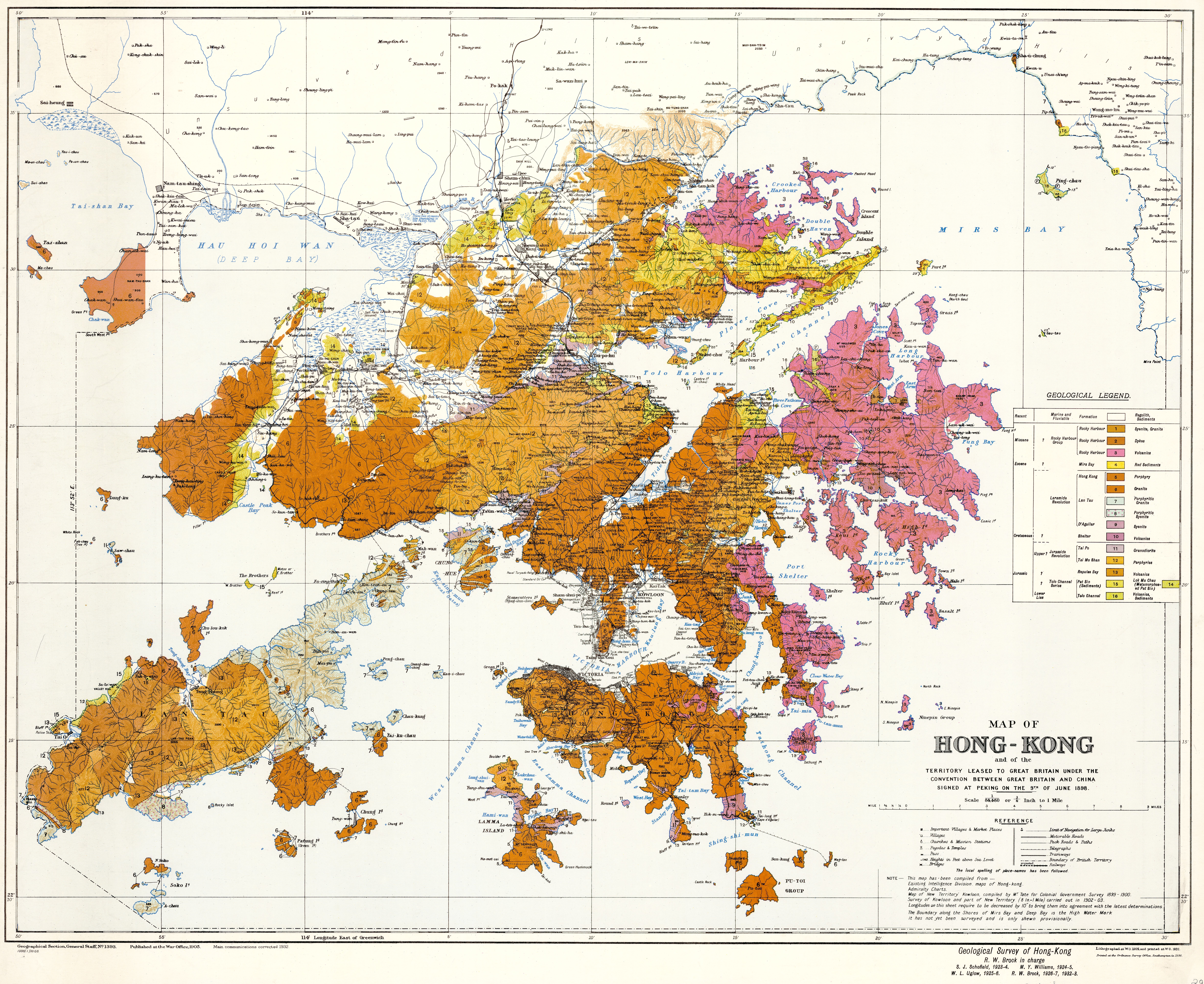
Map of Hong Kong (1936)
The 15-Inch Rainfall Isohyet and China Population Density
The 15-Inch Rainfall Isohyet and China Population Density
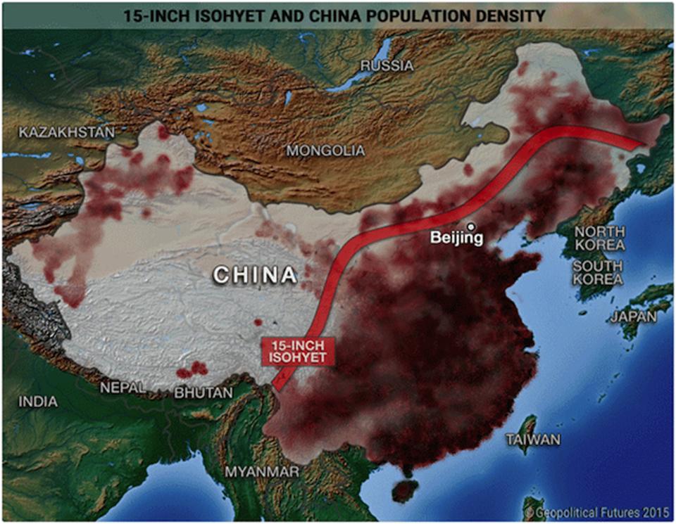
“Red of Disaster”–madrid987
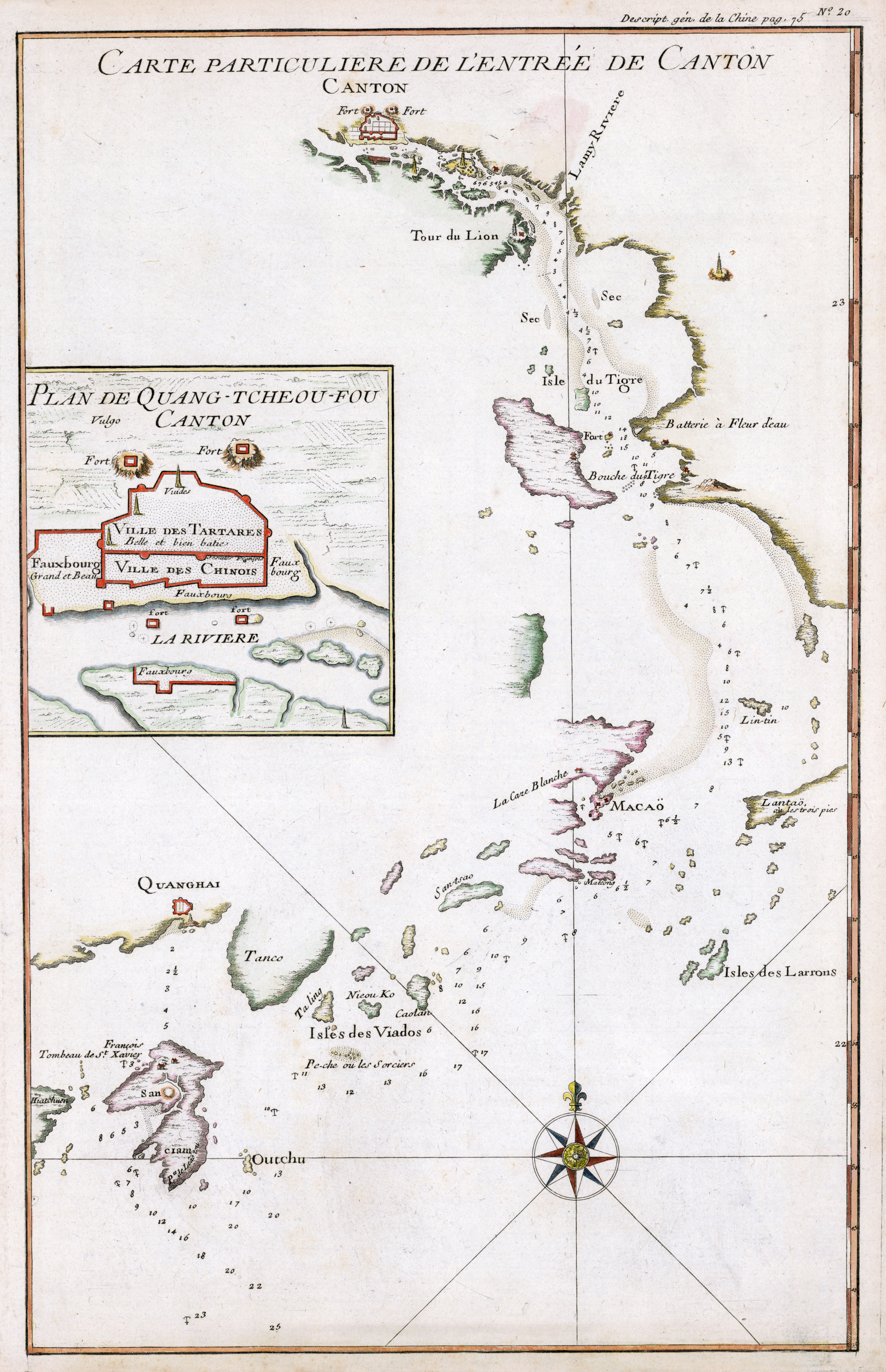
1737 map of Canton, China
China compared to the contiguous United States
China compared to the contiguous United States
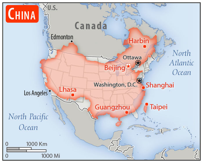
“*Cue Alaska’s walk-in music”–HumanSingularity69
Exaggerated relief map of East Asia at sunrise
Exaggerated relief map of East Asia at sunrise
[5000 × 5000]

China drawn up by roads
China drawn up by roads

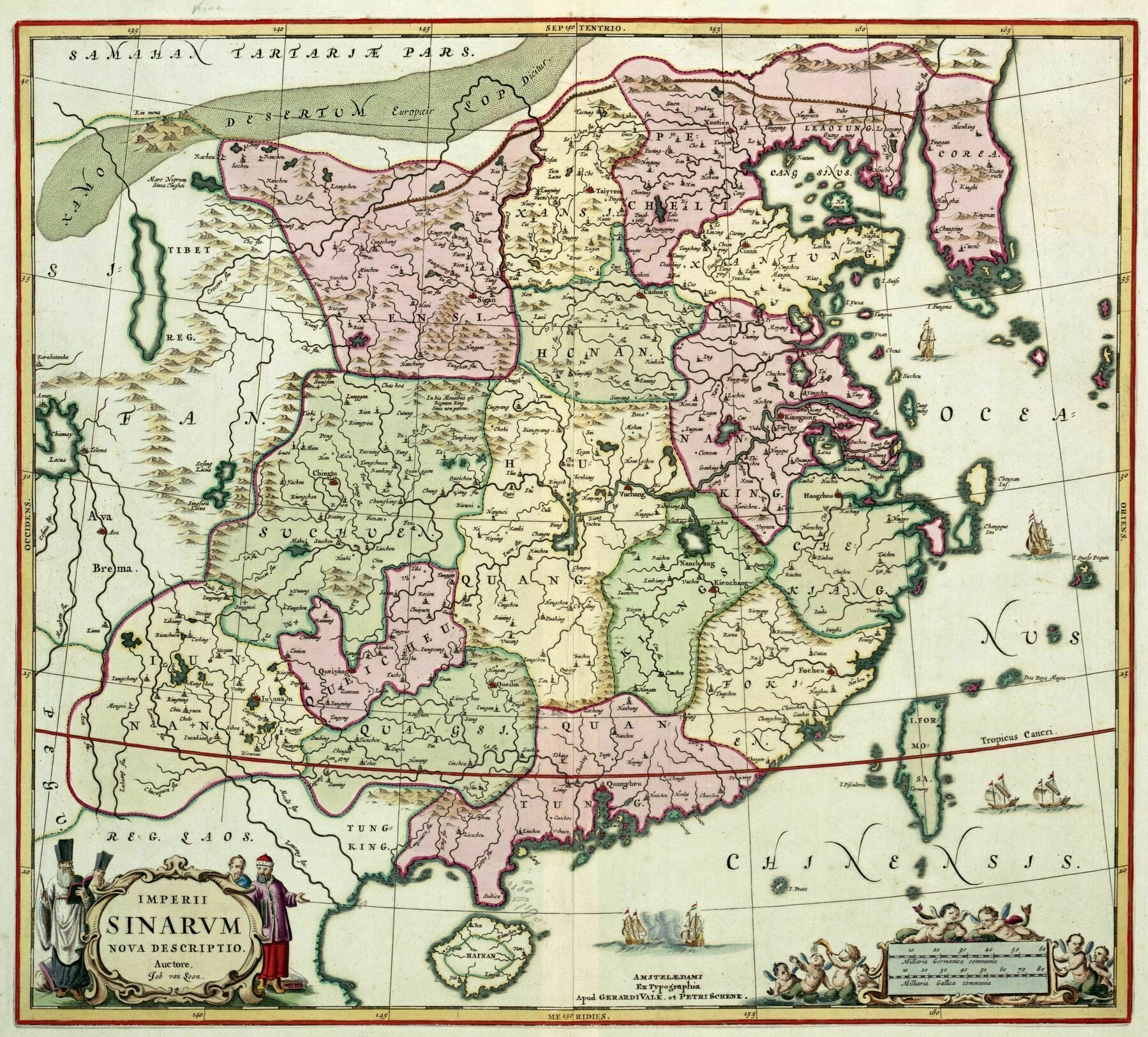
1764 map of China
1764 map of China
[3172 x 2637]
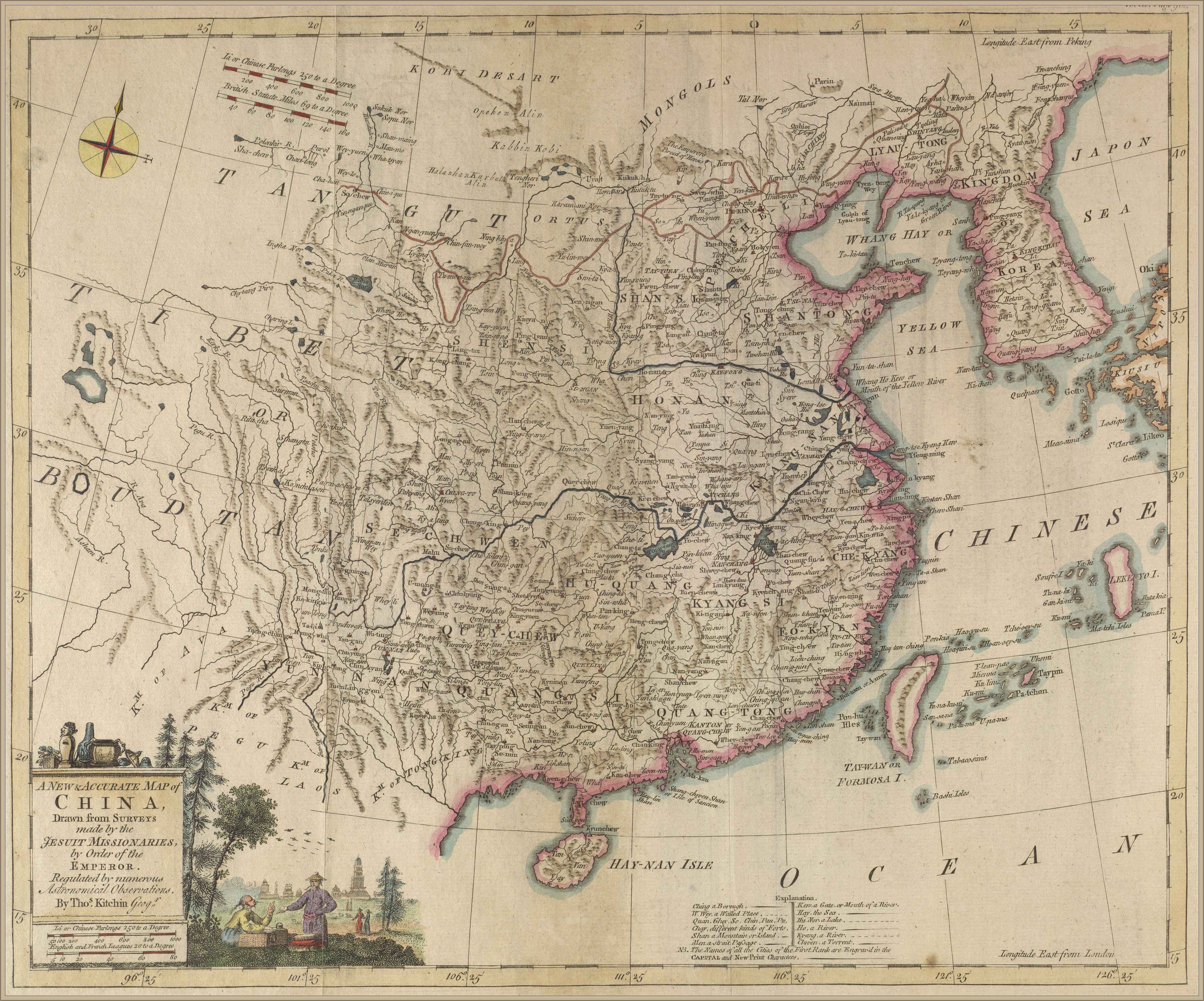
“That time the Yellow River still flowed south of Shandong Peninsula”–kimilil
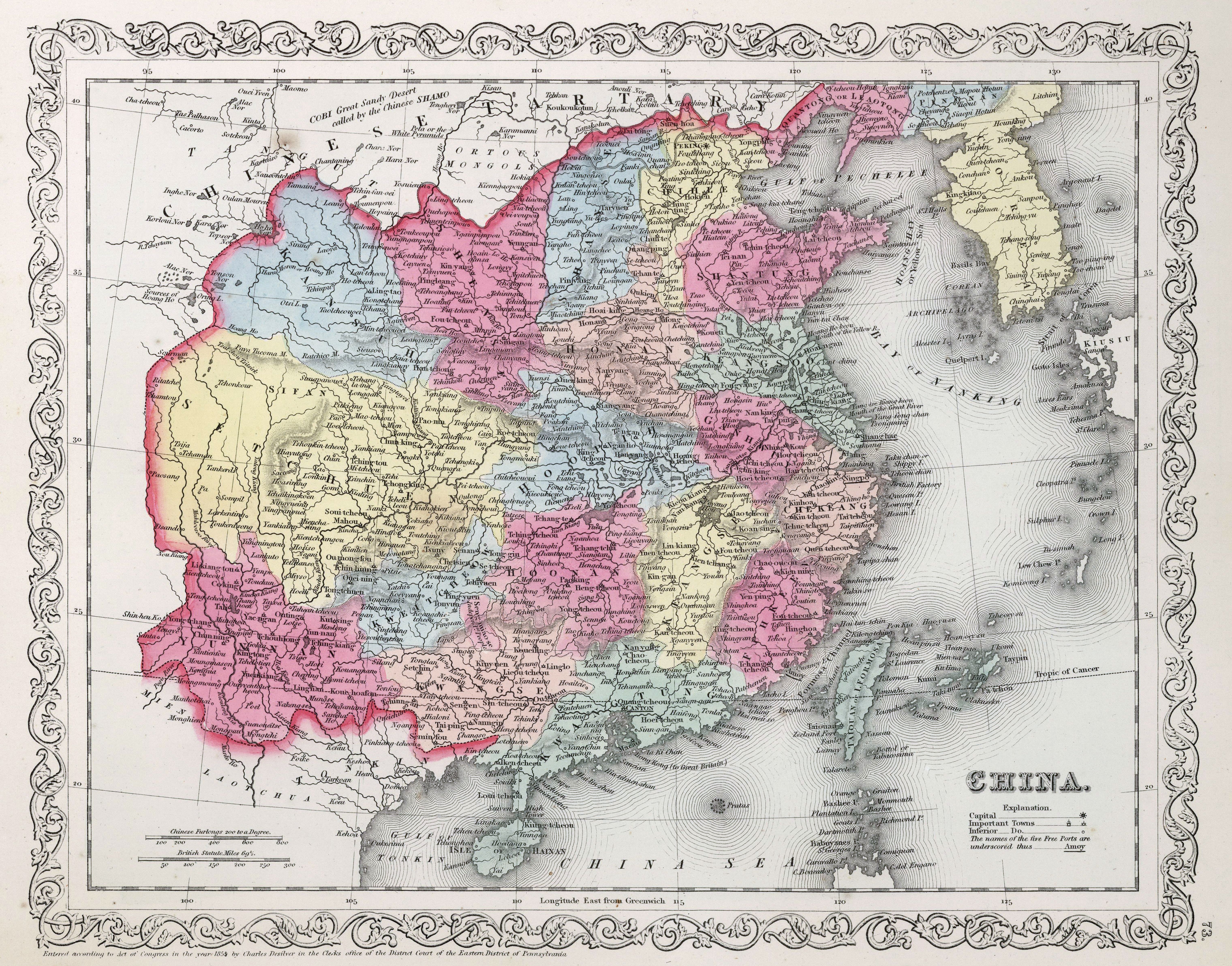
1864 map of China - by Samuel Augustus Mitchell
size: 6080 × 4765
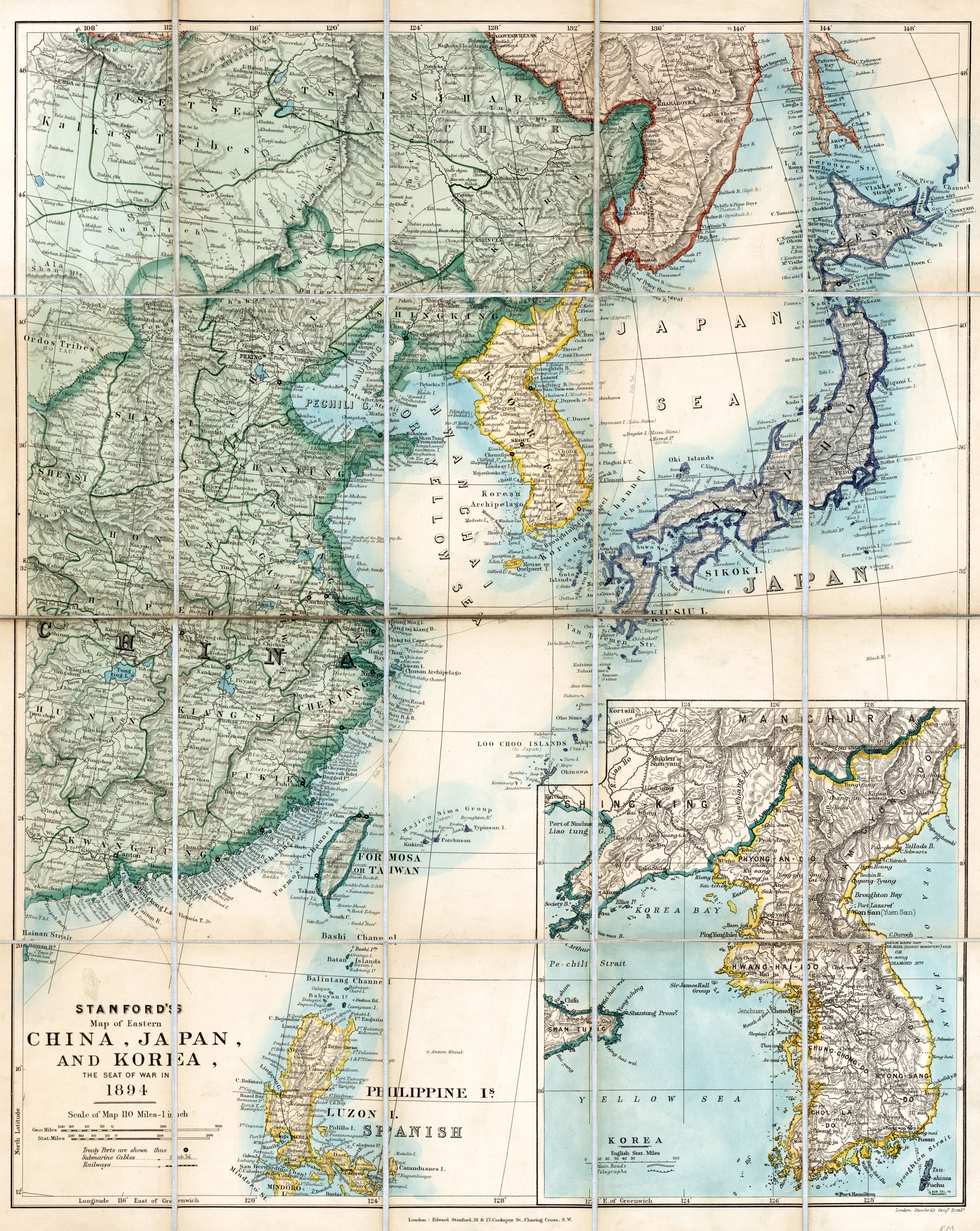
1894 Stanford's map of eastern China, Japan and Korea
China 1931
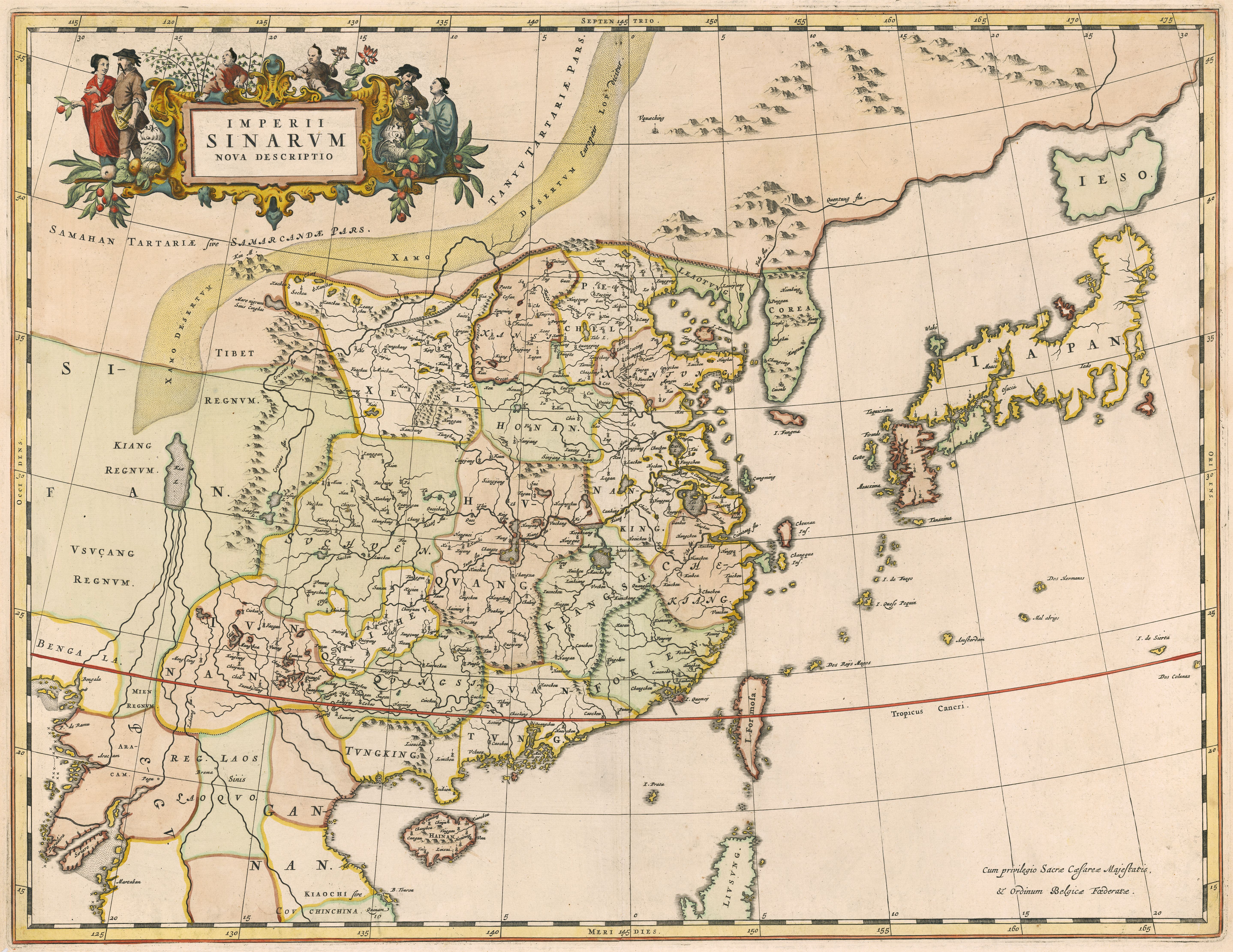
1654 map of China and Japan - by Willem Janszoon Blaeu
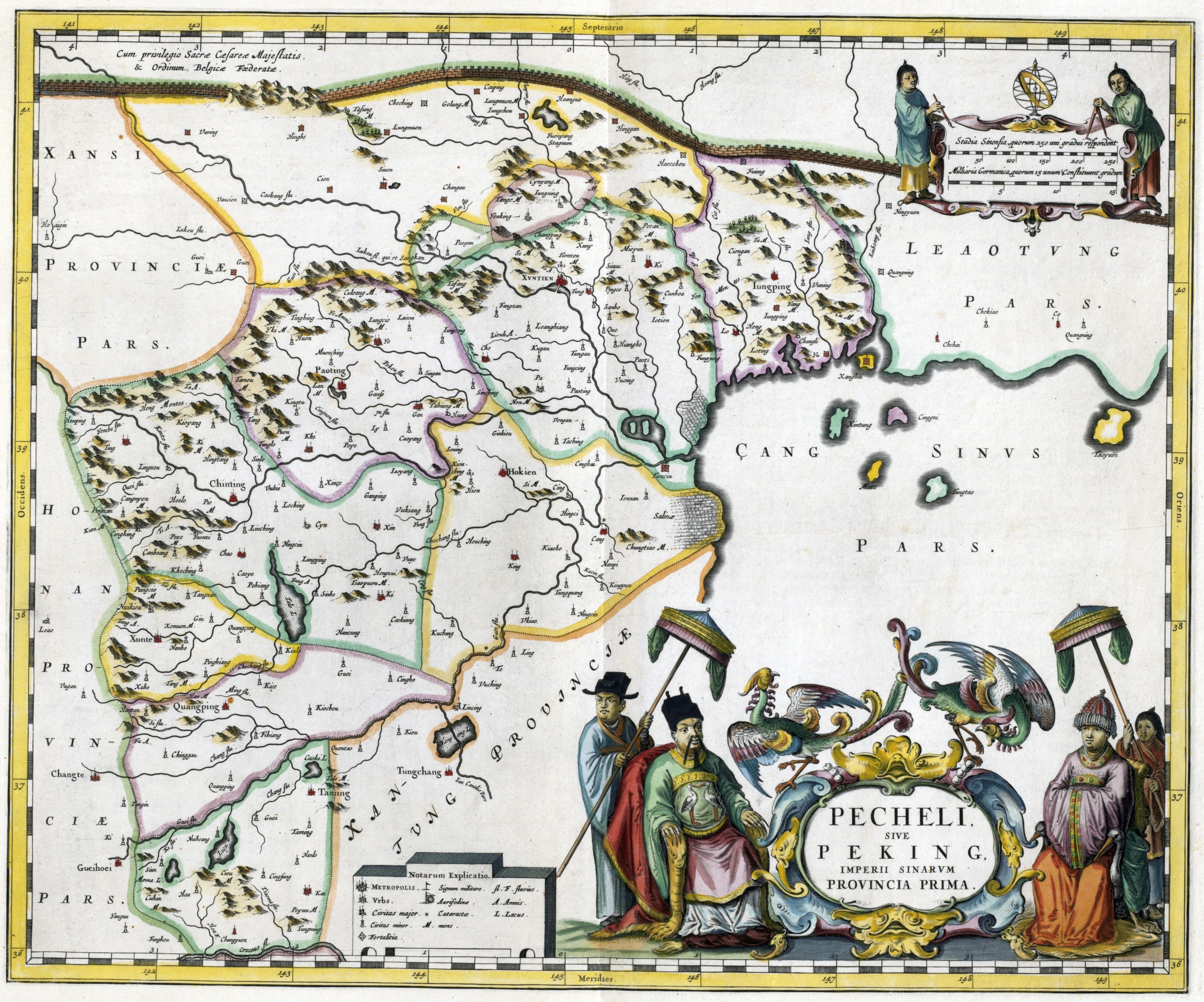
1655 map of Pecheli, including Peking, First Imperial Province of China. Map shows Great Wall of China - by Martino Martini]
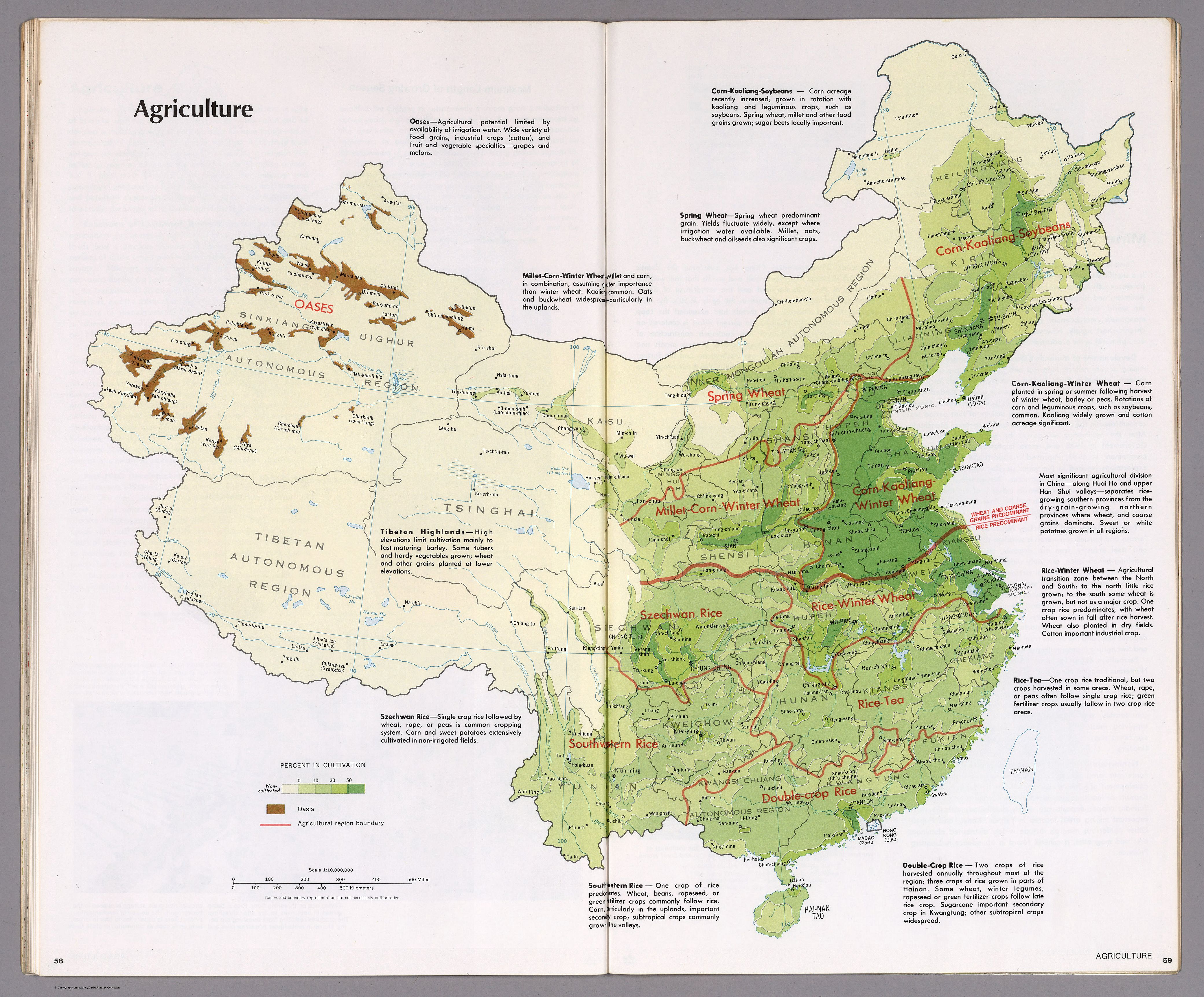
Agriculture of China (1971)
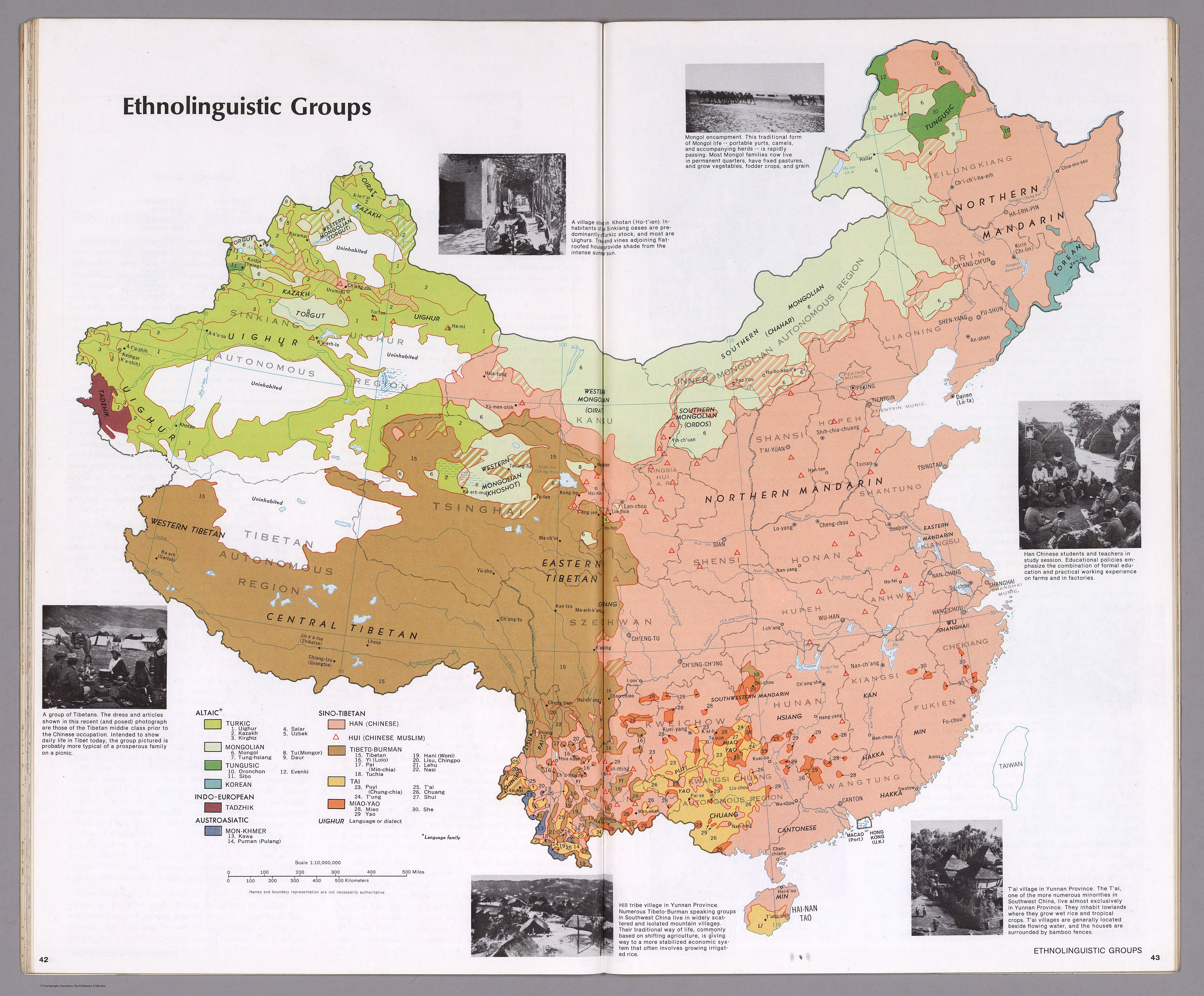
Ethnolinguistic Groups of China (1971)
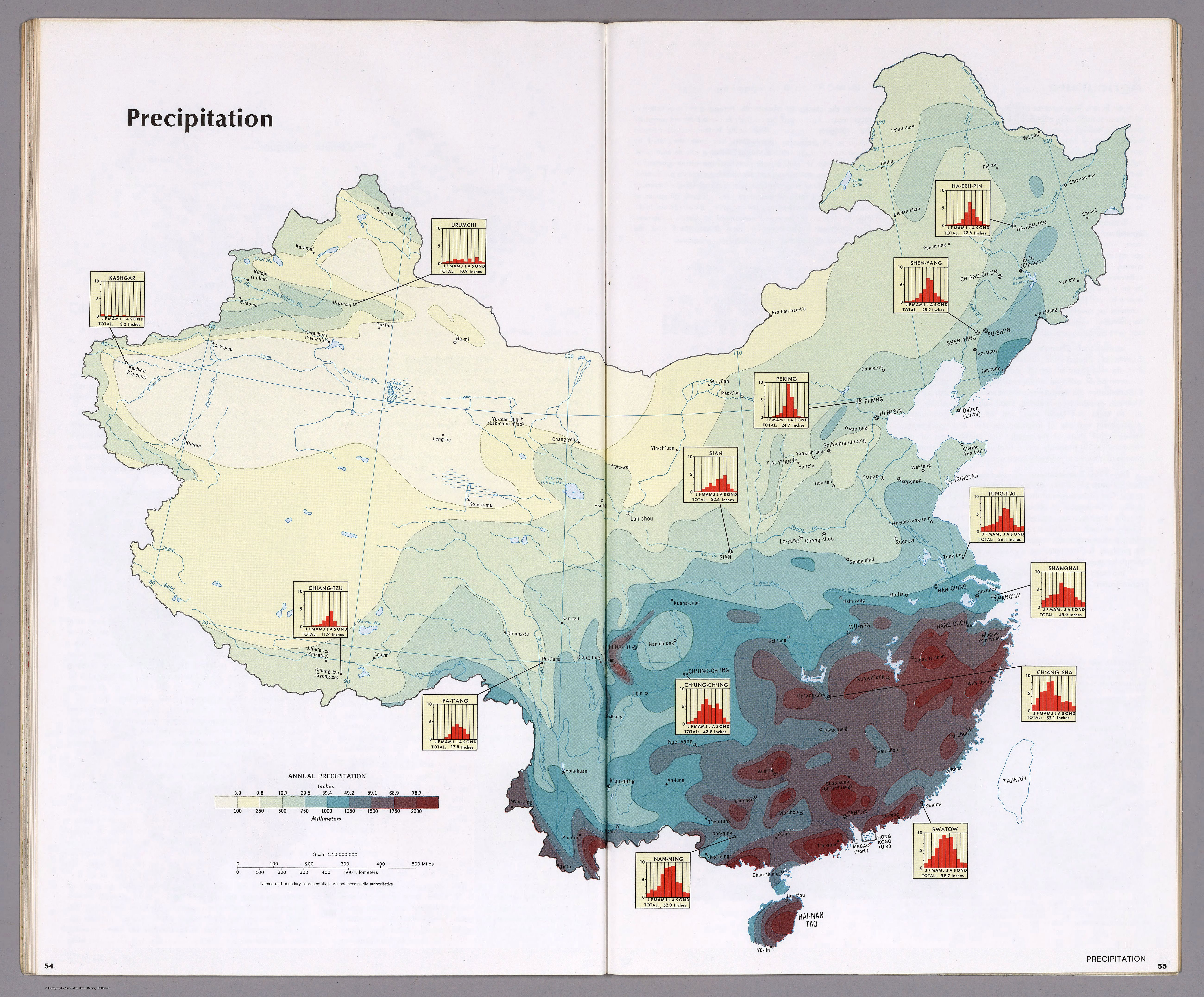
Precipitation of China (1971)
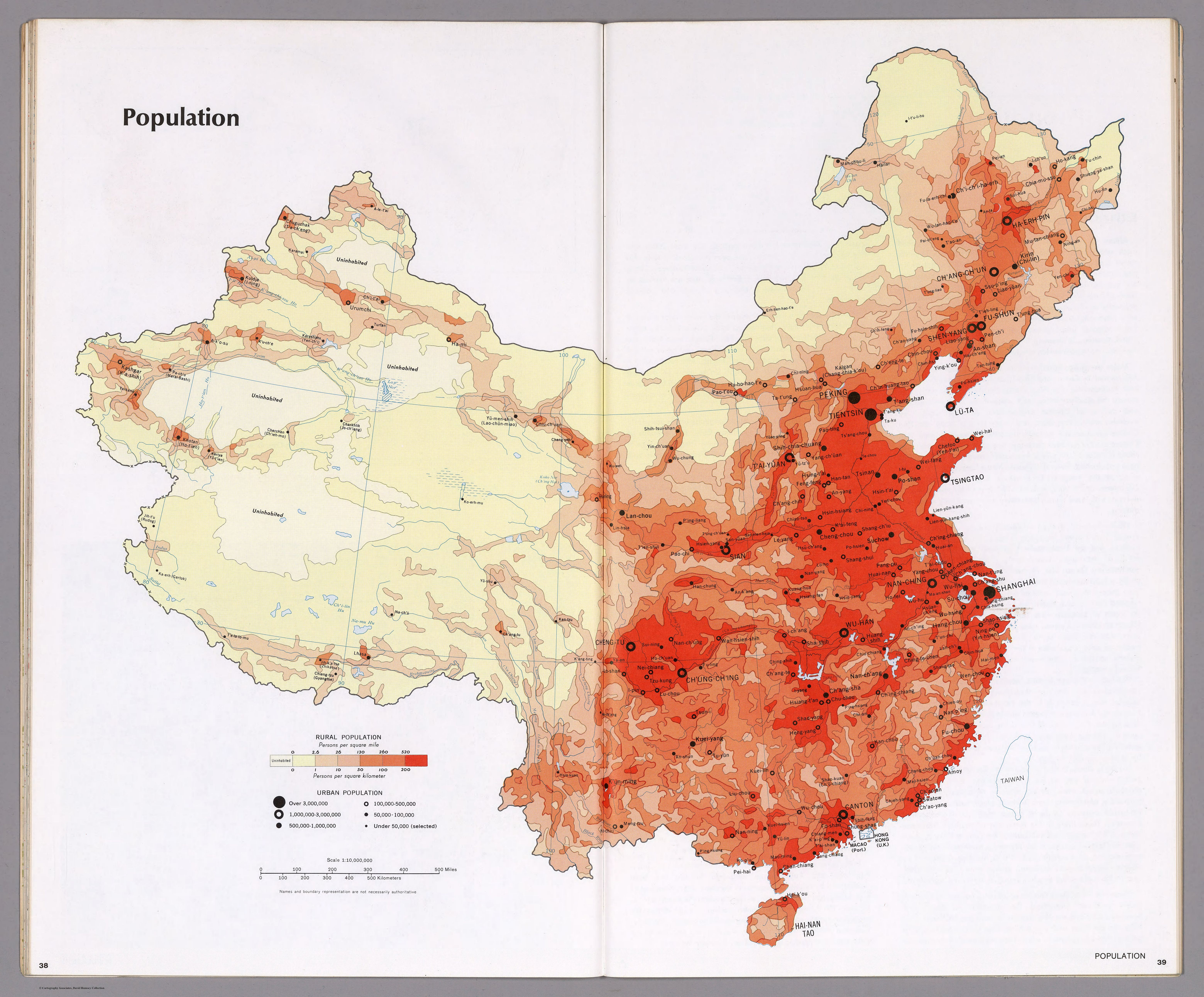
Population density map of China (1971)
