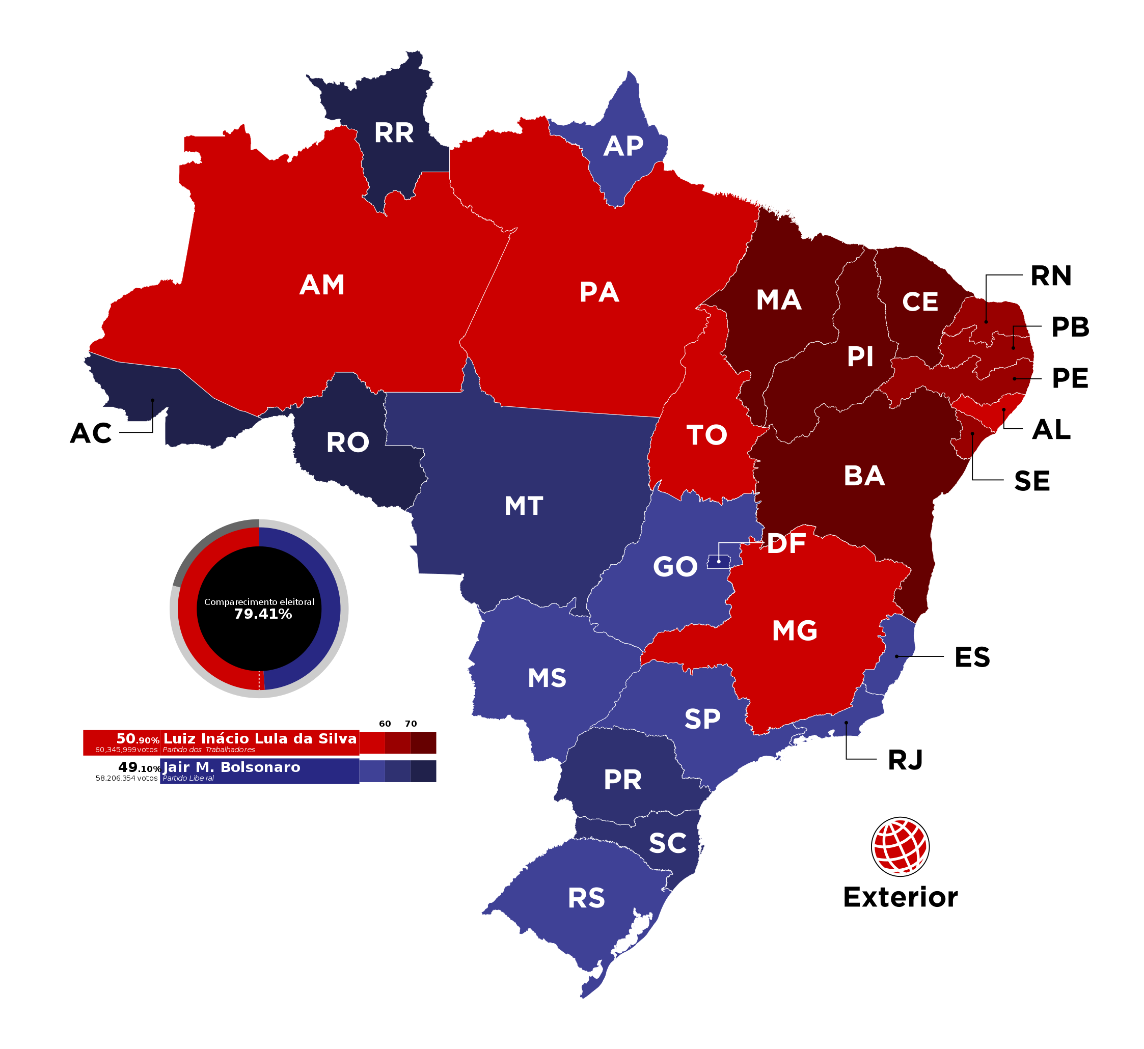
2022 Brazil Presidential Elections, Round 2 vote share by states
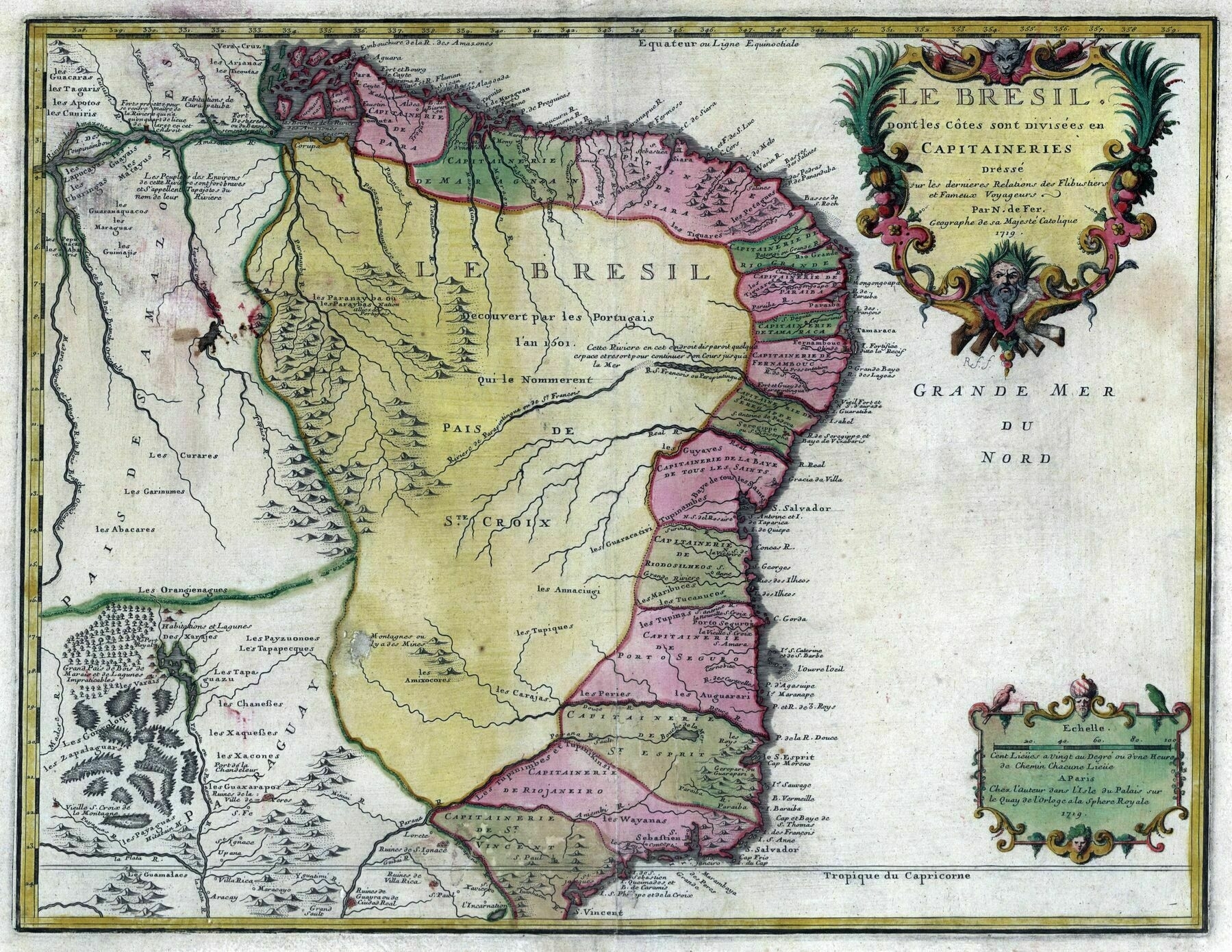
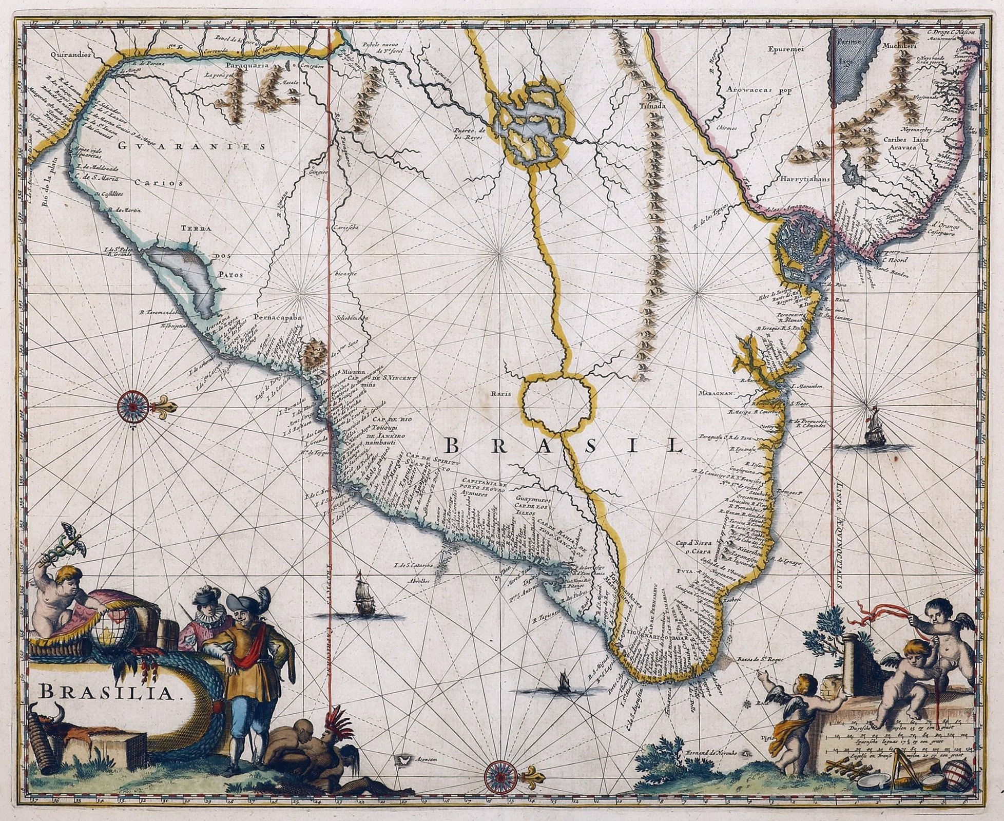
1671 map of Brazil
Population density of Brazil by municipality (2020)
Population density of Brazil by municipality (2020)
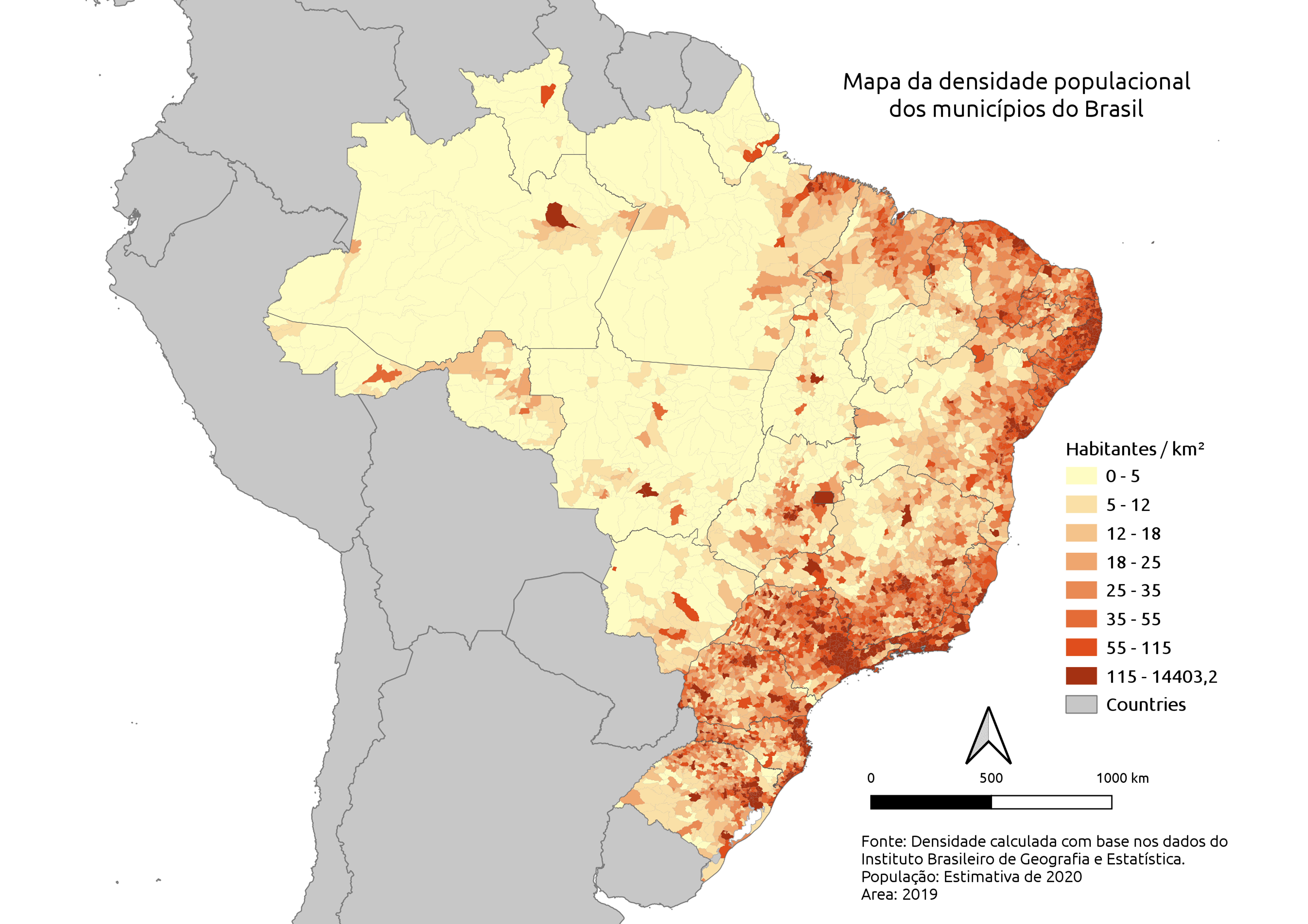
‘Brazil population tends to be C O A S T A L’
1891 map of Brazil - by Joao Coelho
1891 map of Brazil - by Joao Coelho
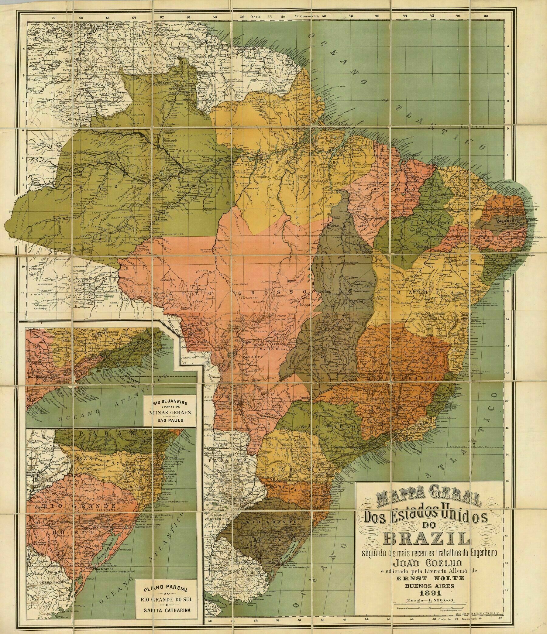
‘Amazing! Thank you very much for sharing it!’–zhezow
1913 map of Brazil
1913 map of Brazil
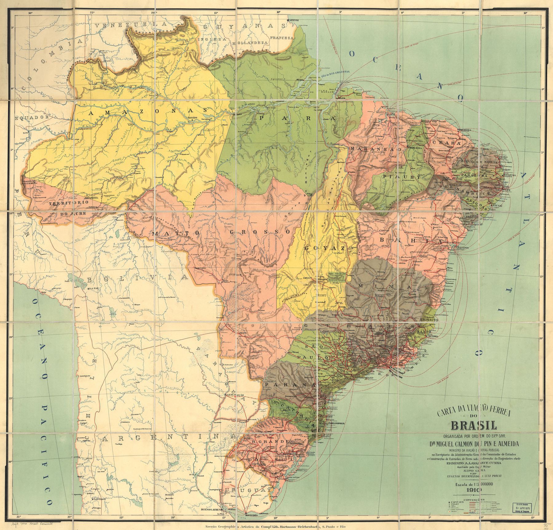
‘Brasilia didn’t exist yet but its territory was already marked’–dom_bul
Brazil solar energy potential
Brazil solar energy potential
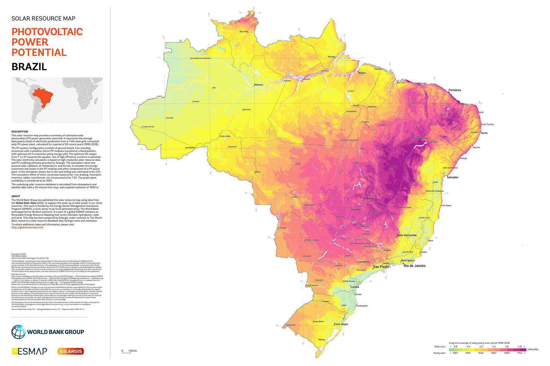
‘A lot of the purple areas are in arid regions or plains actually. The trees are in the yellow areas (the amazon)’–Moikanyoloko
Brazilian river basins
Brazilian river basins
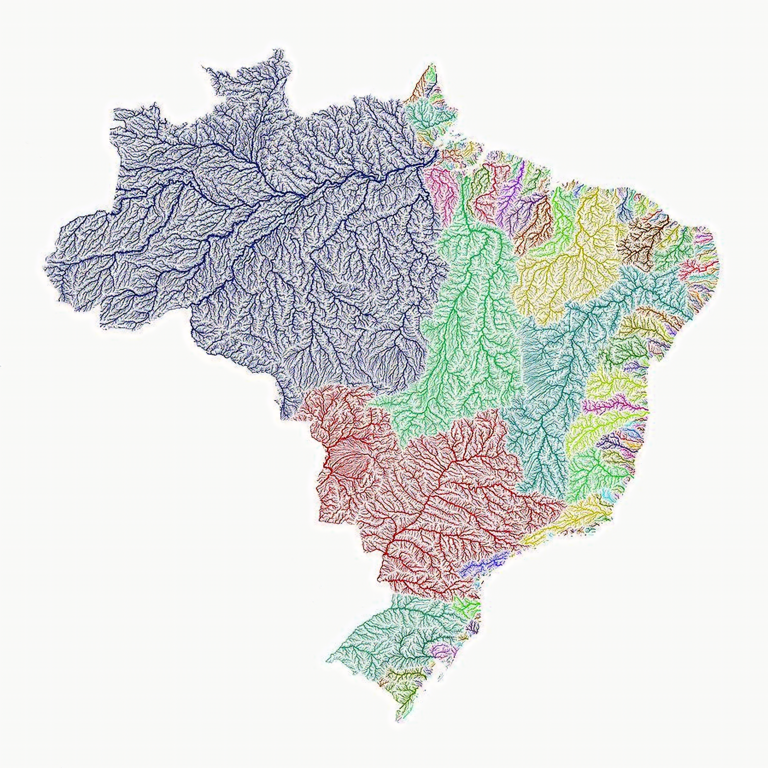
‘What a coincidence that the change in the color of the waters corresponds exactly to the currencies of the states!’–sapphocubas
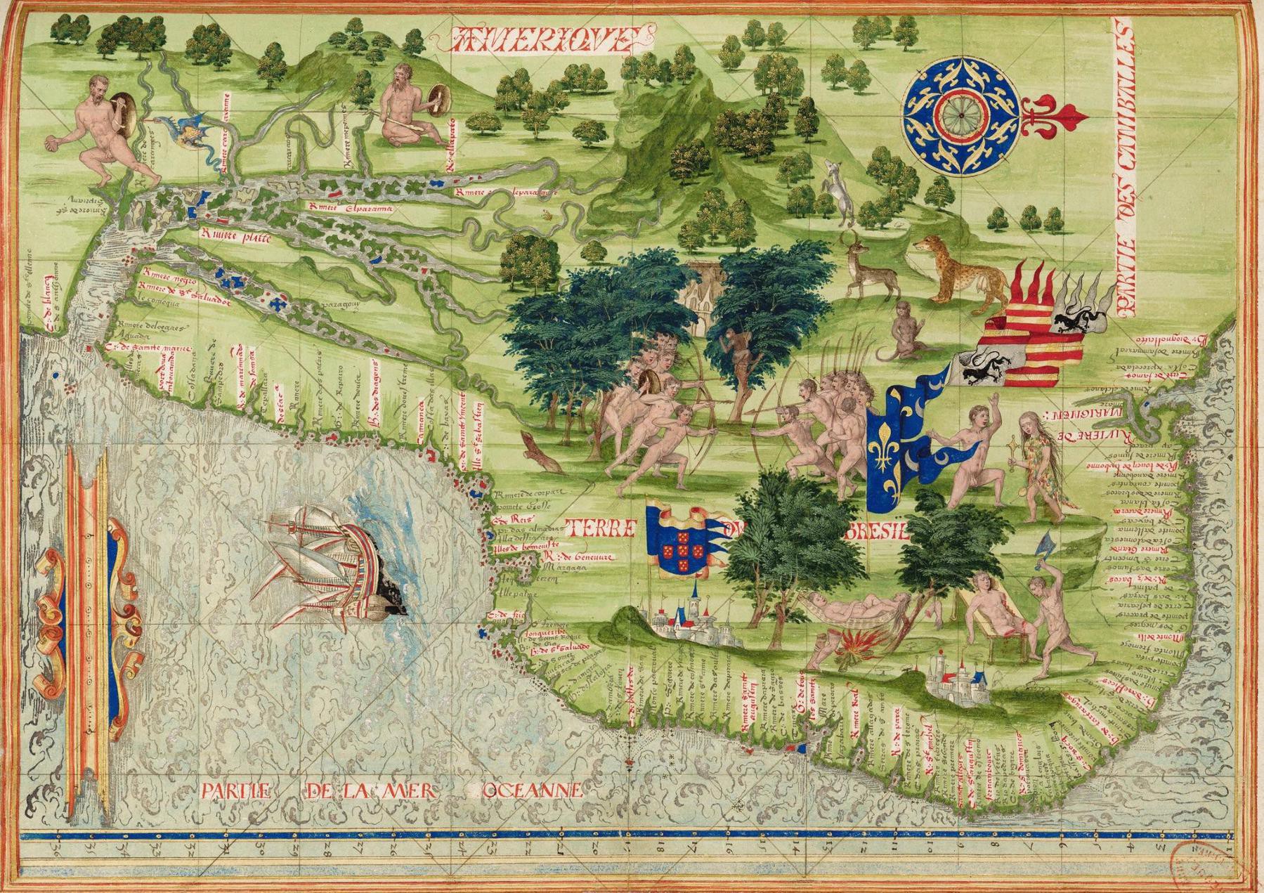
1555 Map of Brazil by Guillaume Le Testu
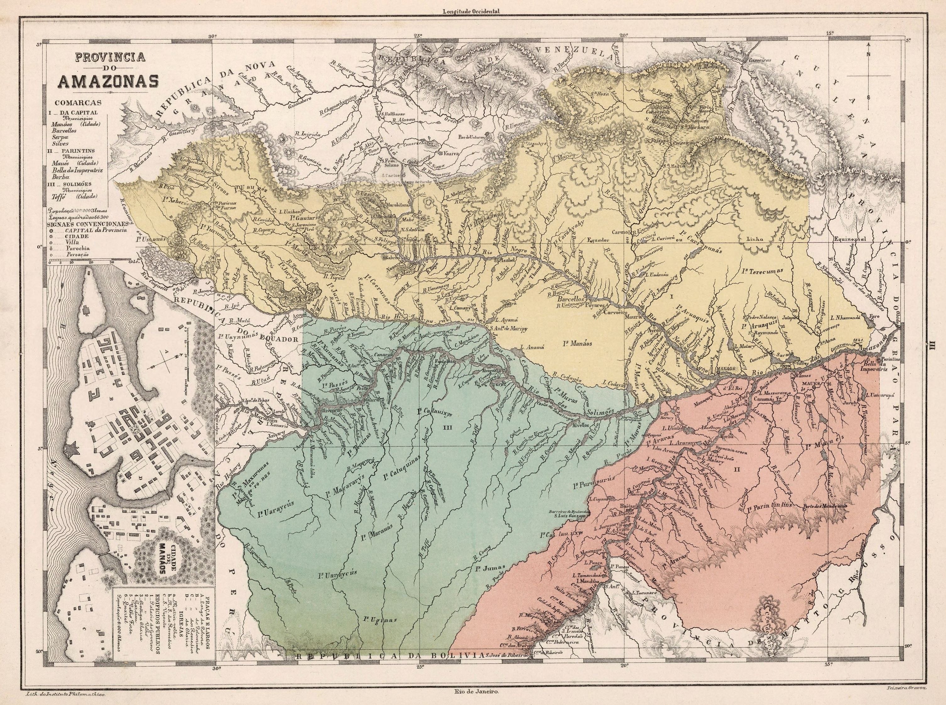
1868 map of Amazonas
1868 map of Amazonas
[3012 × 2243]
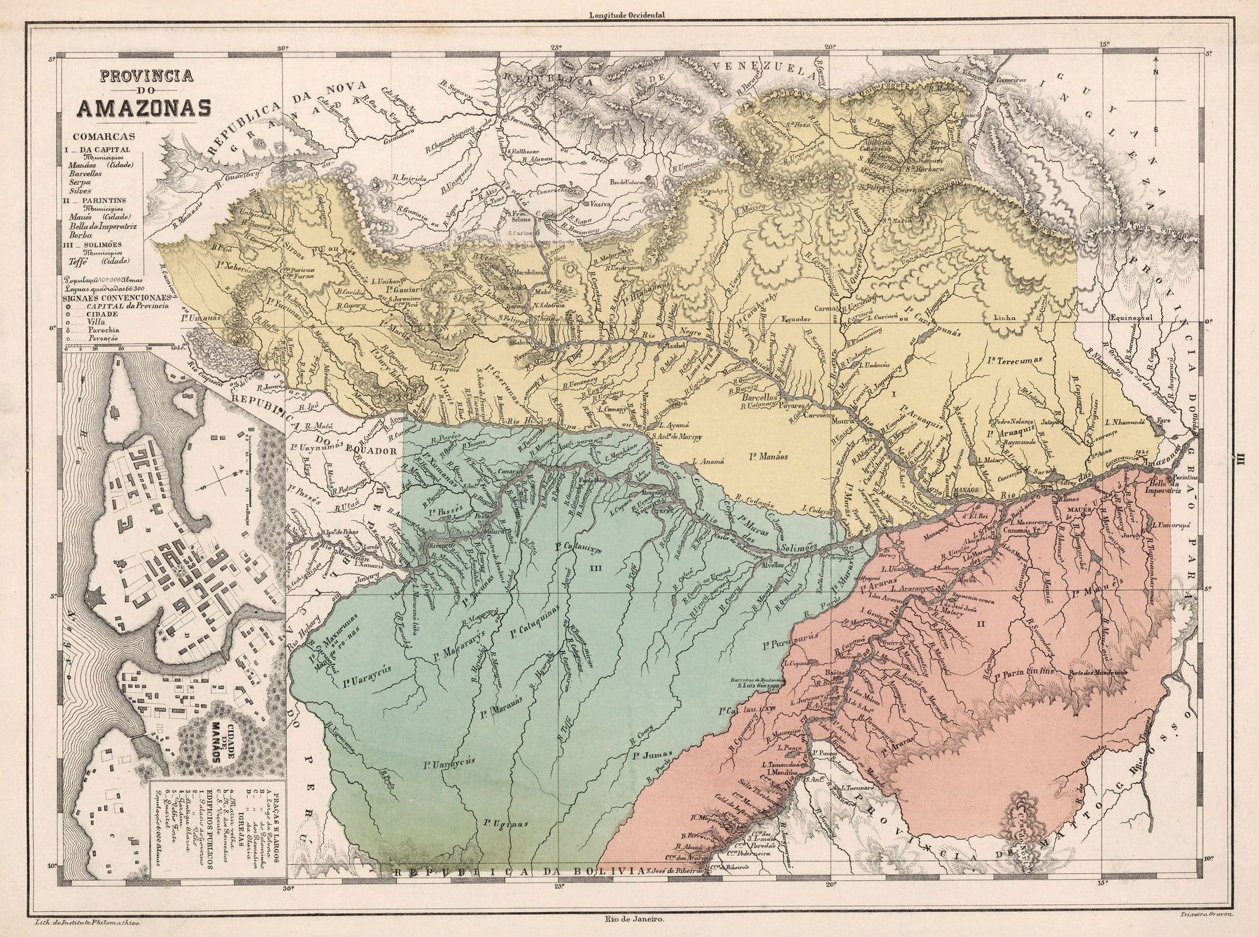
‘Can anyone mark where they carried the ship in Fitzcaraldo?’–anotherMiguel
Exaggerated Relief Map of southeastern Brazil and the surrounding region
Exaggerated Relief Map of southeastern Brazil and the surrounding region
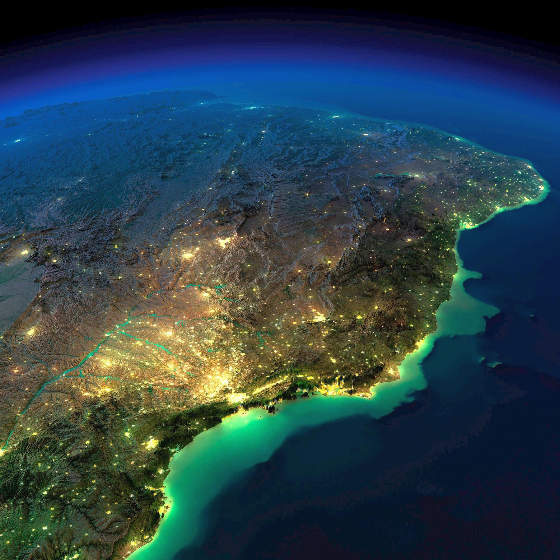
‘Wow best one yet, you can really see how geography shaped Brazil’–newmanstartover
1868 map of Amazonas
Köppen–Geiger climate map of Brazil - recent past and future
Köppen–Geiger climate map of Brazil - recent past and future
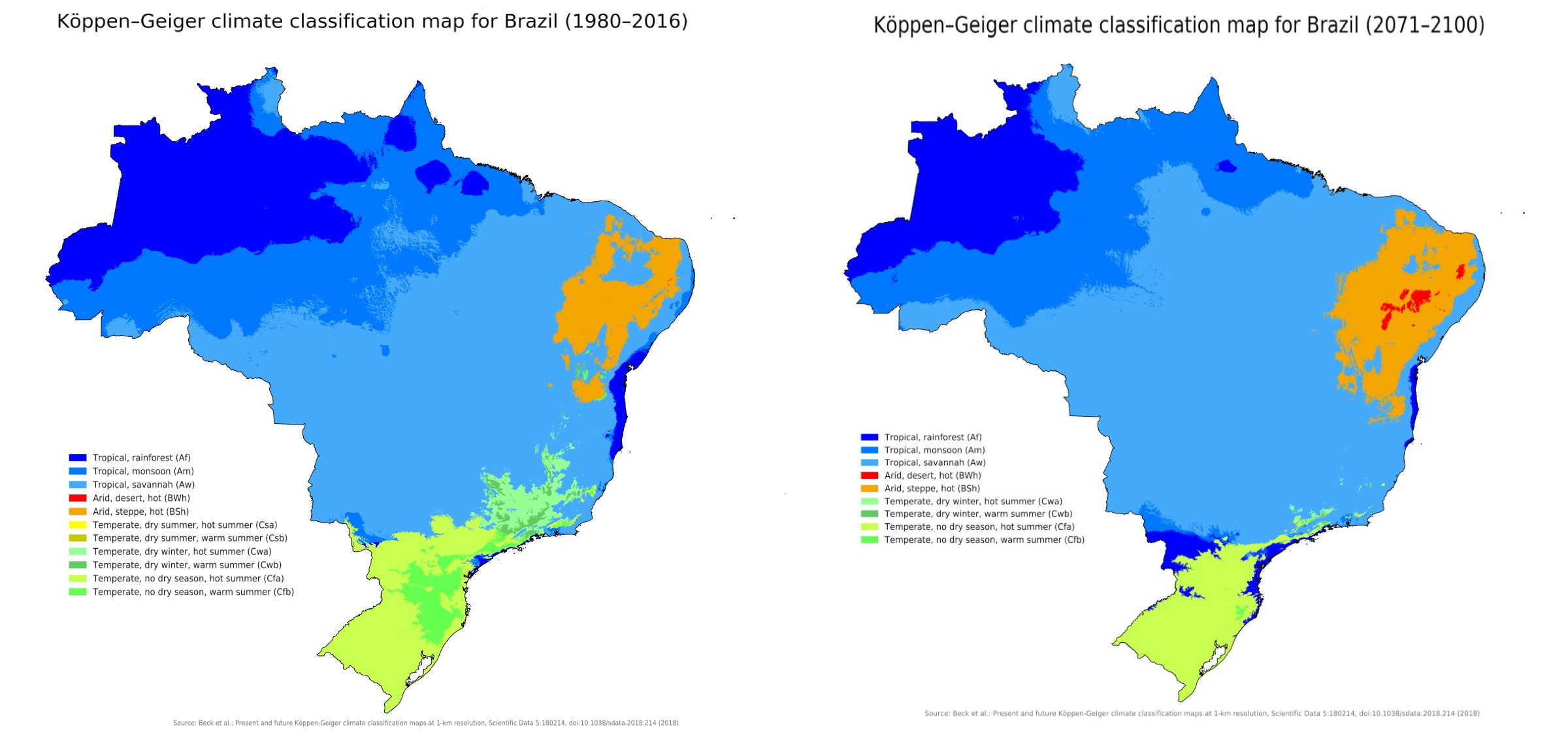
“Many climate models indicate more rain in uruguay and south Brazilian states if global warming get out of control… Just see what happens in warmer el niño years… I heard complains of friends about being one month without sun… all days raining”–adi19rn
1908 Map of the rubber tree growing regions in Brazil
1908 Map of the rubber tree growing regions in Brazil
[8524 x 8719]

“Or as the locals knew it the map of pain and suffering”–no-mad
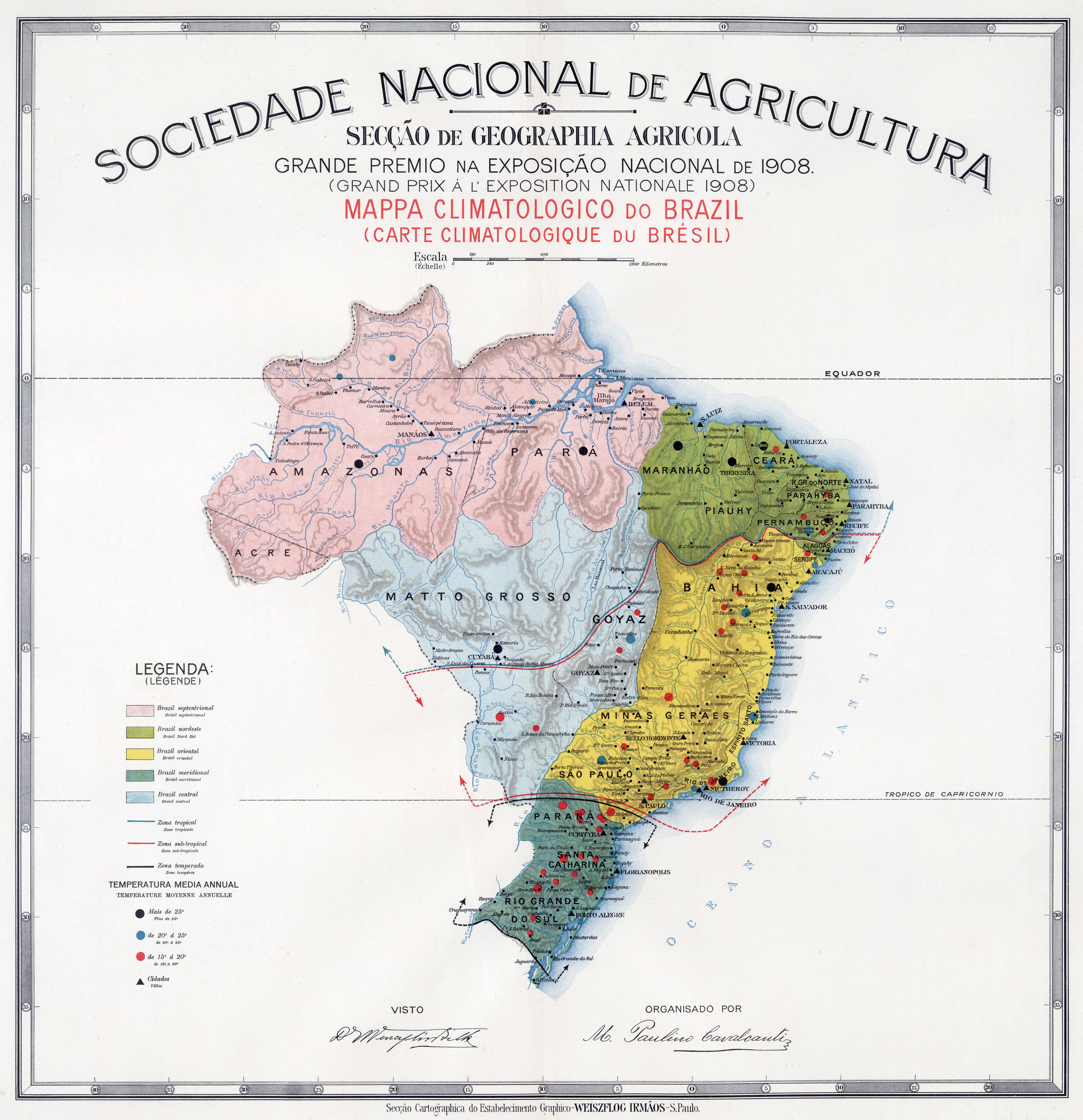
1908 Climate map of Brazil
1908 Climate map of Brazil
[8439 x 8730]
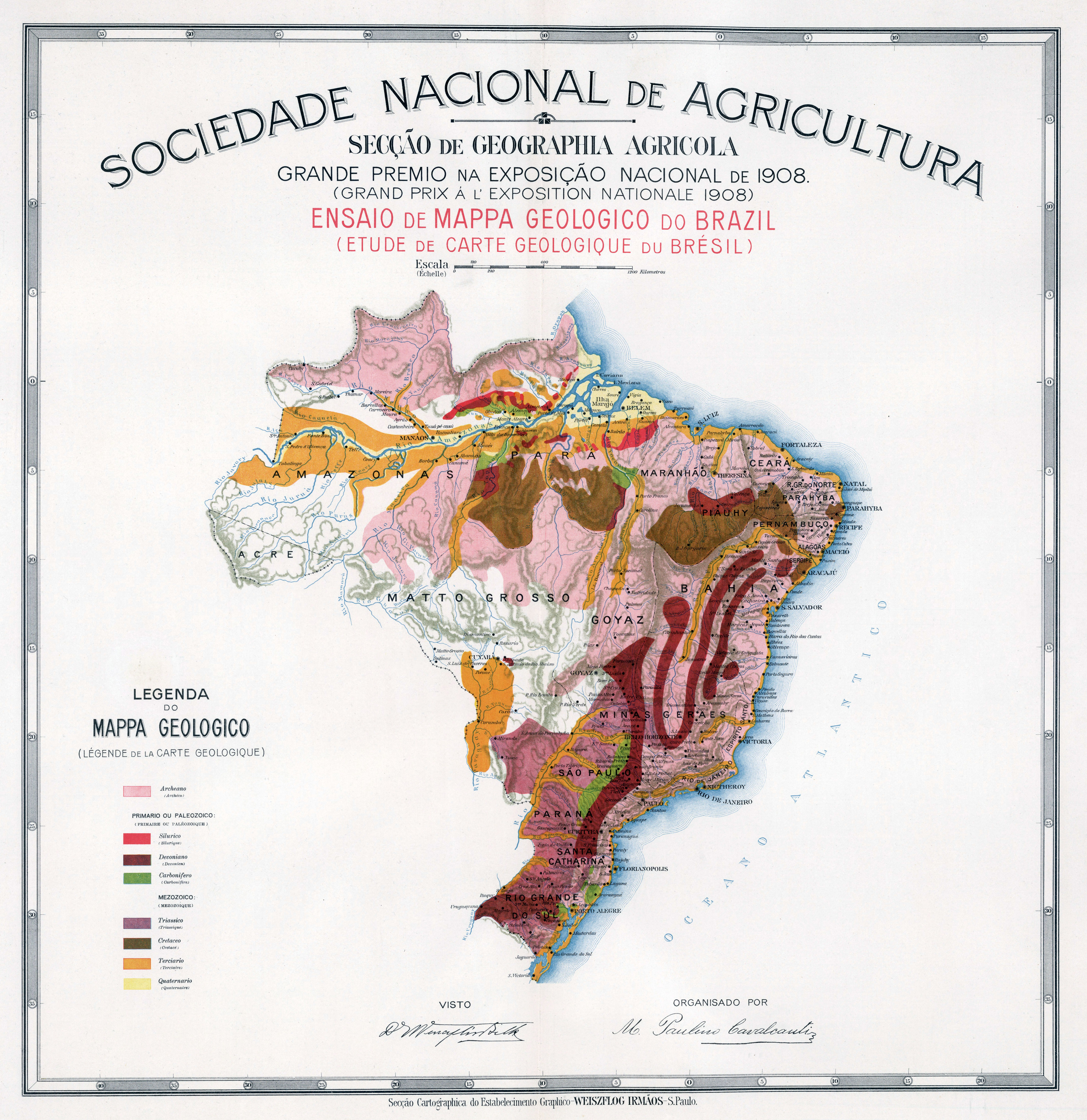
1908 Geological map of Brazil
1908 Geological map of Brazil
[8605 x 8806]
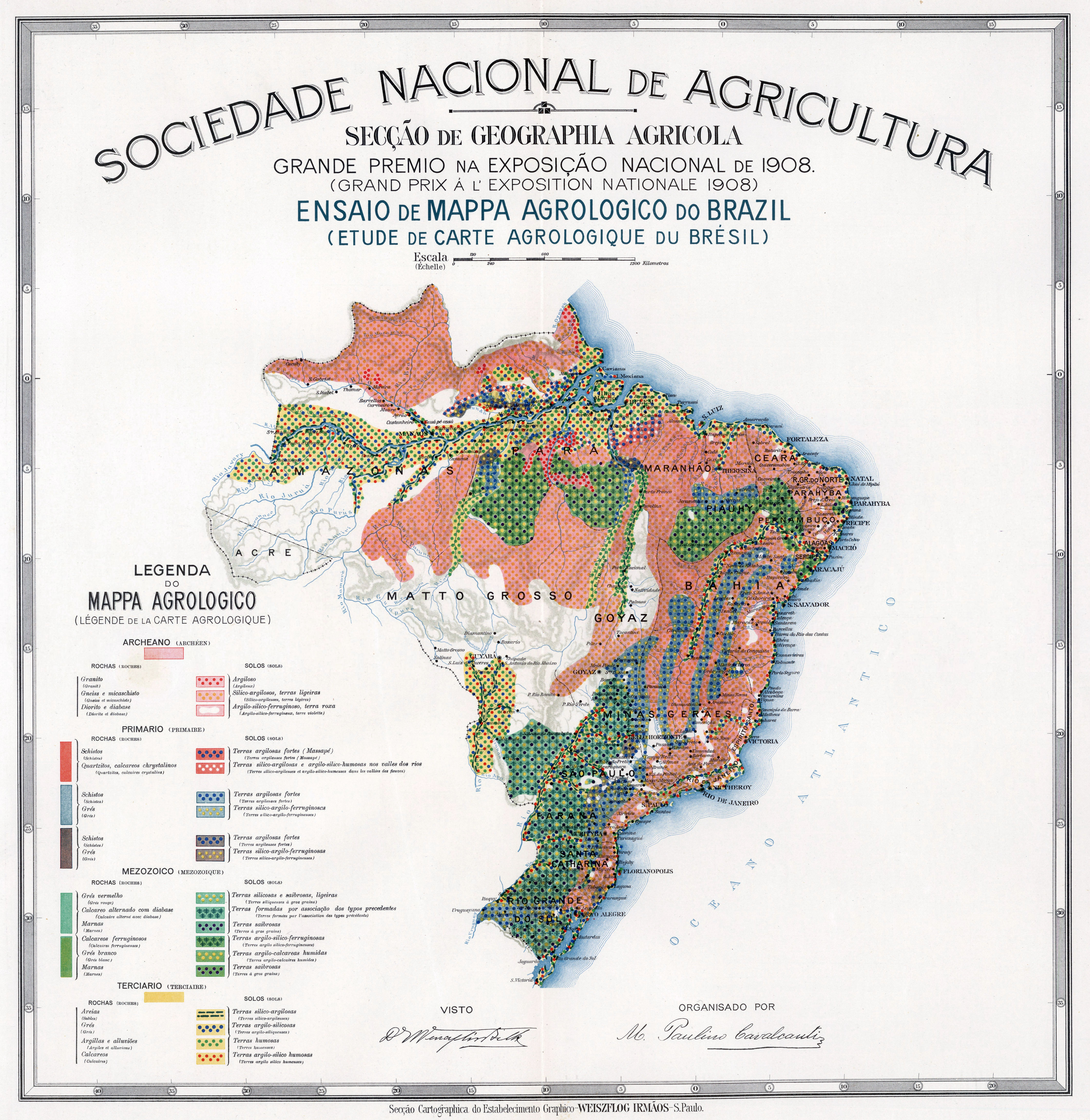
1908 Agrological map of Brazil
1908 Agrological map of Brazil
[8493 x 8721]
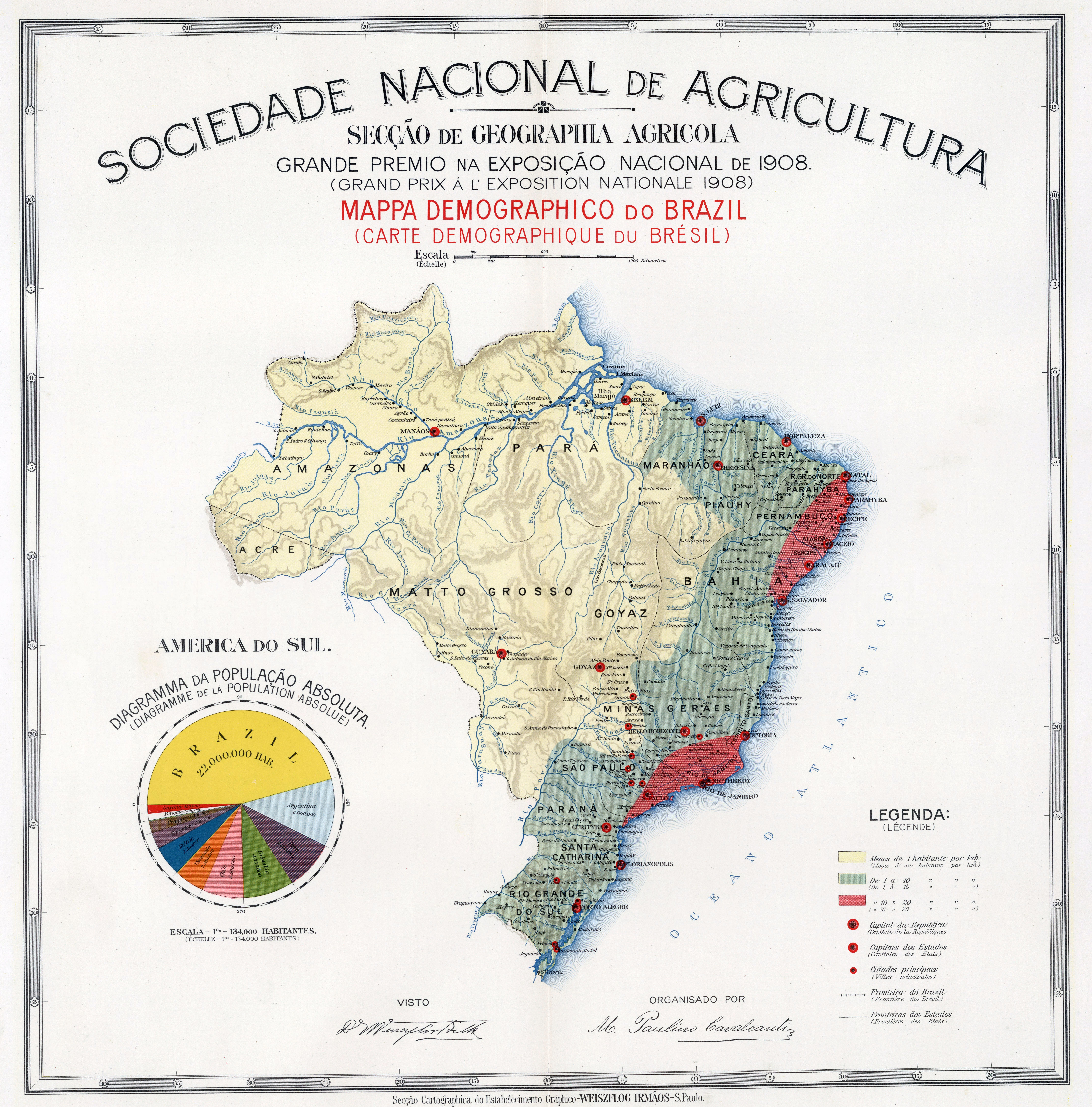
1908 Demographic map of Brazil
1908 Demographic map of Brazil
[8579 x 8693]
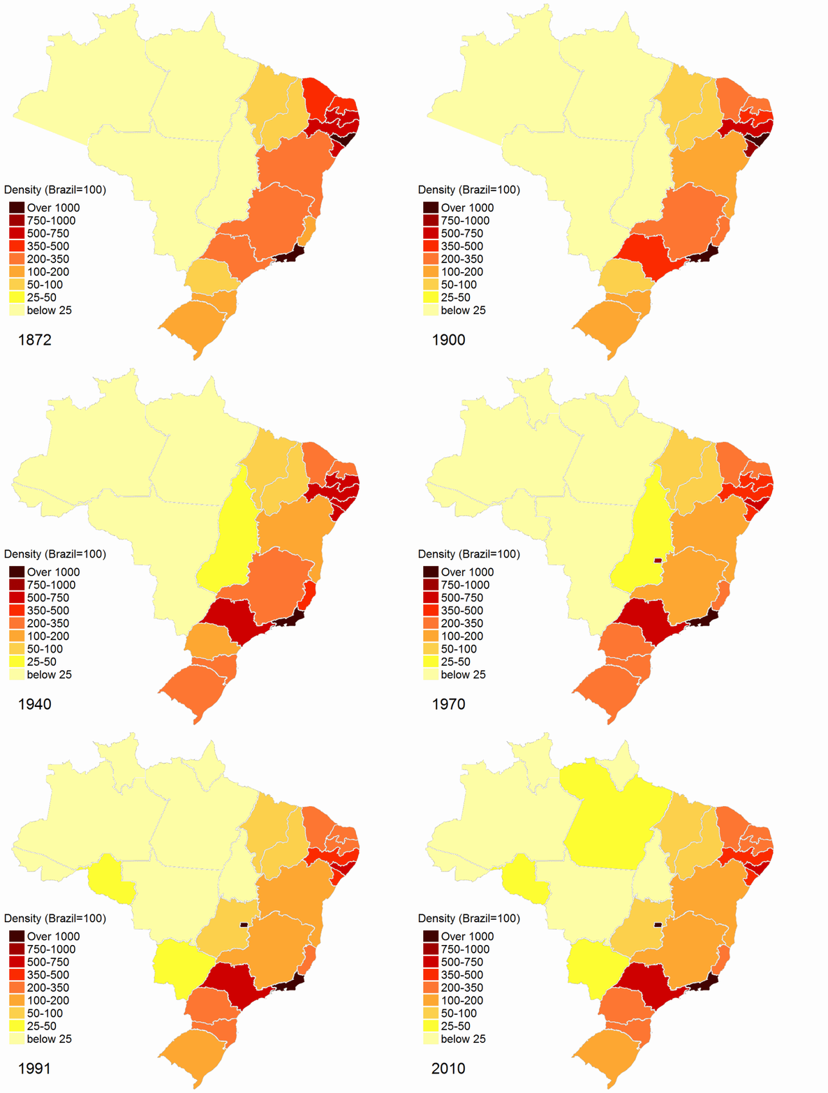
Relative demographic density of Brazilian States throughout the national censuses 1872-2010
Relative demographic density of Brazilian States throughout the national censuses 1872-2010
Size comparison of Brazil to the contiguous United States
Size comparison of Brazil to the contiguous United States
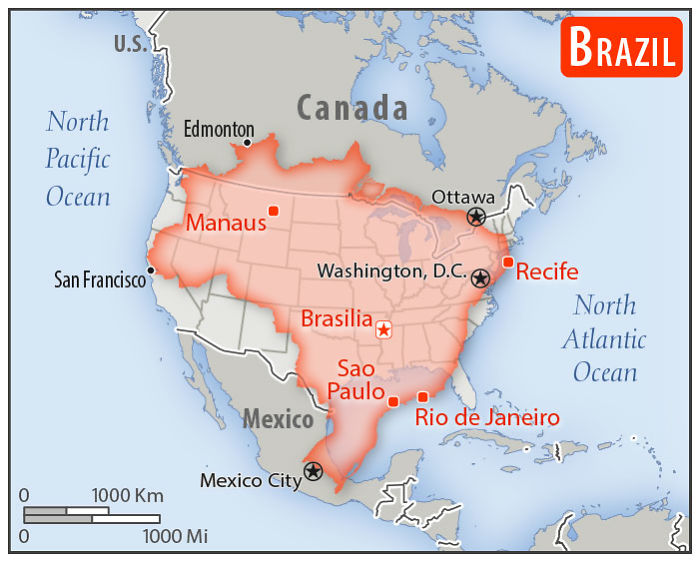
“FYI Contiguous United States - 8,080,464 km² (3,119,884.69 sq mi) Brazil - 8,515,767 km² (3,287,956 sq mi)“–YotaRichard
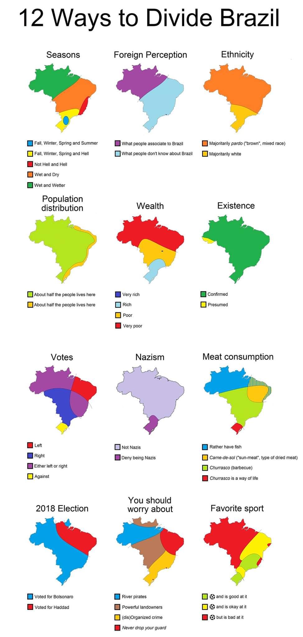
12 ways to divide Brazil
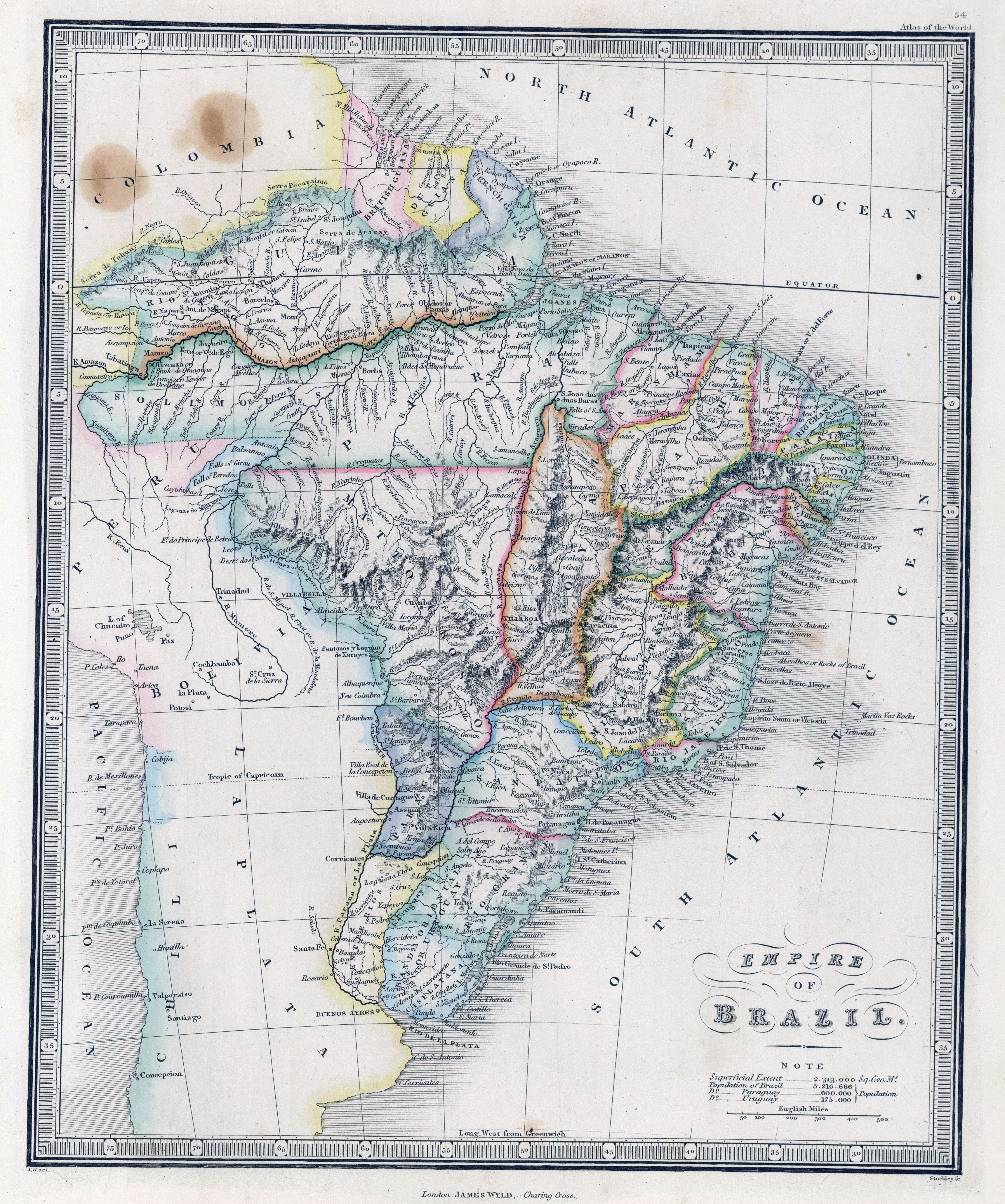
1864 map of Brazil- by James Wyld
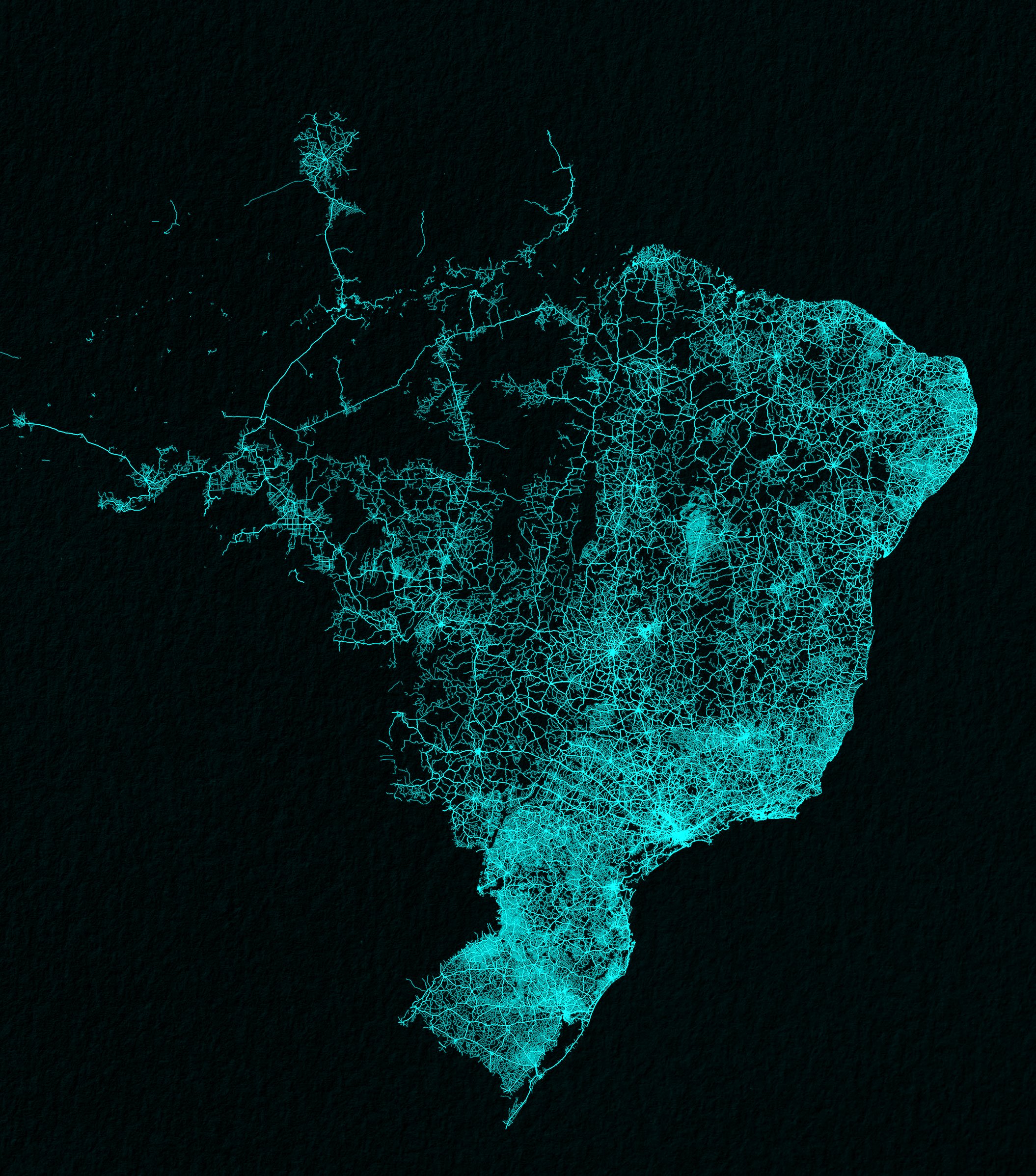
Brazil drawn up by roads
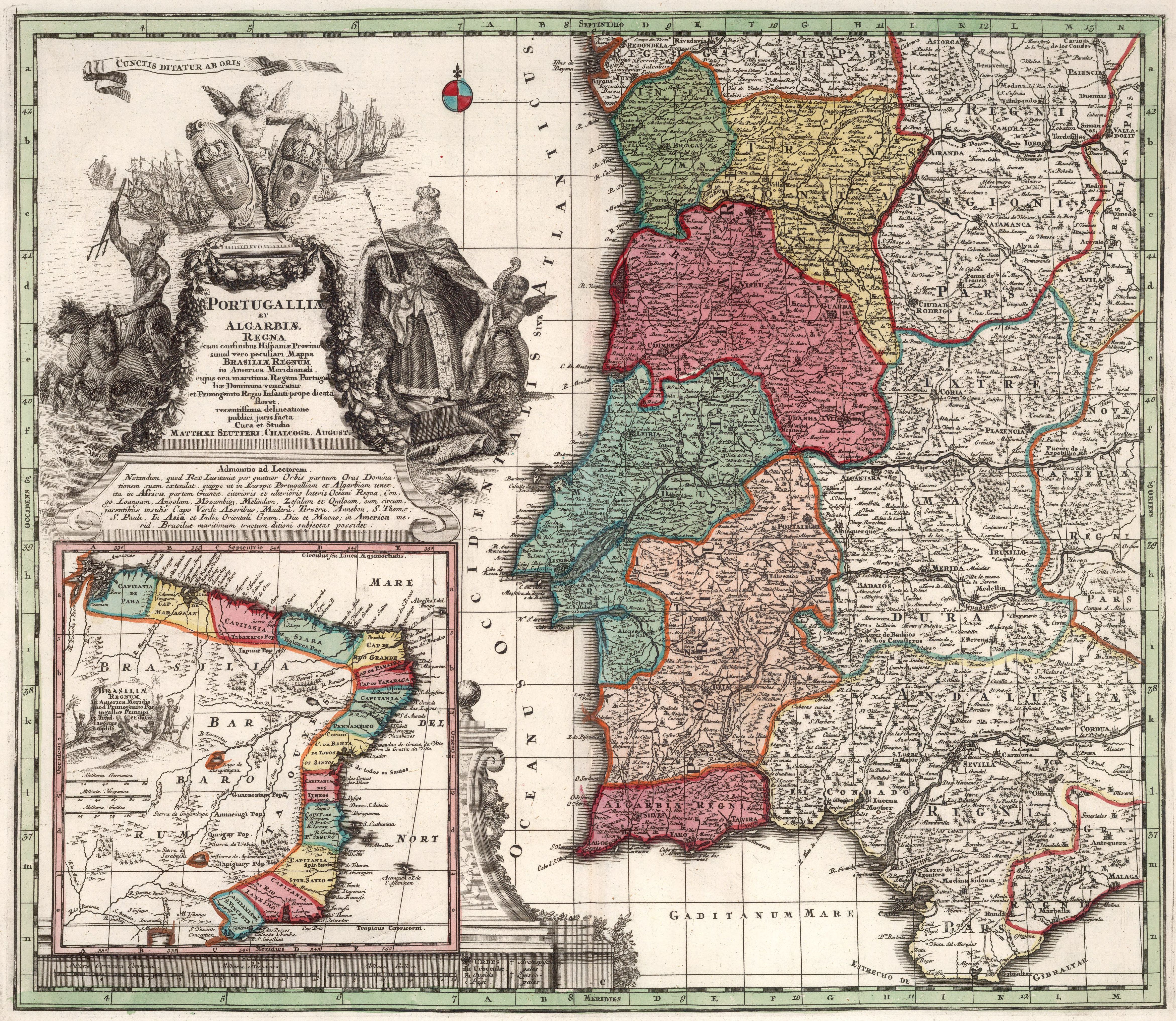
1727 map of Potugal (and Brazil)
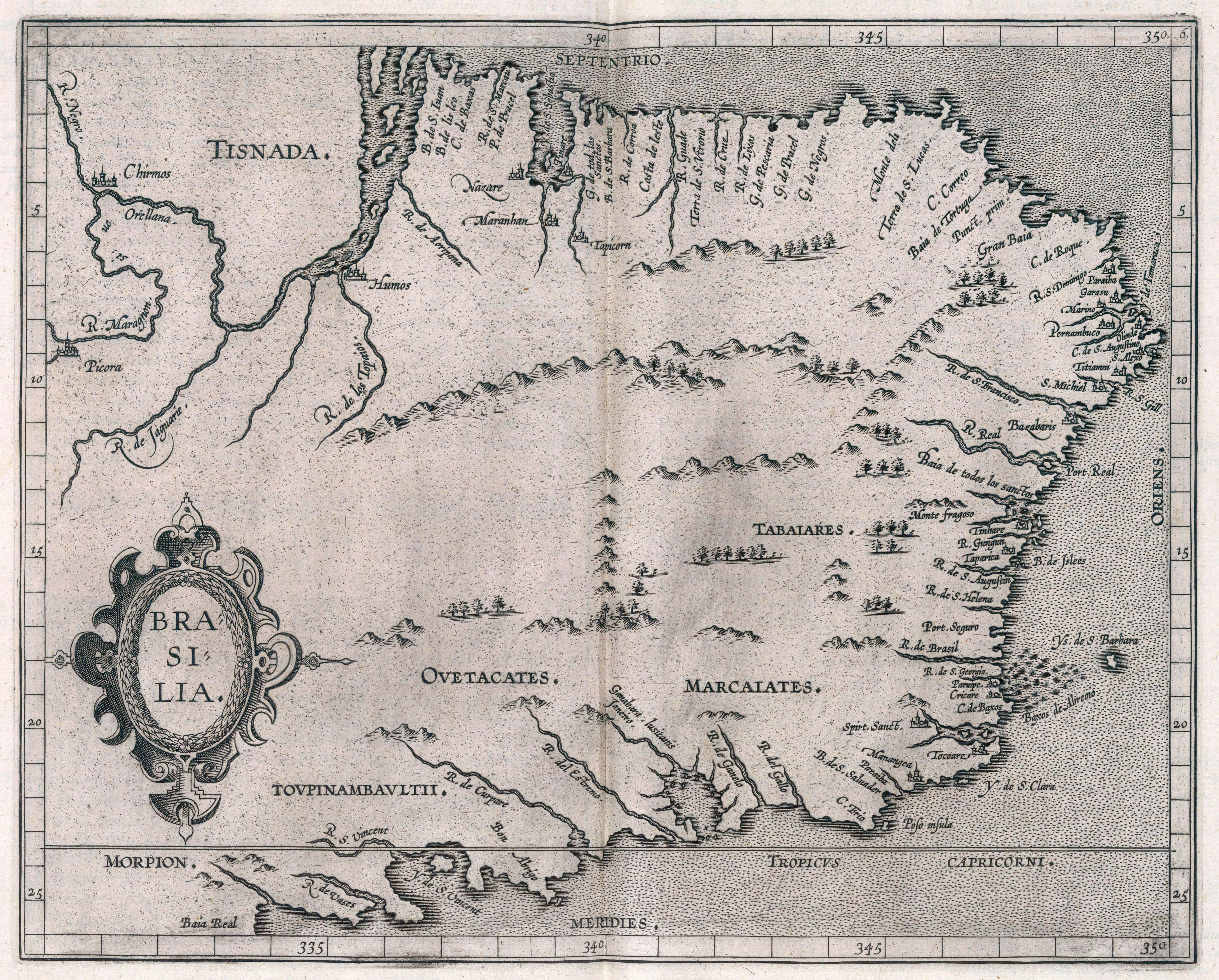
1597 map of Brazil
