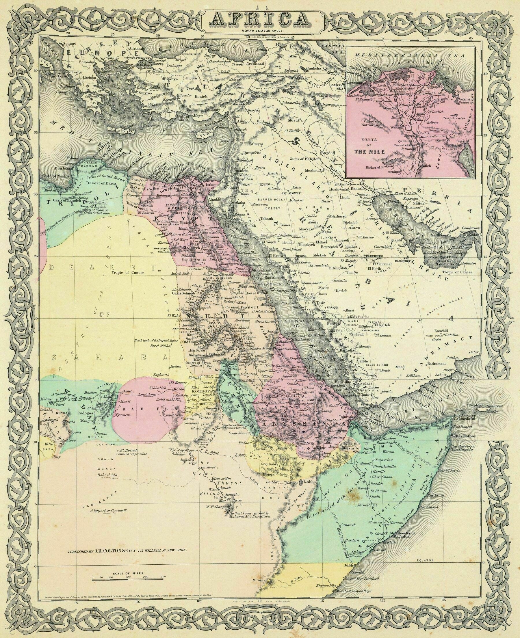
1856 Colton map of north east Africa
1856 Colton map of north east Africa
‘Work of art. There is a Colton Maps plug in for ArcGIS. Any chance it’s the same…?’
Relief map of Africa (1990)
Relief map of Africa (1990)
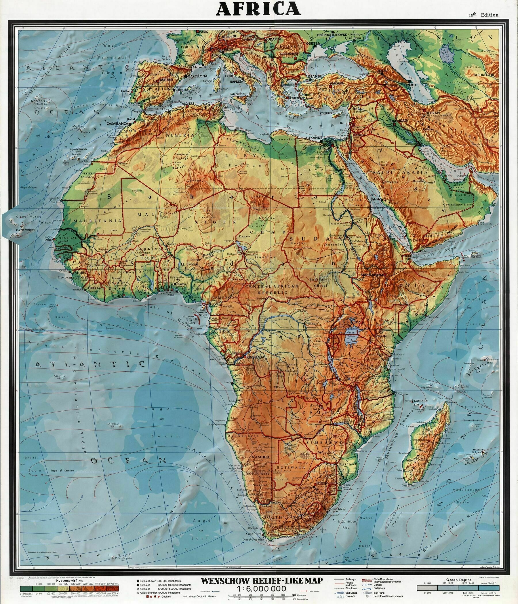
‘I thought sub saharan Africa was mostly jungles and forests. Am I uninformed?
You can still have hills in a jungle.
Depending on how you define Sub Saharan Africa, it ranges from arid Savannah to tropical rainforest’
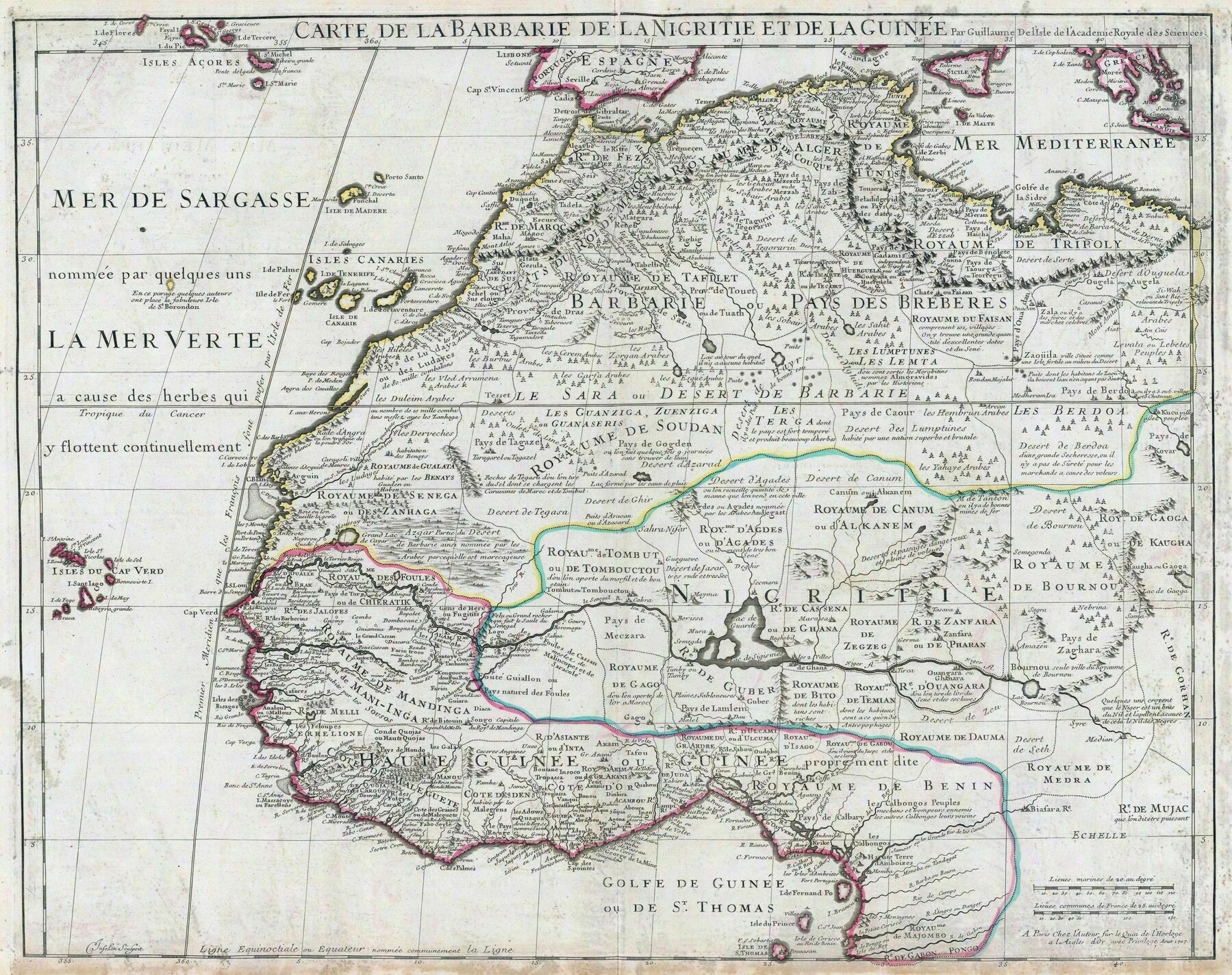
1707 map of west and northwest Africa
1699 map of northern and central Africa - by Heinich Scherer
1699 map of northern and central Africa - by Heinich Scherer
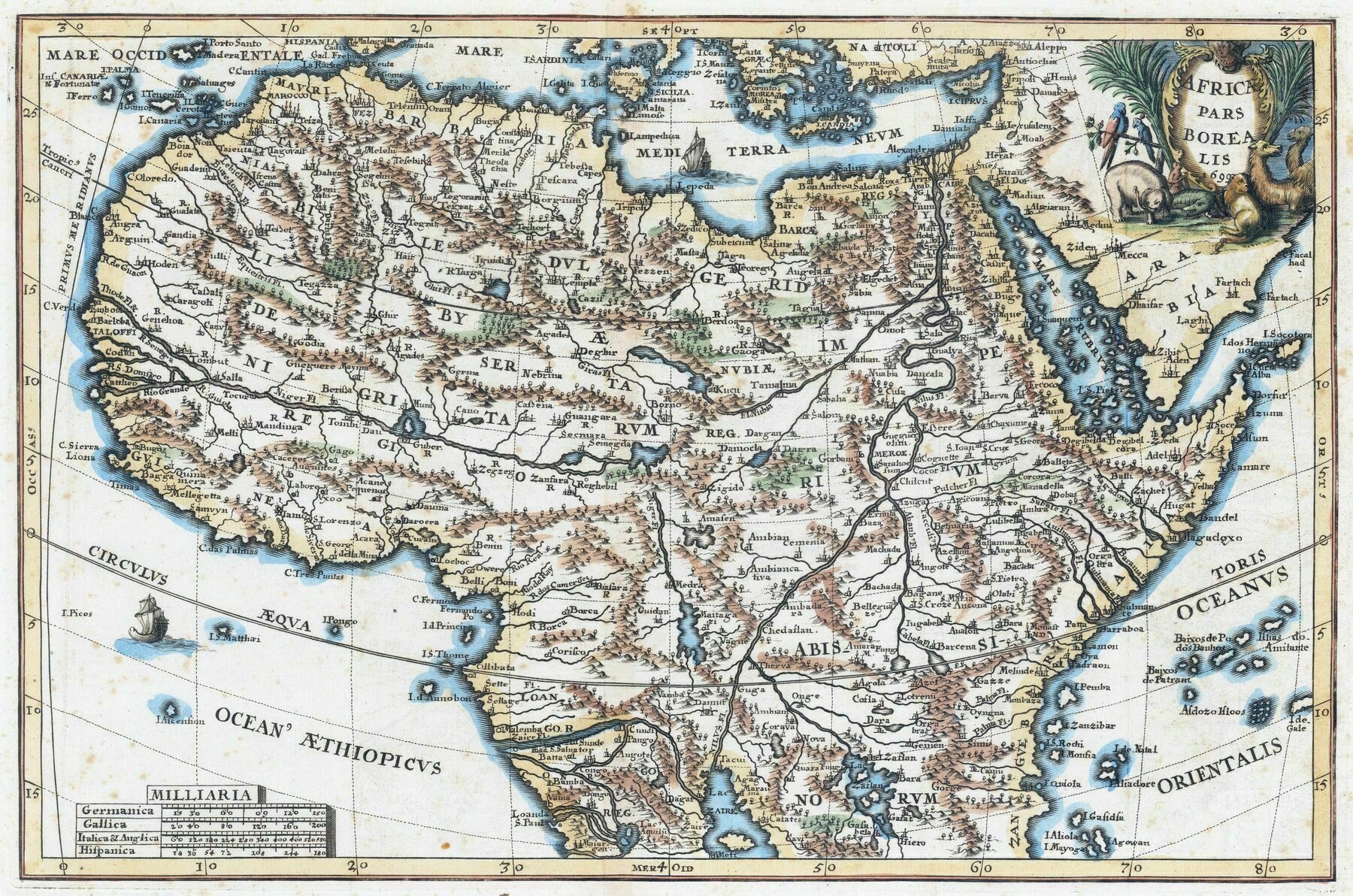
“This is a decorative regional map from Scherer’s monumental Jesuit inspired work. Africa is shown northwards of the mythological source lakes of the Nile, with extensive, though often fantastical, detail”
1843 ethnographic map of Africa - by J.C. Prichard
1843 ethnographic map of Africa - by J.C. Prichard
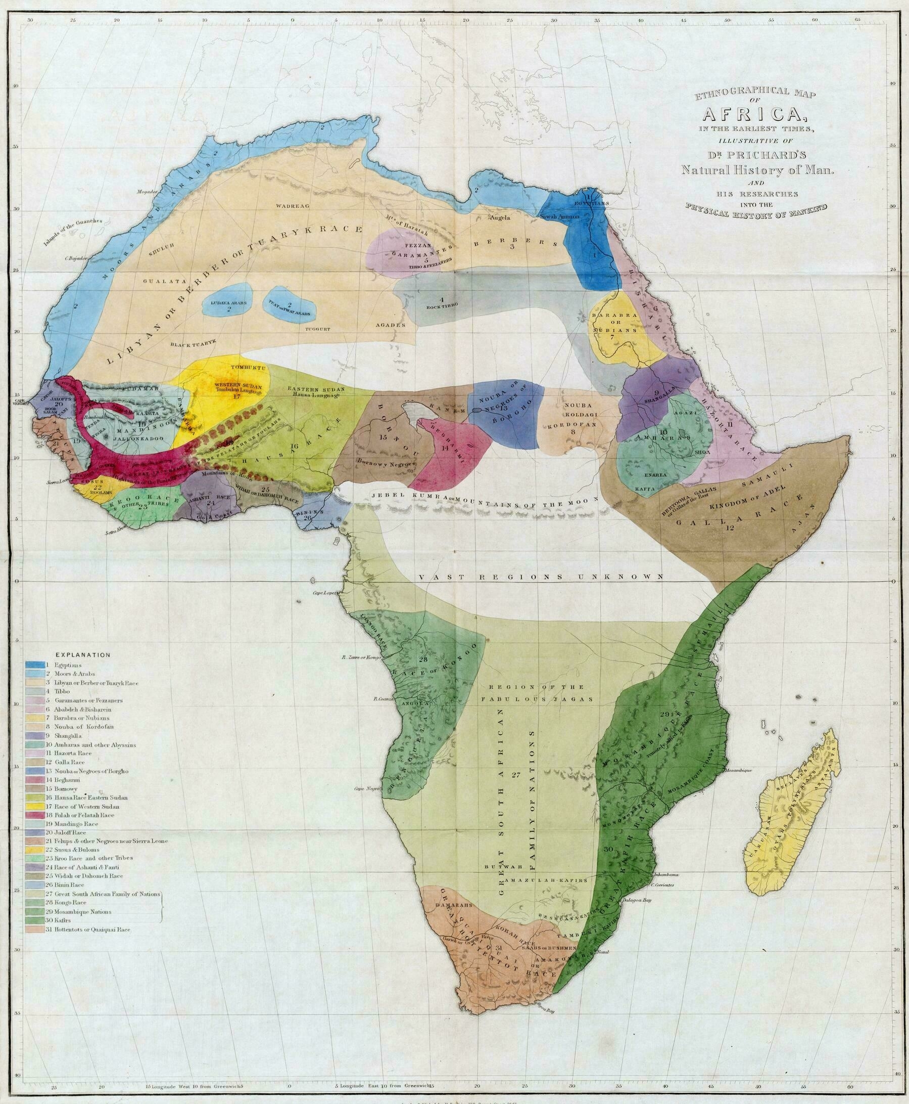
“Mountains of the Moon is a great name for a mythical mountain range.
George Martin thought so, as there is a mountain range named as such in his novels.”
Theater of war in Europe, Africa, and Western Asia - National Geographic Society (1942)
Theater of war in Europe, Africa, and Western Asia - National Geographic Society (1942)
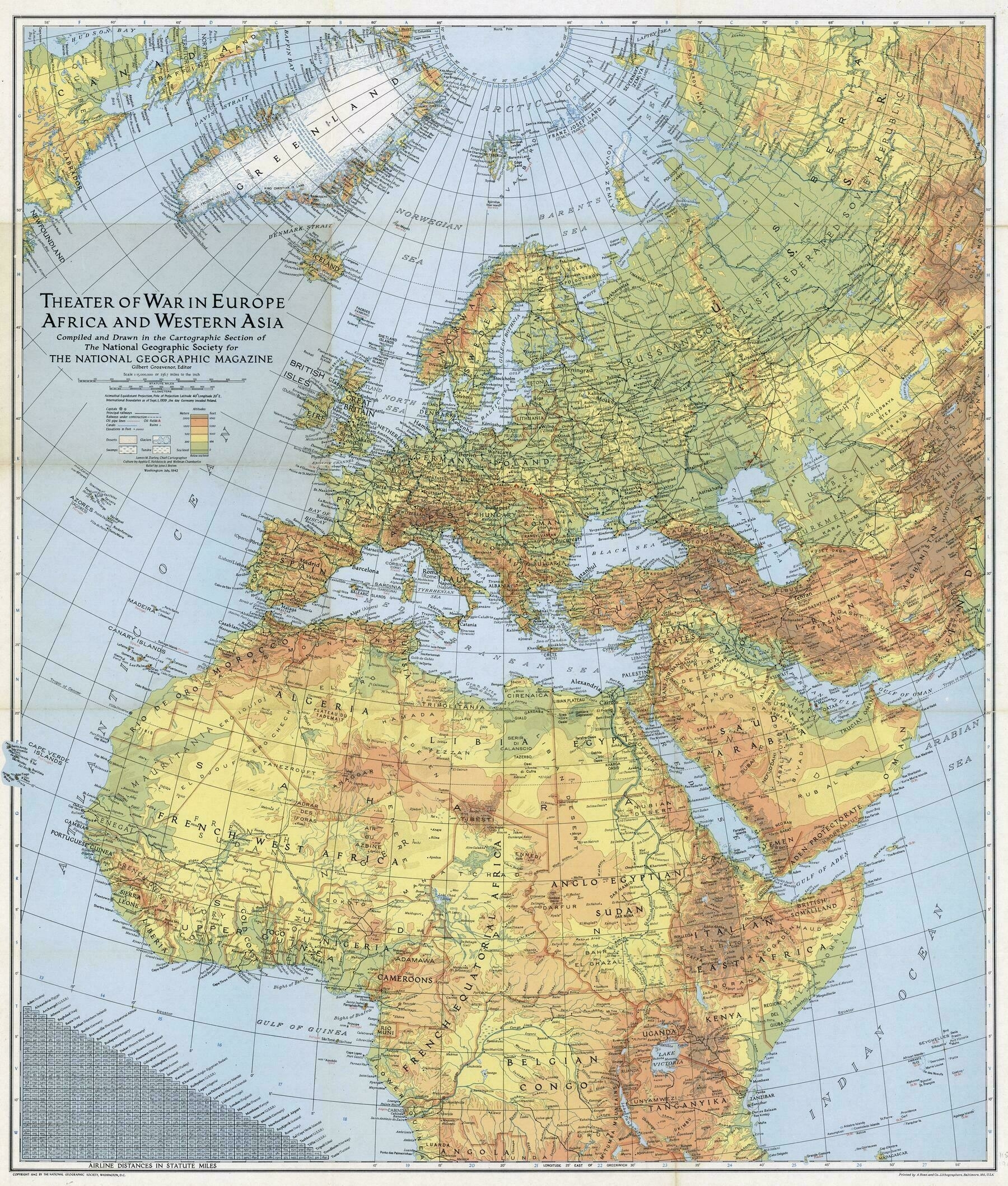
‘I’m in love with the way Ireland is represented on this map
According to Wikipedia, the Brits and Irish were disputing the name of Ireland, starting in 1937. Then, the Irish wanted to call it Éire in Irish but Ireland in English; the Brits wanted to call it Eire (no accent) in English to better separate it from Northern Ireland. There was mention of an Irish politician who was ambivalent to that fact; he appreciated the nation being called Eire but also knew that calling it Ireland would cement its claim to the whole island.
It’s hard to say what the NatGeo map makers were thinking when they made this. Maybe they were following the British state’s example; maybe they were opting for a more nativist representation of Ireland. Probably, they just picked what would best represent the country to those reading the map and didn’t give it much thought’
1606 map of West Africa
1606 map of West Africa
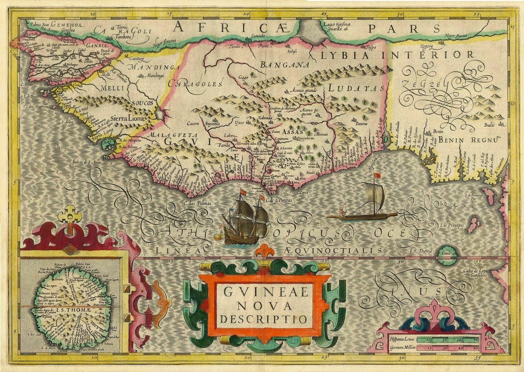
‘What language was this in ? It looks like Latin ? Also, Slaves were actively being traded (or stolen) here during this year, correct ? I’m just curious…
Could be portuguese. I know they were among the first to map the coast of West Afrika.
Edit: I mean alongside with latin of course’
1834 map of Africa, with an inset of Liberia - by H.S. Tanner
1834 map of Africa, with an inset of Liberia - by H.S. Tanner. Shows central Africa as a desert ; also shows the Mountains of Kong
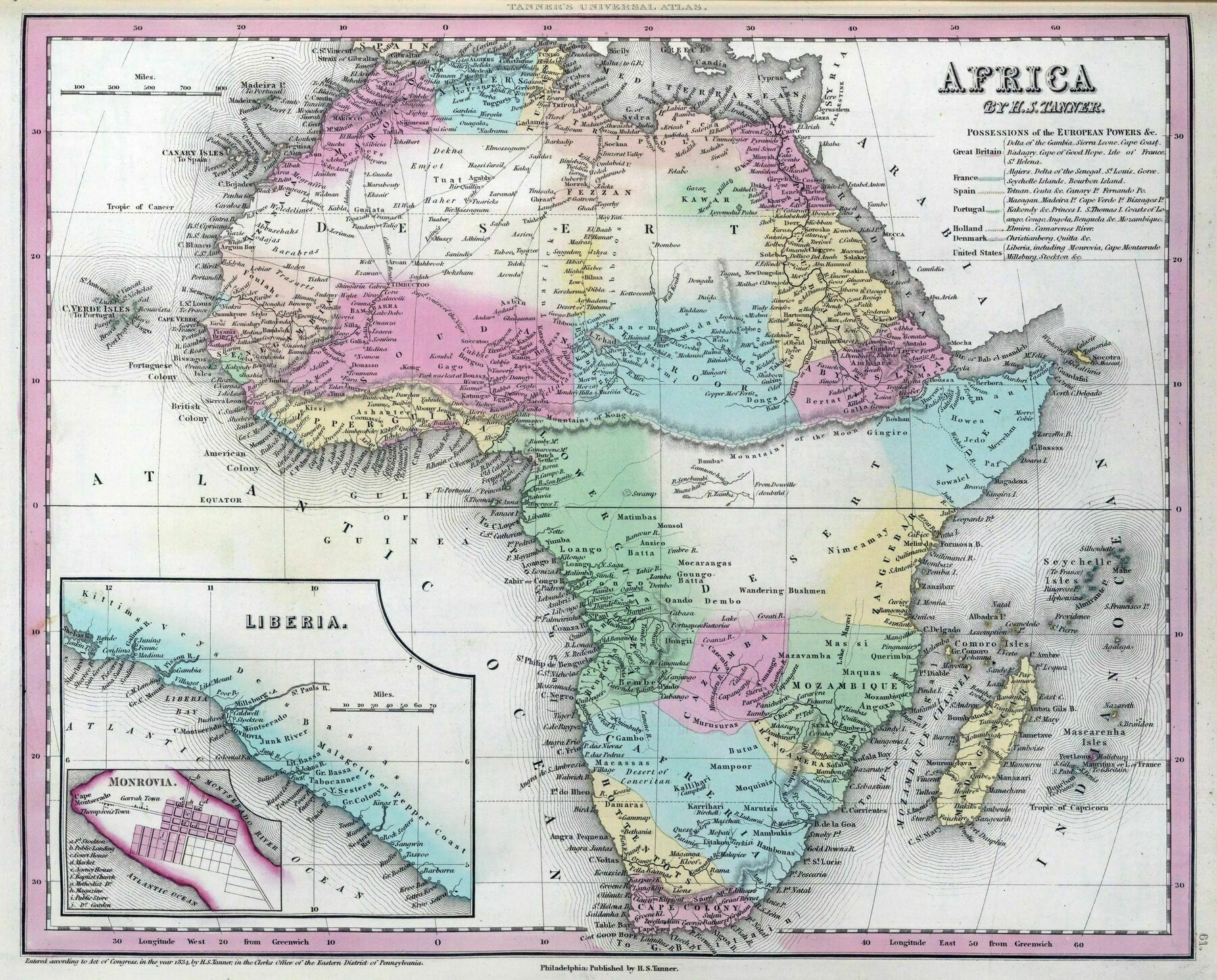
‘It’s astonishing to see just how recently European maps of Africa were this inaccurate. Did muslim and sub-saharan scholars have more accurate maps of Africa during that time period? Im almost convinced they did’
Bantoid Languages
Bantoid Languages
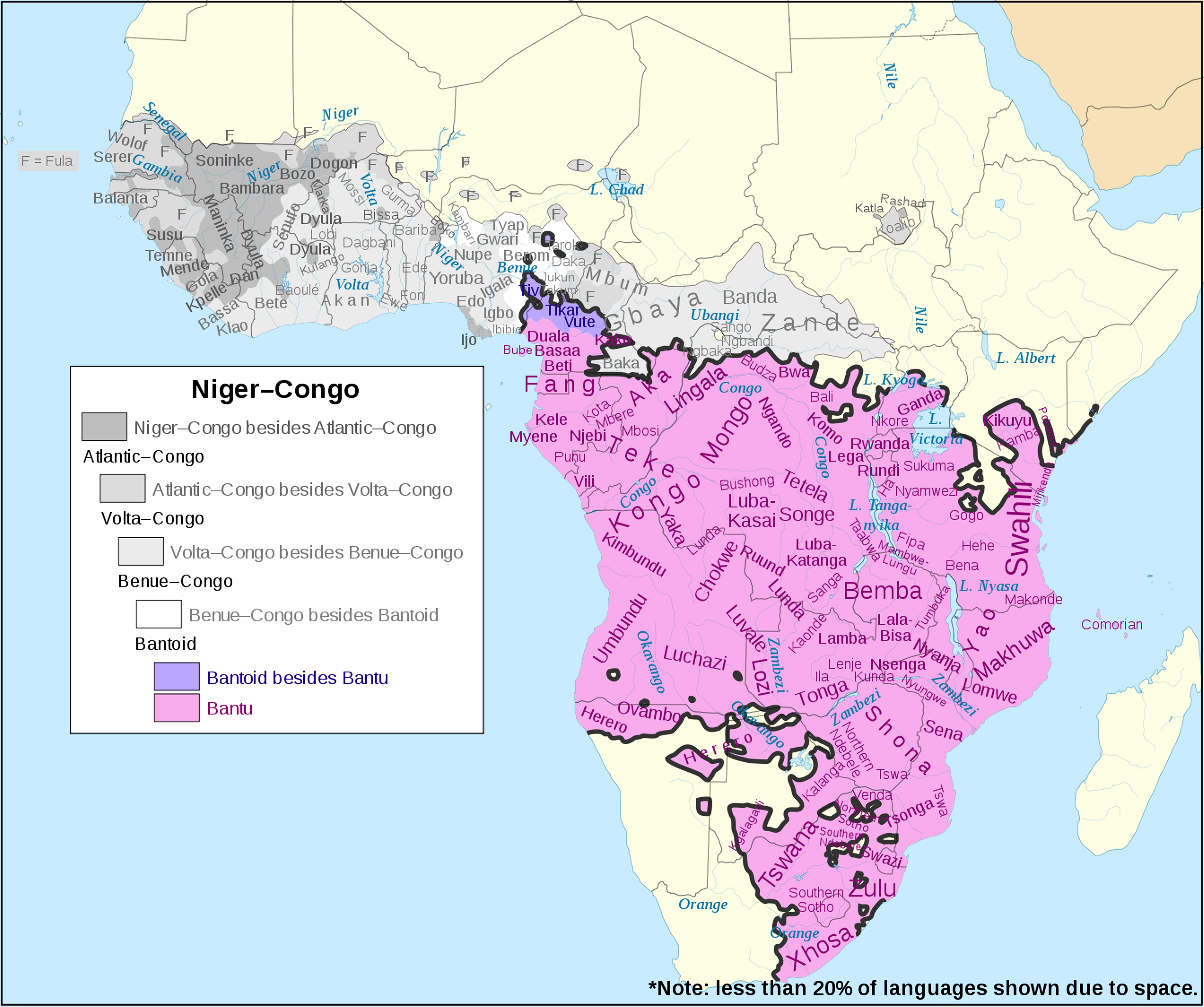
‘The extent of Bantu languages spreads further around Lake Victoria. My family live in a village in Kenya NW of Kisumu and speak a Bantu language’
1660 map of Africa, with an inset of France / Ioanne Baptista Nicolosi
1660 map of Africa, with an inset of France / Ioanne Baptista Nicolosi
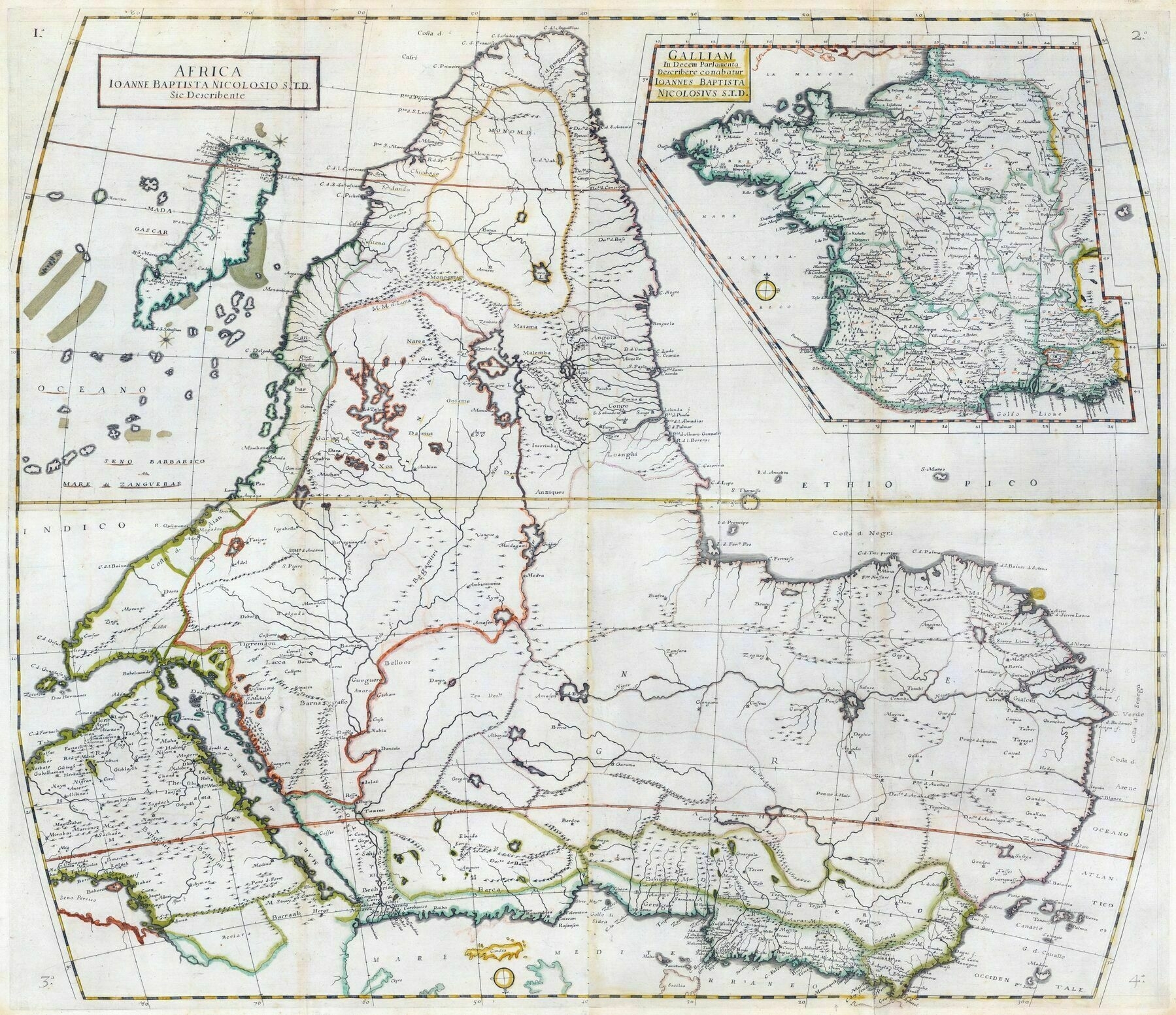
‘I’m amazed that in this map it seems like they’ve already discovered the source of the Nile’–PyromaniacG
1968 shaded relief map of Africa (with political and language map insets)
1968 shaded relief map of Africa (with political and language map insets)
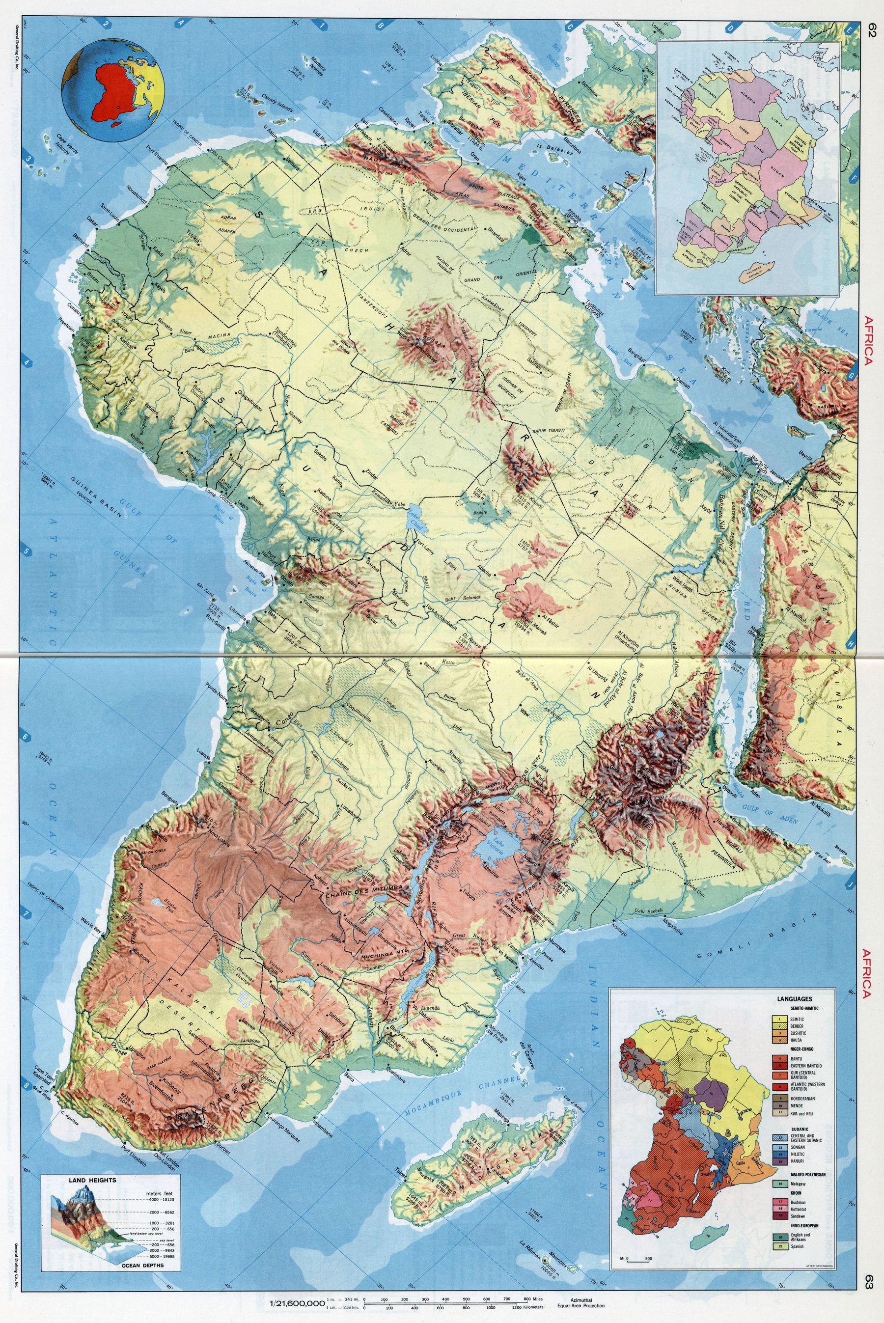
‘I have never seen this alignment before!’–tonwood
Size comparison of Africa (1963)
Size comparison of Africa (1963)
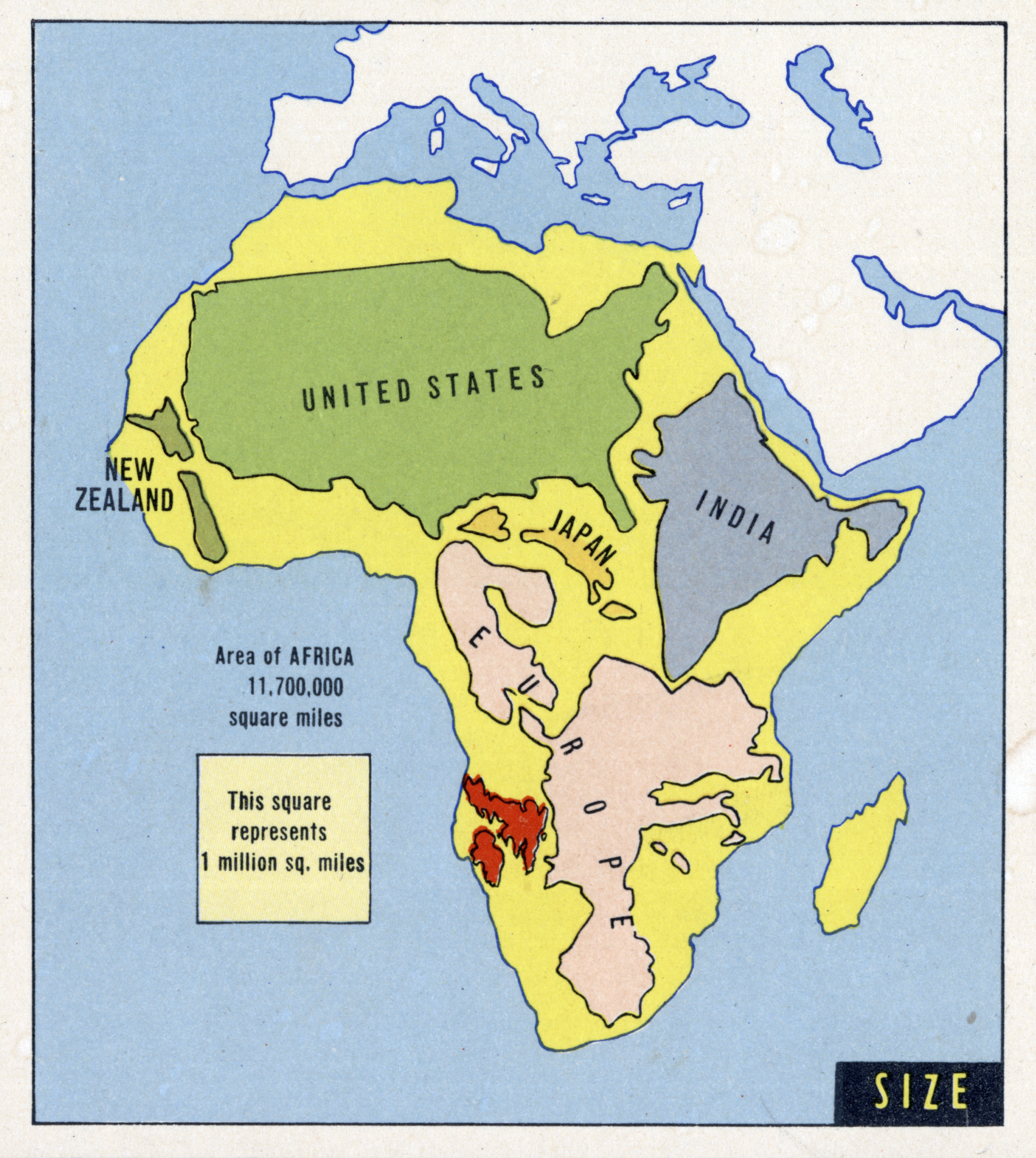
“Crazy thinking that the Sahara is bigger than all the continental US”–Public-Finger
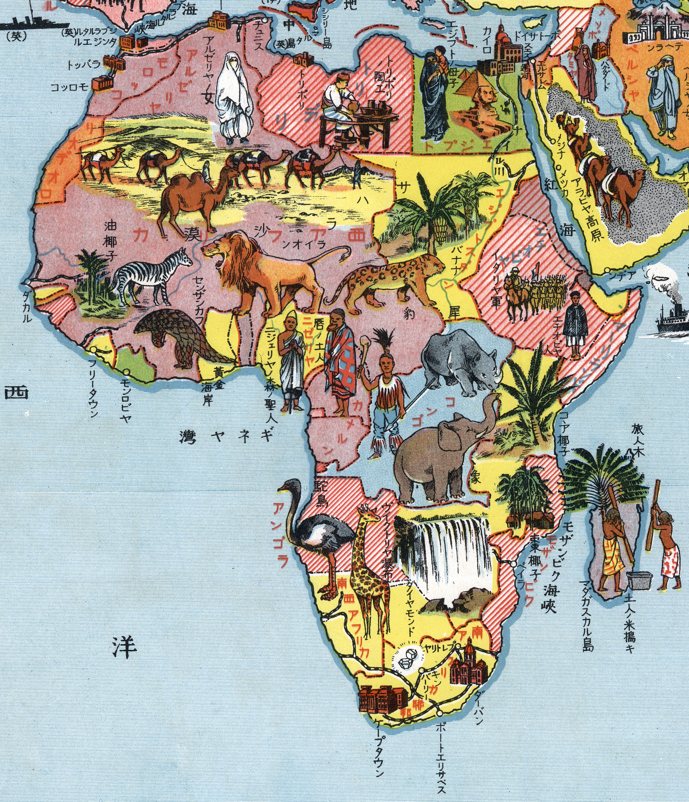
1938 Japanese pictorial map of Africa
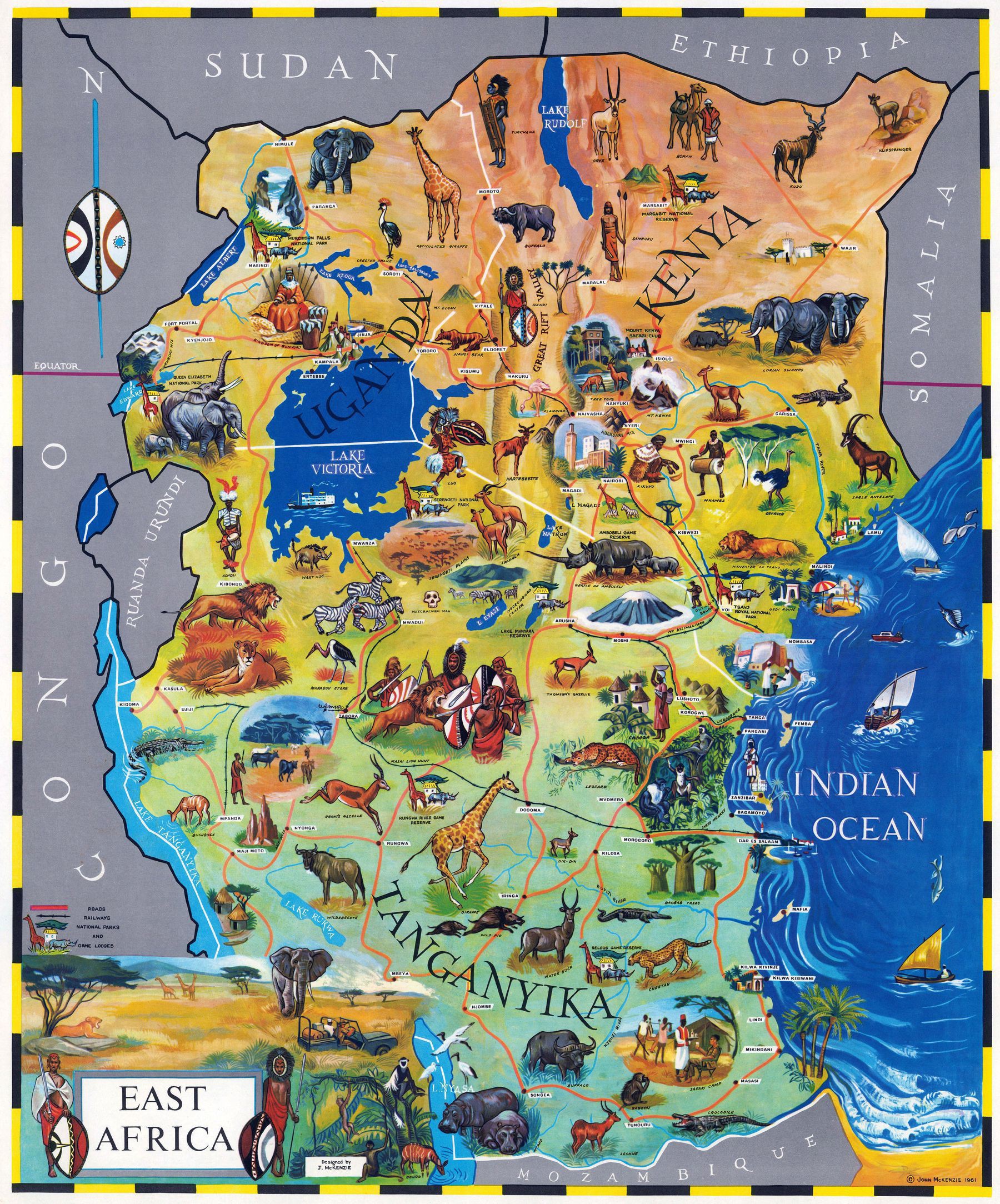
East Africa pictorial map (1961)
A 1963 prediction of Africa at the beginning of the 21st century
A 1963 prediction of Africa at the beginning of the 21st century
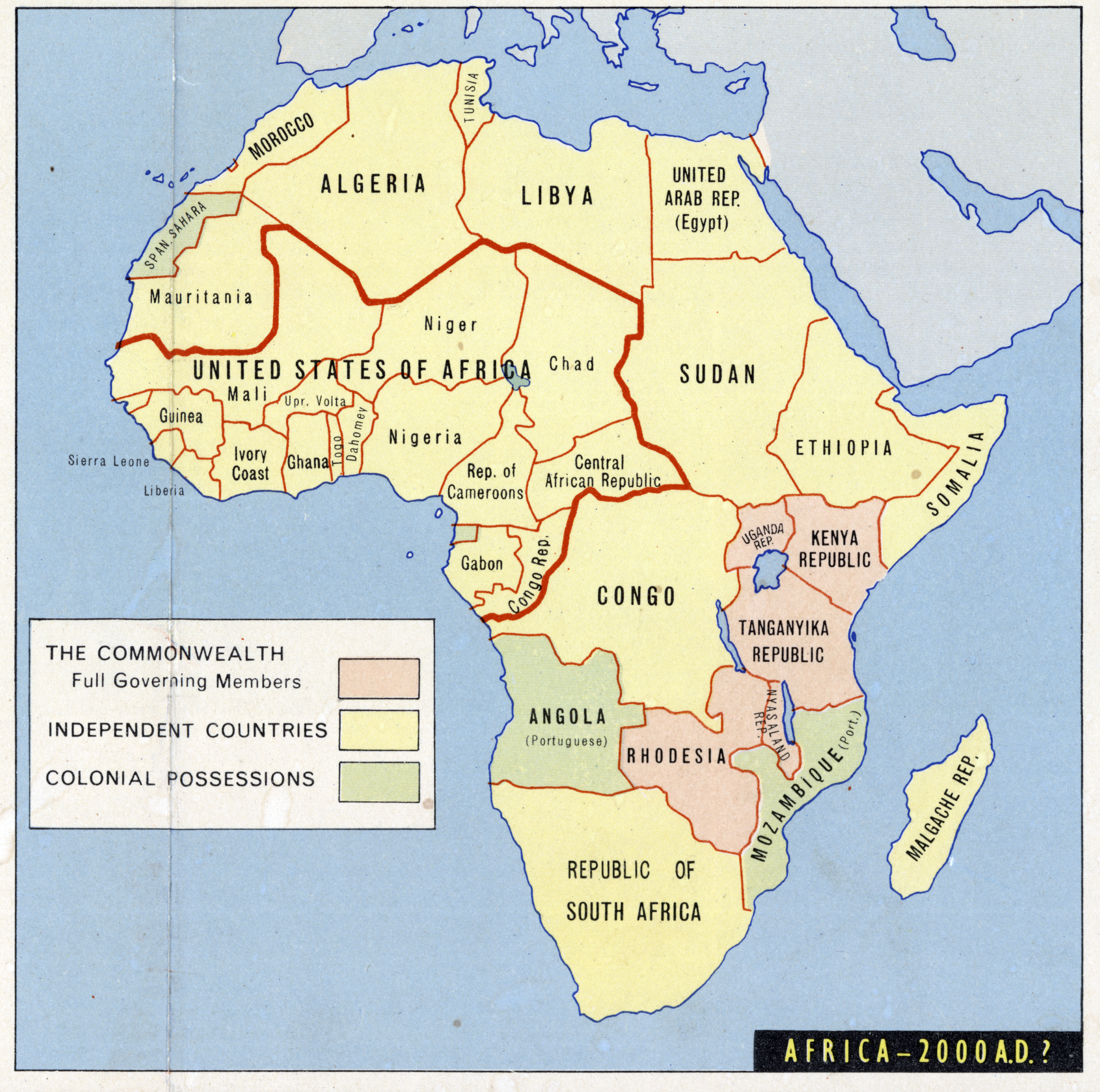
‘They were right about the Portuguese fighting like hell to keep their colonies at least … Yeah they kept them until the early 70s, a time when pretty much all former colonial nations had given independence or abandoned their colonies
It’s even funnier when you think about that as early as 1914 there was an agreement between Britain and Germany to split Mozambique between the two Nation’s colonies, which was then obviously interrupted by another minor historical event, you probably don’t know about it’
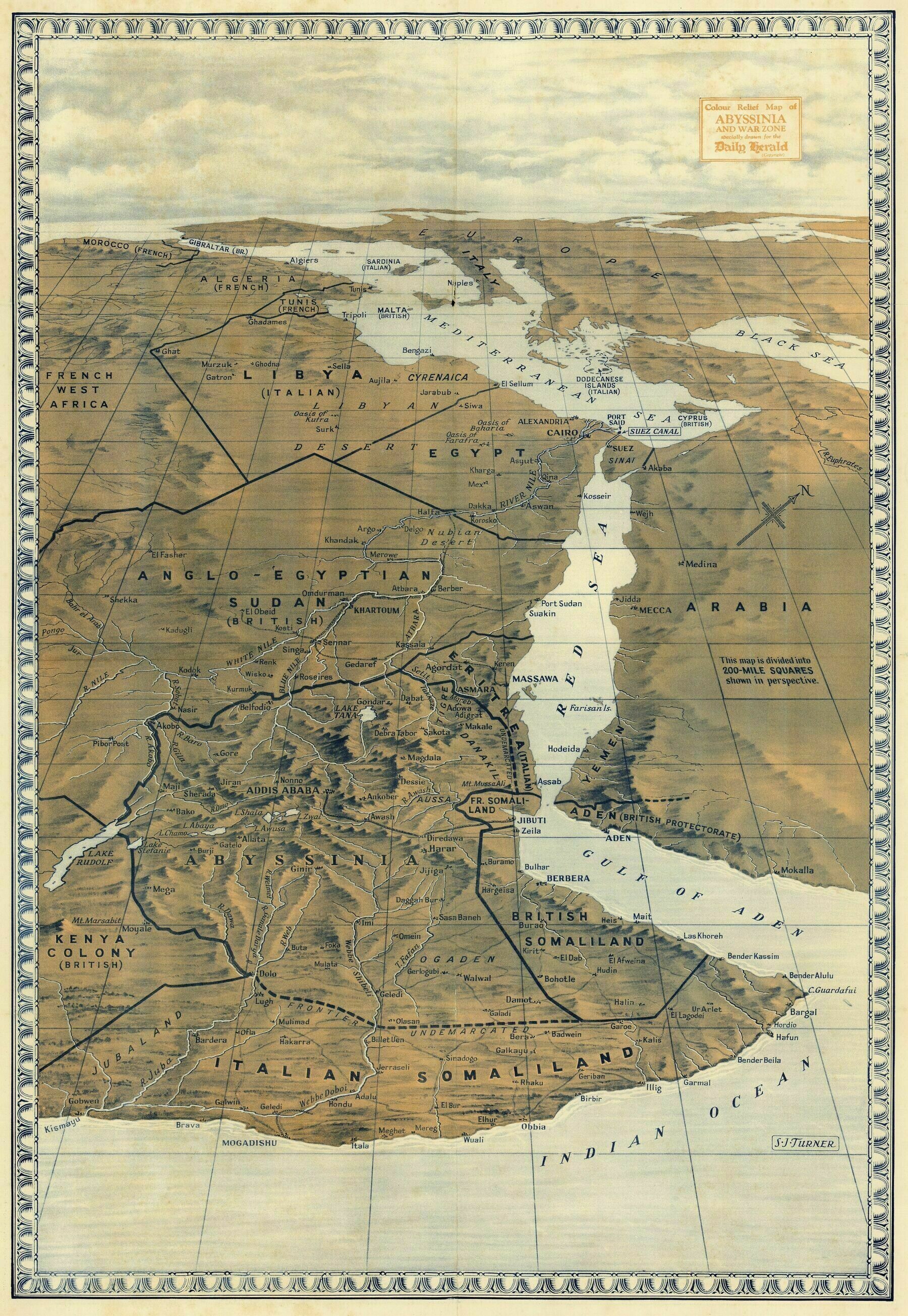
1938 birdseye view from way up high gazing towards Europe from the Horn of Africa - by S.J. Turner
1938 birdseye view from way up high gazing towards Europe from the Horn of Africa - by S.J. Turner
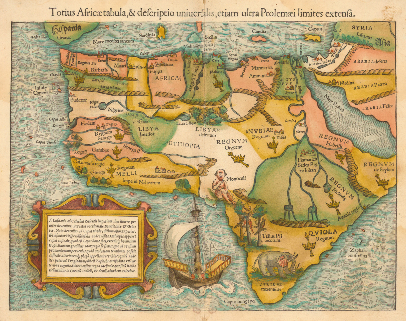
1556 Sebastian Münster map of Africa
1556 Sebastian Münster map of Africa
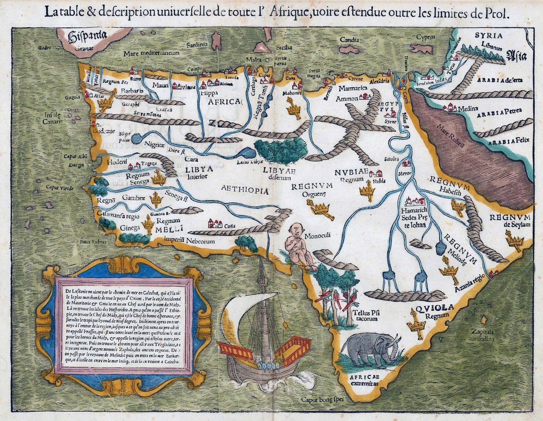
‘almost like mercator projection’–ryd333r
1554 Map of Africa - by Sebastain Munster
Northern and Central Africa satellite imagery + 3D elevation - by Scott Reinhard
Northern and Central Africa satellite imagery + 3D elevation - by Scott Reinhard
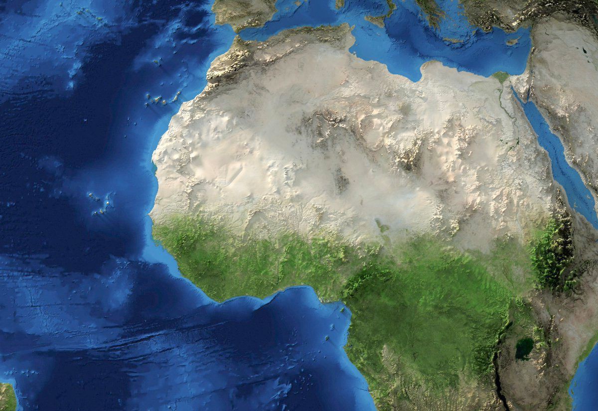
‘It looks like there is a meteor crater there in the Western Sahara … Good catch!…Earth’
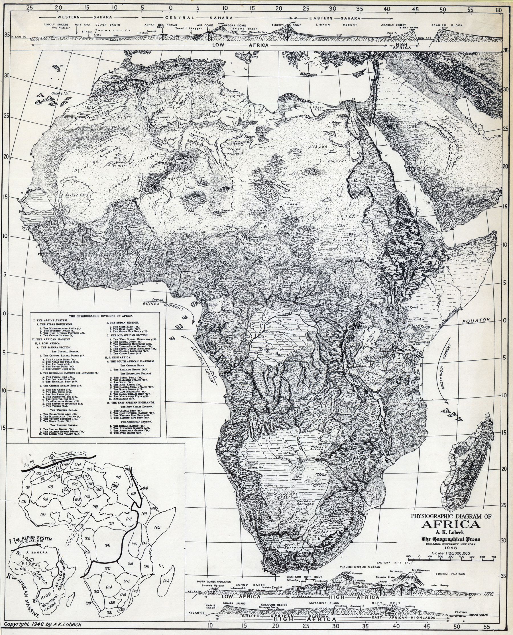
Physiographic diagram of Africa, 1946
Forest Cover of Africa
Forest Cover of Africa
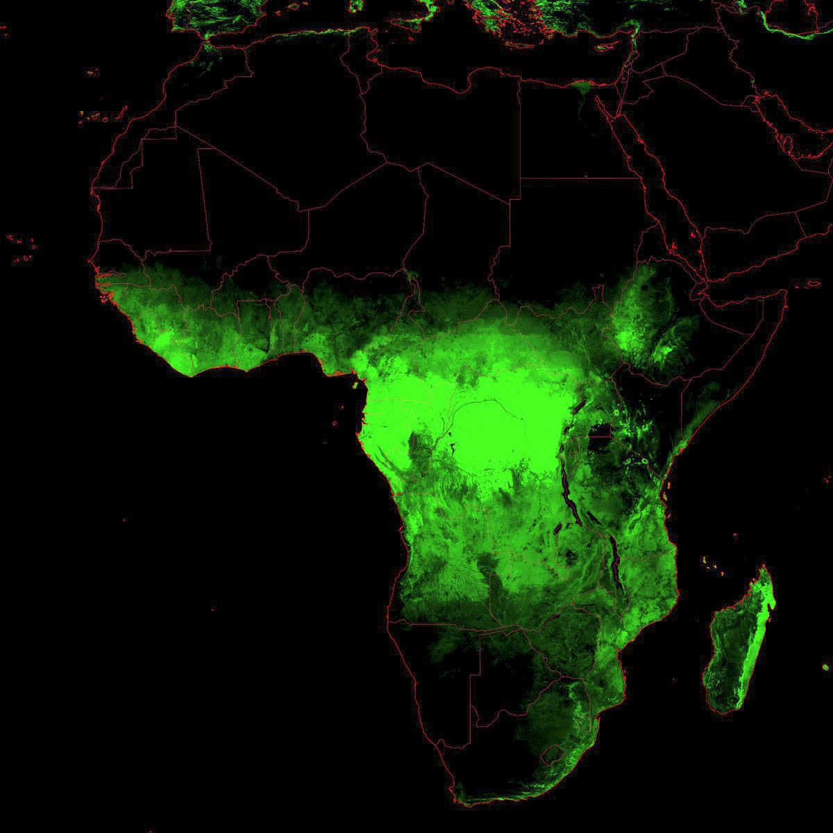
‘Wow, the Sahara desert is really gaining ground’–froglelefrogle
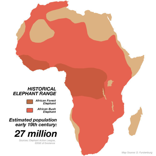
Historical Elephant Range
Sub-Saharan Africa solar energy potential
Sub-Saharan Africa solar energy potential
[11338 × 7558]
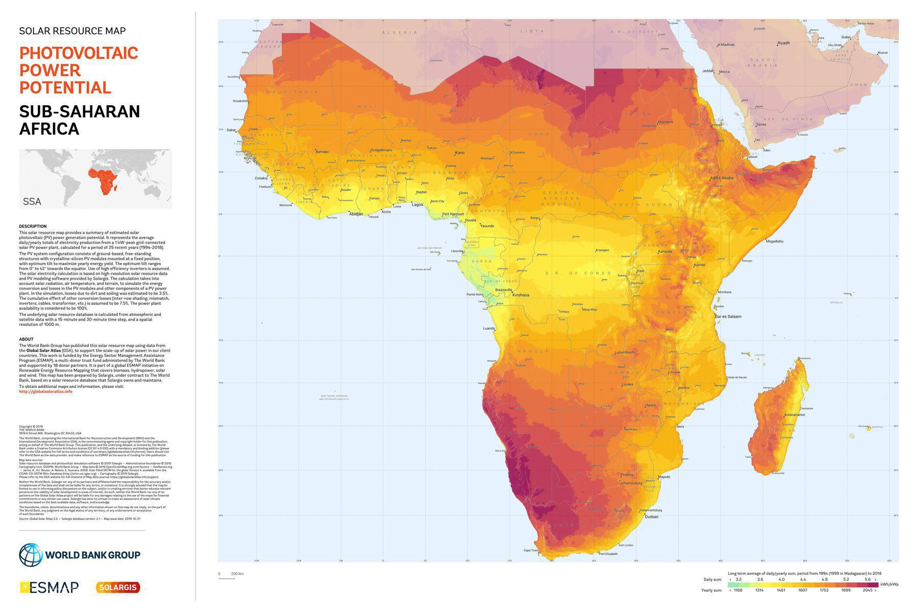
‘It’s interesting that power potential declines closer to the equator. I guess it has to do with more cloud coverage’
Japanese pictorial map of Africa from 1942
Japanese pictorial map of Africa from 1942
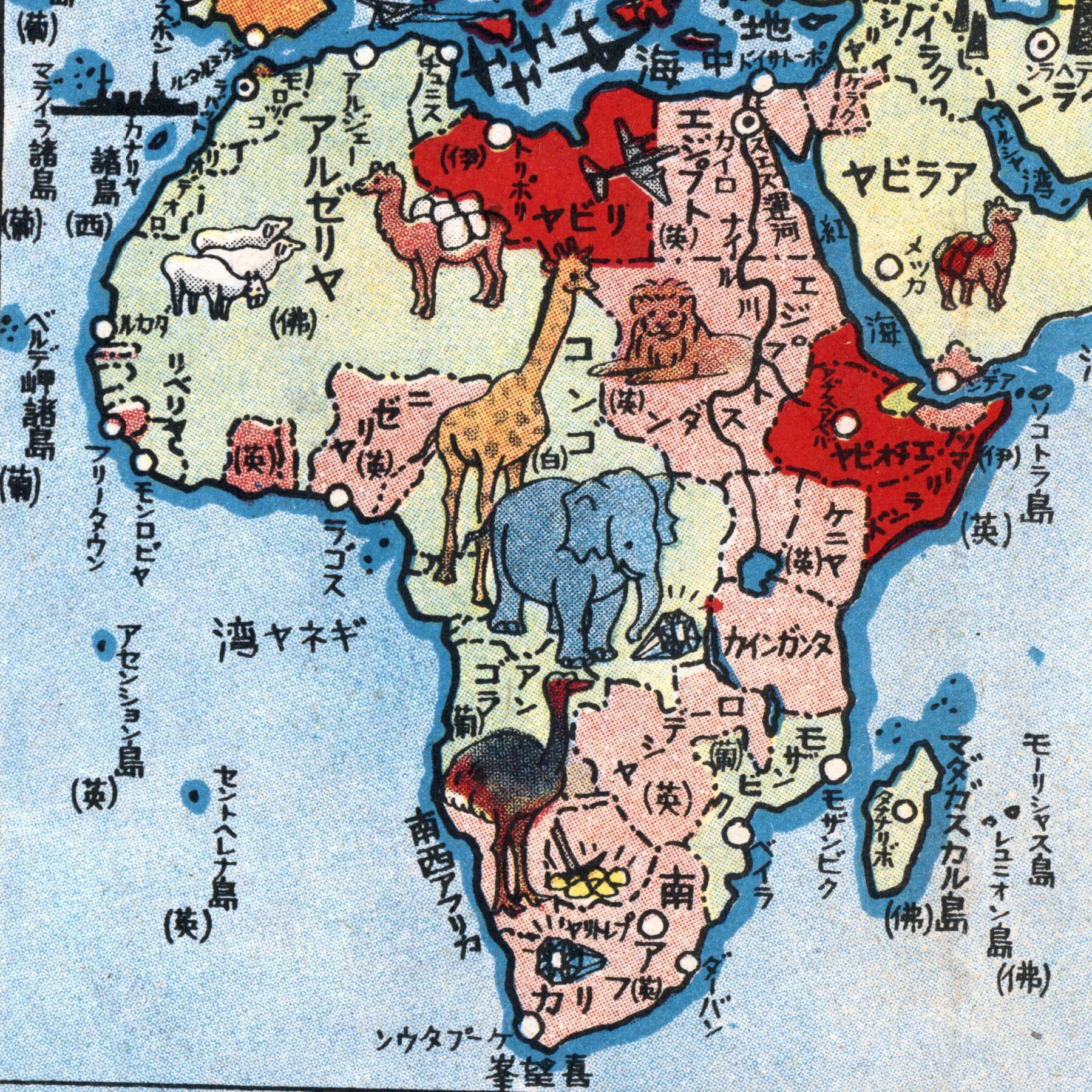
‘Who says you can’t have some fun during an imperialist war?’–nakedsamurai

