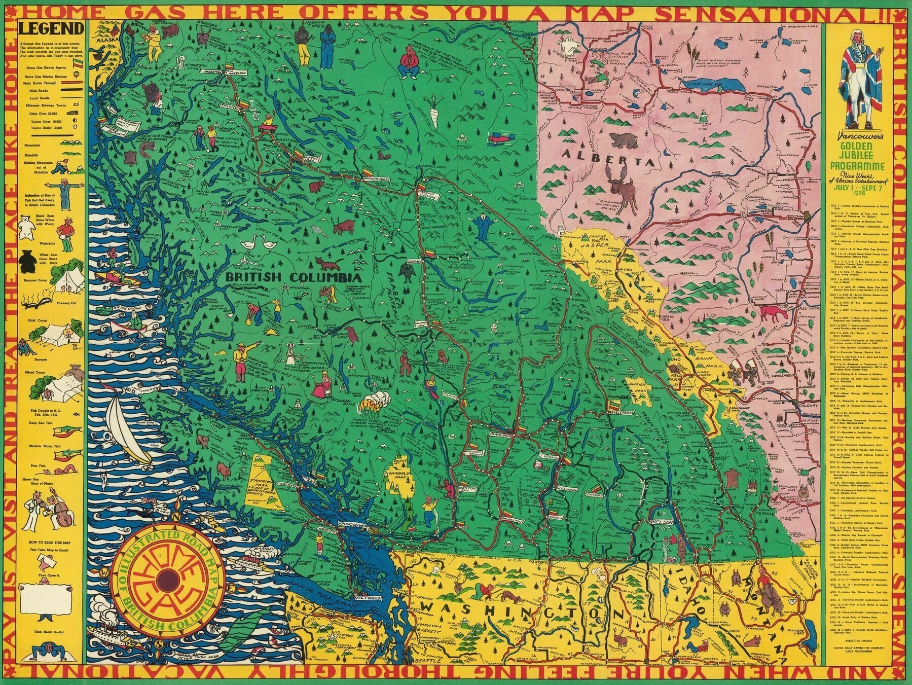
Illustrated road map of British Columbia (1936)
Illustrated road map of British Columbia (1936)

‘Oh nice, cool find! It even has the small towns like Nazko, Likely and Horsefly on it so you know it’s legit lol. A little sad Stewart got barely cut off in the NW but I double checked at it was only incorporated in 1930 so would have been pretty new anyway. Interesting that they use the Union Jack to represent the Canadian side of the US/Canada border up there.’
