Rand McNally map of Australia and New Zealand (1889)
Rand McNally map of Australia and New Zealand (1889)
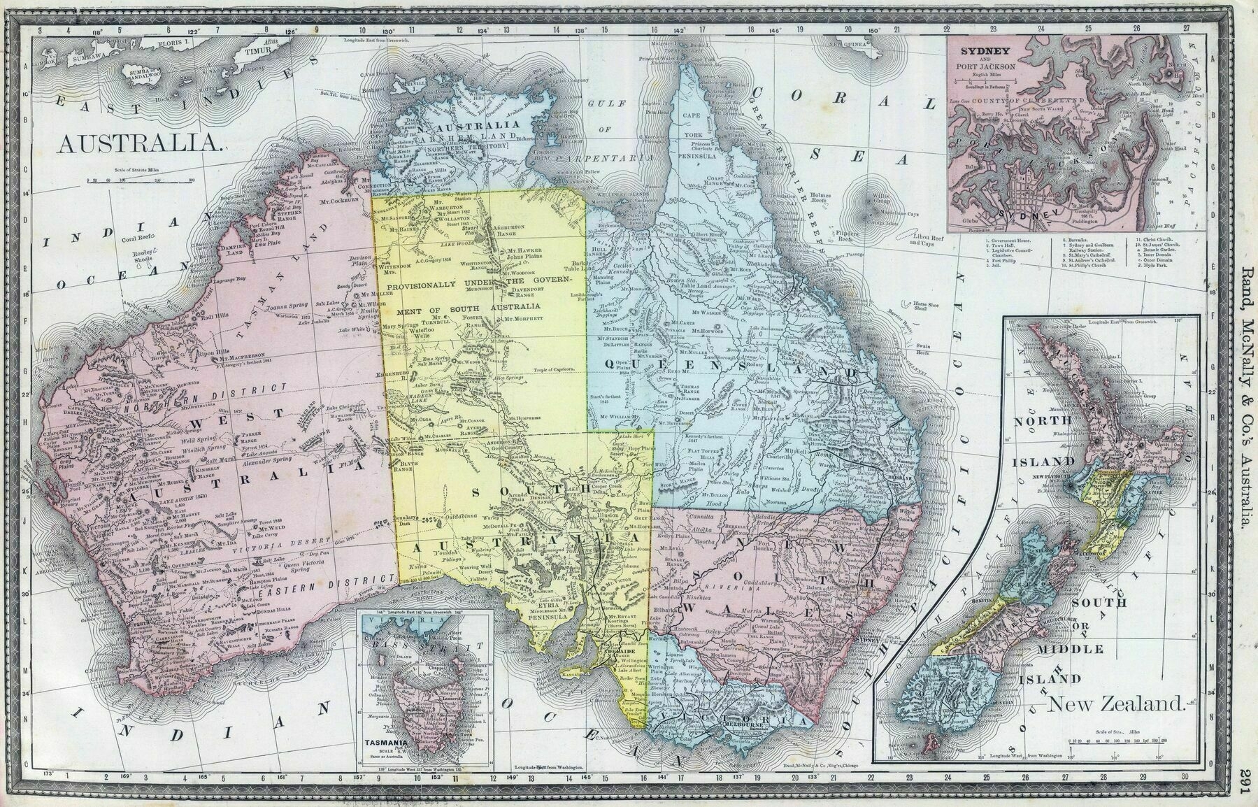
‘Wasn’t a lot mapped in the Pilbara and Kimberly back then’
Rand McNally map of Australia and New Zealand (1889)
‘Wasn’t a lot mapped in the Pilbara and Kimberly back then’
1937 map of Greater Asia - by Tadayoshi Fuchida & Henshukyoku Kingu
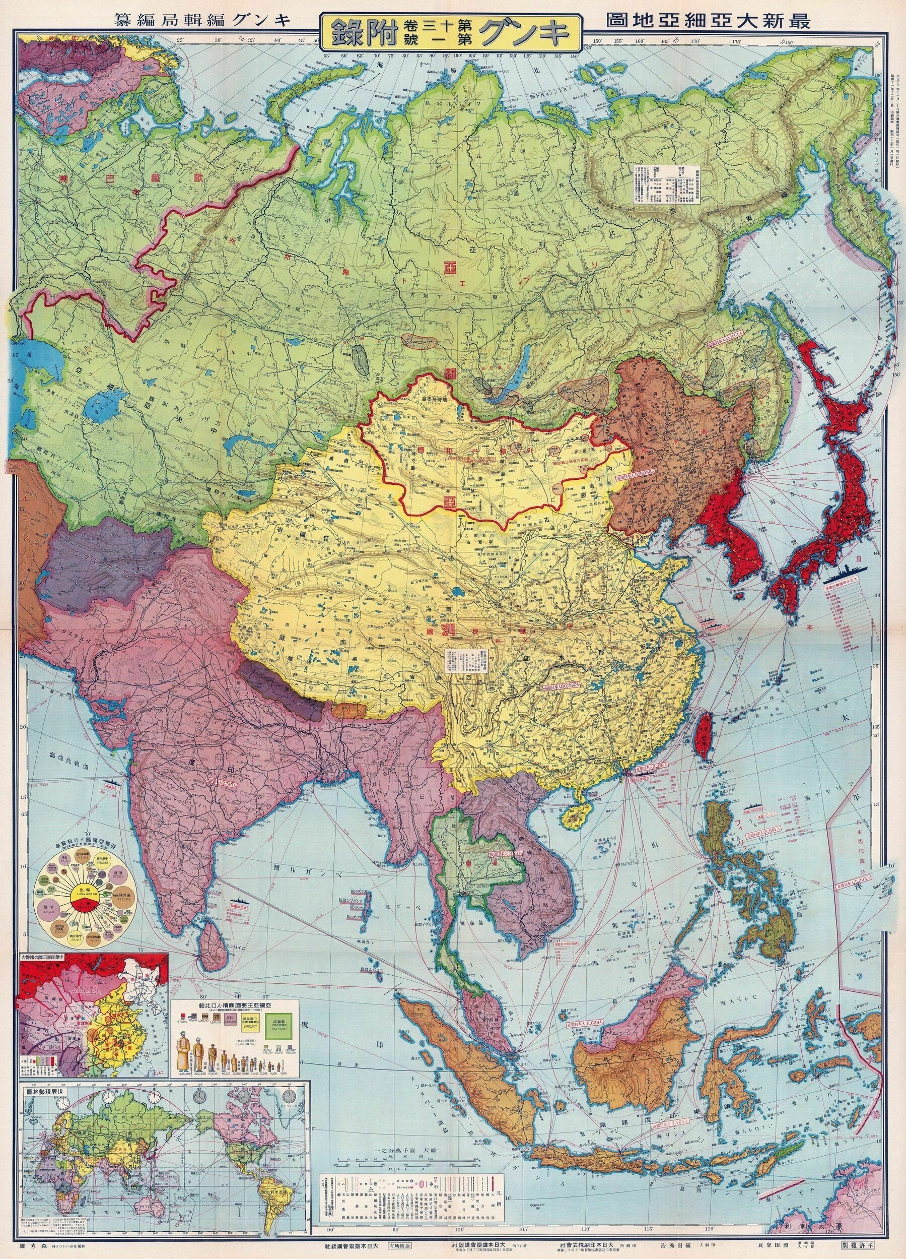
‘That’s an awesome map. Love the aesthetics of historical maps made in non-Western countries, especially Japan’
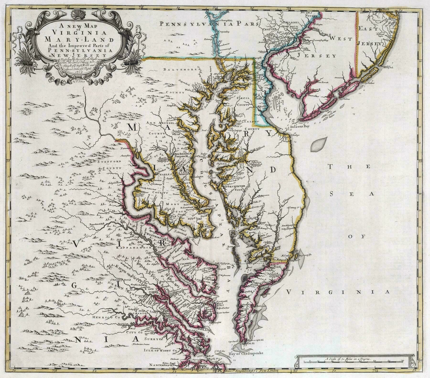
1721 map of Virginia, Maryland, and parts of Pennsylvania & New Jersey - by John Senex
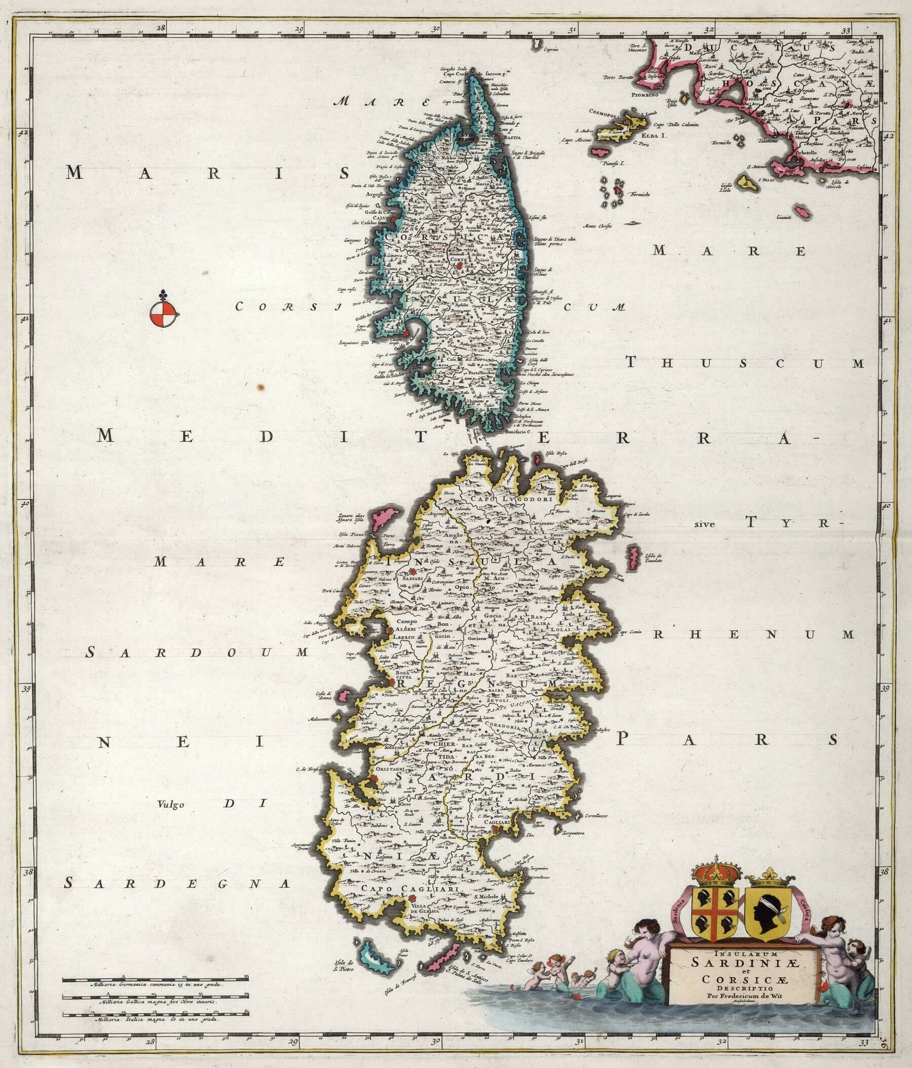
1682 map of Sardinia and Corsica - by Frederick de Wit
‘A very naughty boy who really likes artillery is from one of these’
How Sydney’s urban rail system will look in 2030

‘Sweet. Still nothing on northern beaches
makes sense that people from the richest part of sydney are complaining about public transportation let alone anything, surely if u can afford houses and land rates out there use own a car that u can drive on the nice/smooth roads use have.🤦♂️😂😂
cos out west where these plans are, the pot holes are as big as the empty space in some of northern beaches residents heads or as big as ur egos, (them said pot holes are from around 5 yrs back that still ain’t been fixed properly and keep getting worse mind u) and the same roads are what lead out to where all the new estates are being built up aswell as the airport… does the beaches have a air port or land for new housing🤷♂️🤷♂️
the western/south western-ers actually need it cos as well as the horrid roads and all the crap being built out here, they still only get max 3 busses a day in most parts (not including school busses which are private) while use get them by the hr and in some parts use get them every half hr😂😂, so just be grateful for what use already have & patient cos even tho they say 2030 we all know that’s gonna be 2035-36
Take it easy champ. Roads are fucked over this way too. Ppl just don’t want a train line. Plain n simple. Not sure what you mean by complaining about public transport. We’ve got buses, and ferries from manly. Chatswood is 15min from Dee why where there are trains. Pub transport should be focused on where there is population growth. Nthn beaches isn’t an area that will have massive population growth’
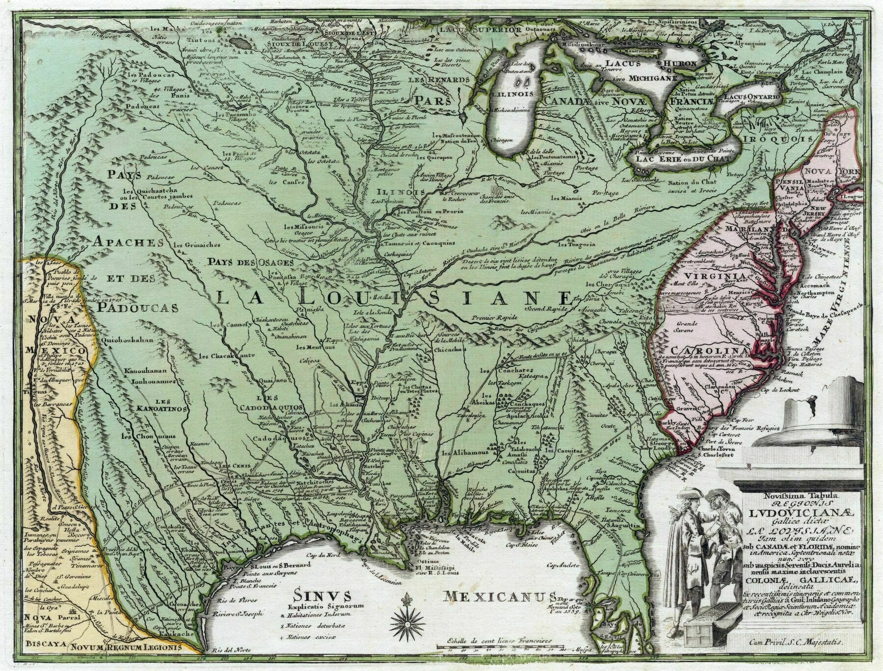
1720 map of Virginia, Maryland, Carolina and New Jersey - by Johann Baptist Homann

World Empires in 1900
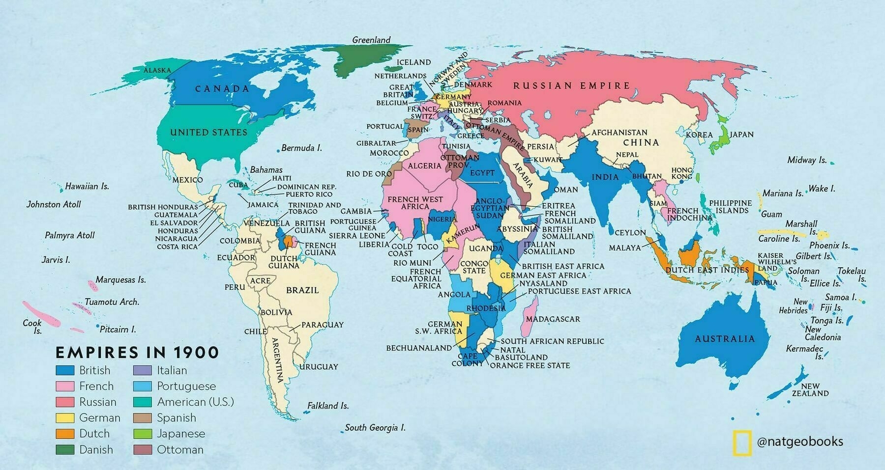
‘British in blue and France in pink is an unexpected color scheme
You’re an unexpected color scheme’
Victoria Railways map of Melbourne and suburbs (1934)
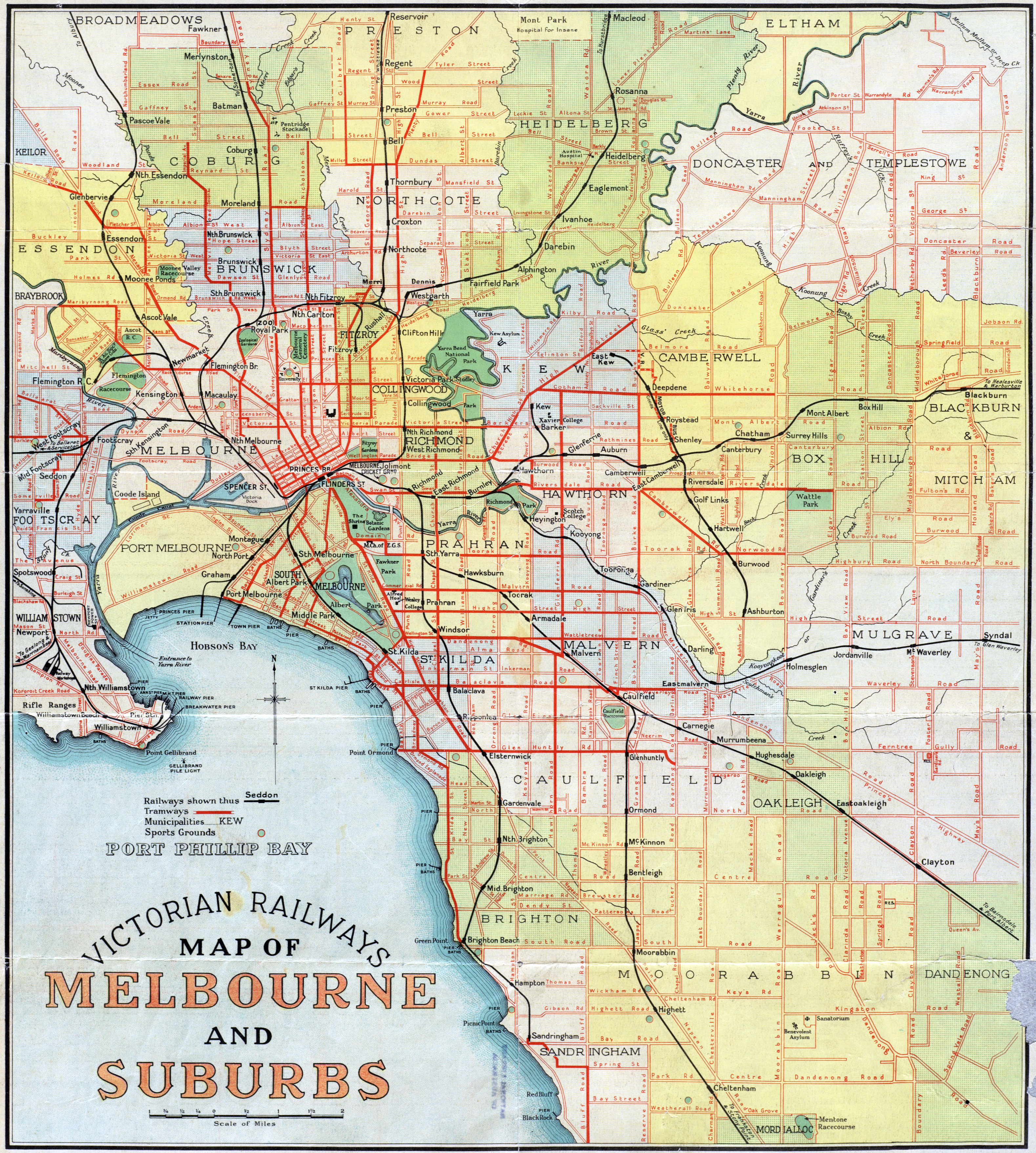
‘90 years and basically the only changes in the south of the map is the removal of the Brighton beach tram and extending the 64 from north road to Nepean hwy!
The trams really need more expansion
But then looking at the roads…check out Springvale Rd compared to what it is now! (Currently longest road in metro Melbourne)’
Dominant religion in Pakistan districts (2017)

‘If I remember correctly, the hindu and Sikh population of Pakistan was roughly 20% at the time of the partition. Lahore was also am important centre for Sikhism
East Pakistan(Bangladesh) inlcuded maybe?
yep. West Pakistan(what is modern day pakistan) had 1.7% back in 1950
In 1941 Hindus were 14% of West Pakistan and 28% of East Pakistan. You do the math. 2 million people died during the partition of India in the sectarian conflict
well cause most of the non muslims migrated to india obv. Sectarian violence was 2 way, not limited to muslims killing hindus. infact most were prob muslims due to greater number of migrants’
Population density map of the United States in 1790 (published 1903)
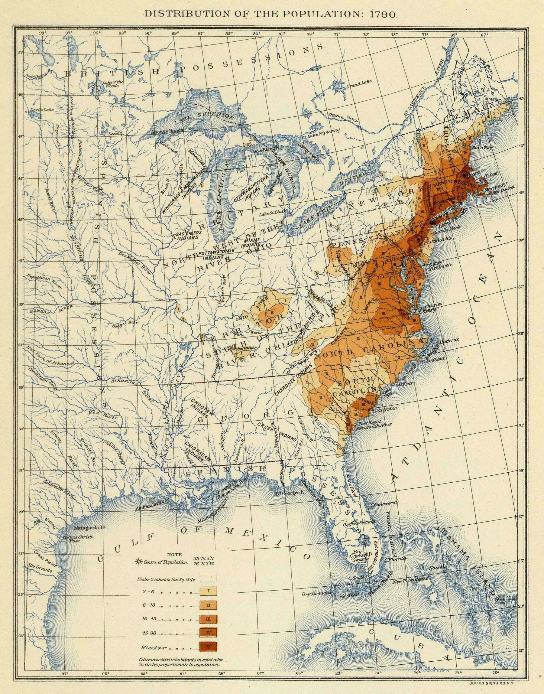
‘White is the populated parts, but not by them
I’m sure I already know the answer to this, but I wonder if the map makers gave any consideration to areas with larger populations that they knew about, and just decided that the the “under 2 per sq mi” still applied in those cases.
Again, I’m thinking I know the answer already. Being generous maybe in “the population” at the top, the means our’
Australian State Governments as of late November, 2022
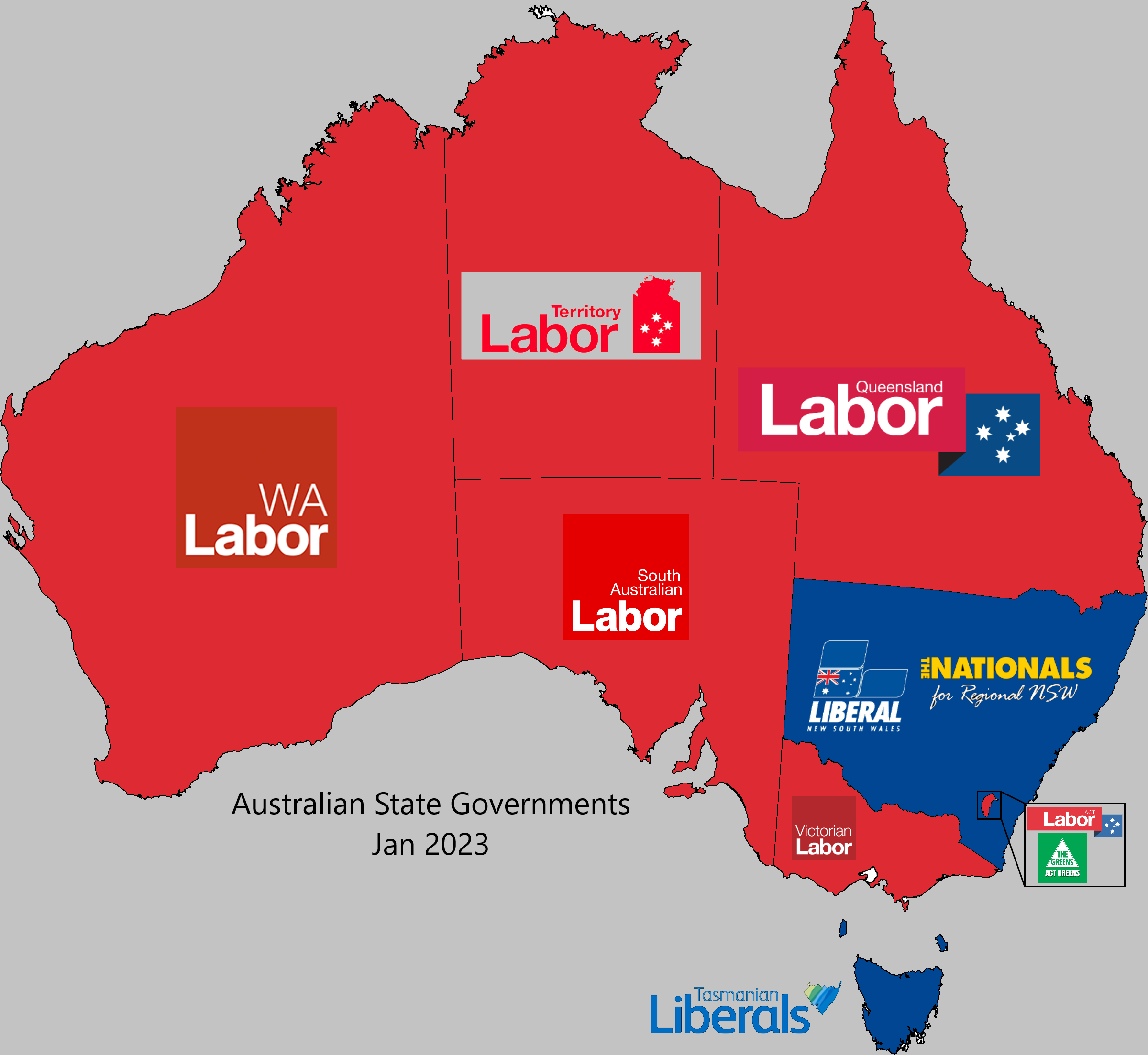
‘The vic liberals were just not a viable option. And the election results show that.
It would have been nice to get rid of Dan and all the corruption questions that hang over them, but the Libs are just a mess.
They need to do some serious rebranding and work out what they stand for and what they believe in.
The Federal libs are WAY too conservative for a modern Australia. The party is 90% old men and even the few women they have were quite vocal about how shitty they were treated.
Unless they can pull themselves together and do some serious self reflection they are going to spend a long time in the wilderness’
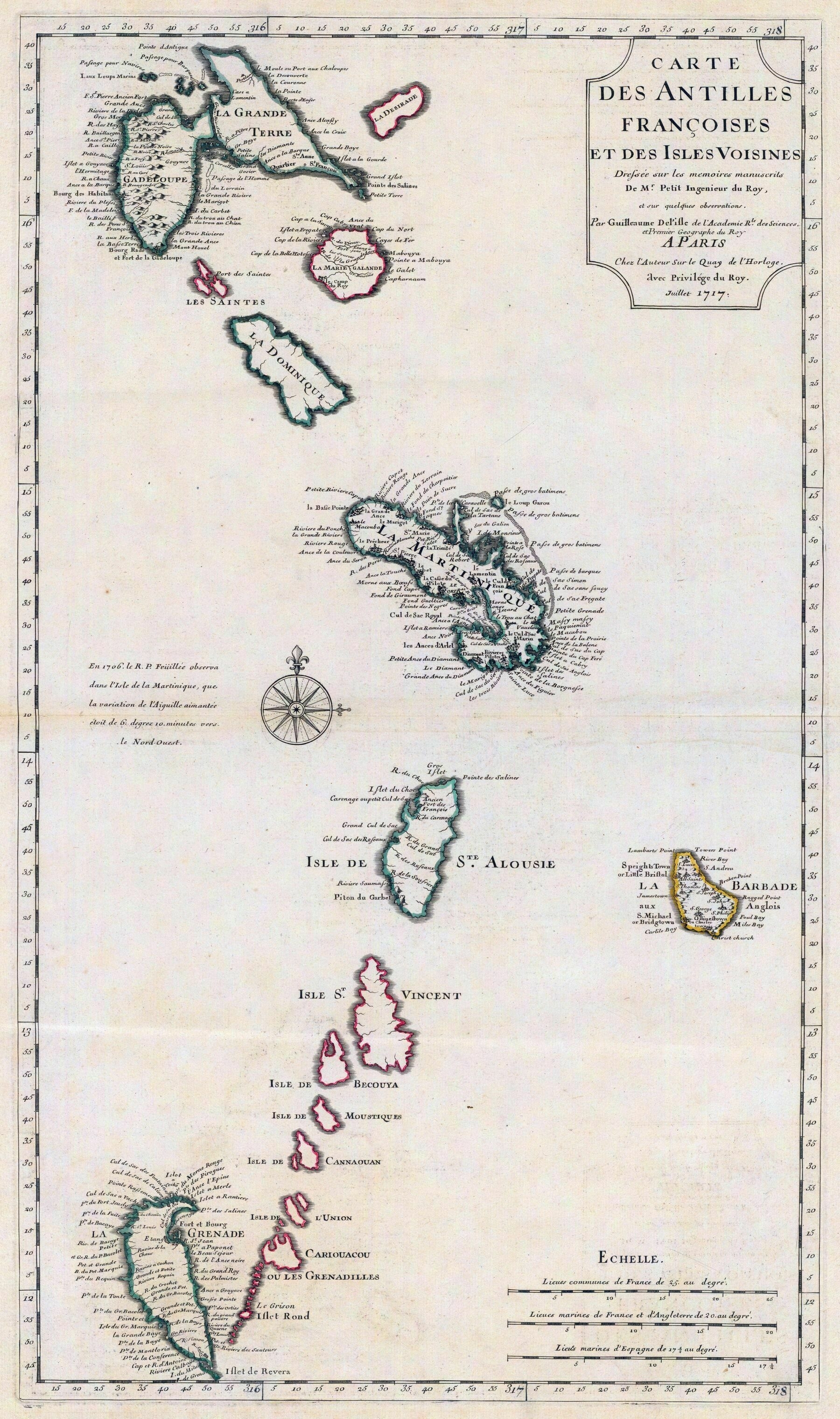
1718 map of Guadeloupe, Dominica, Martinique, Saint Lucia, Saint Vincent and the Grenadines, Barbados and Grenada - by Guillaume de L’Isle
1717 map of far north Scandinavia and Svalbard - by George Willdey
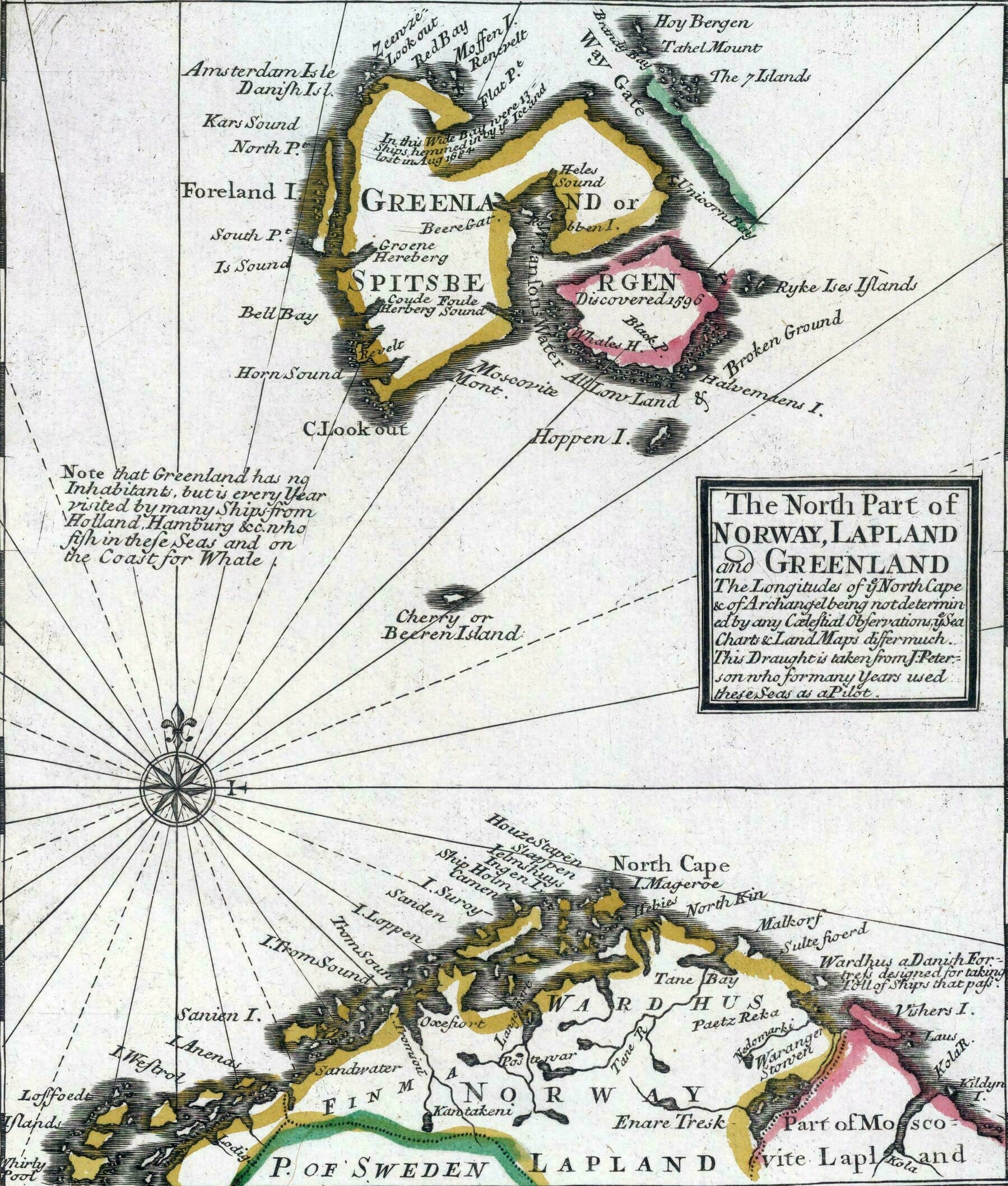
‘Why does it says Greenland?
Apparently in the 17th-18th centuries whalers often referred to the Svalbard archipelago as Greenland. I don’t know why, since proper Greenland was already known as such by then’
Michigan population density (2020)

‘Upper Peninsula has very few people
Not a good deal to exchange Toledo Strip for the Upper Peninsula
Except for all the Iron, Copper, and timber’
Major Ethnic Groups of Central Asia (1992)
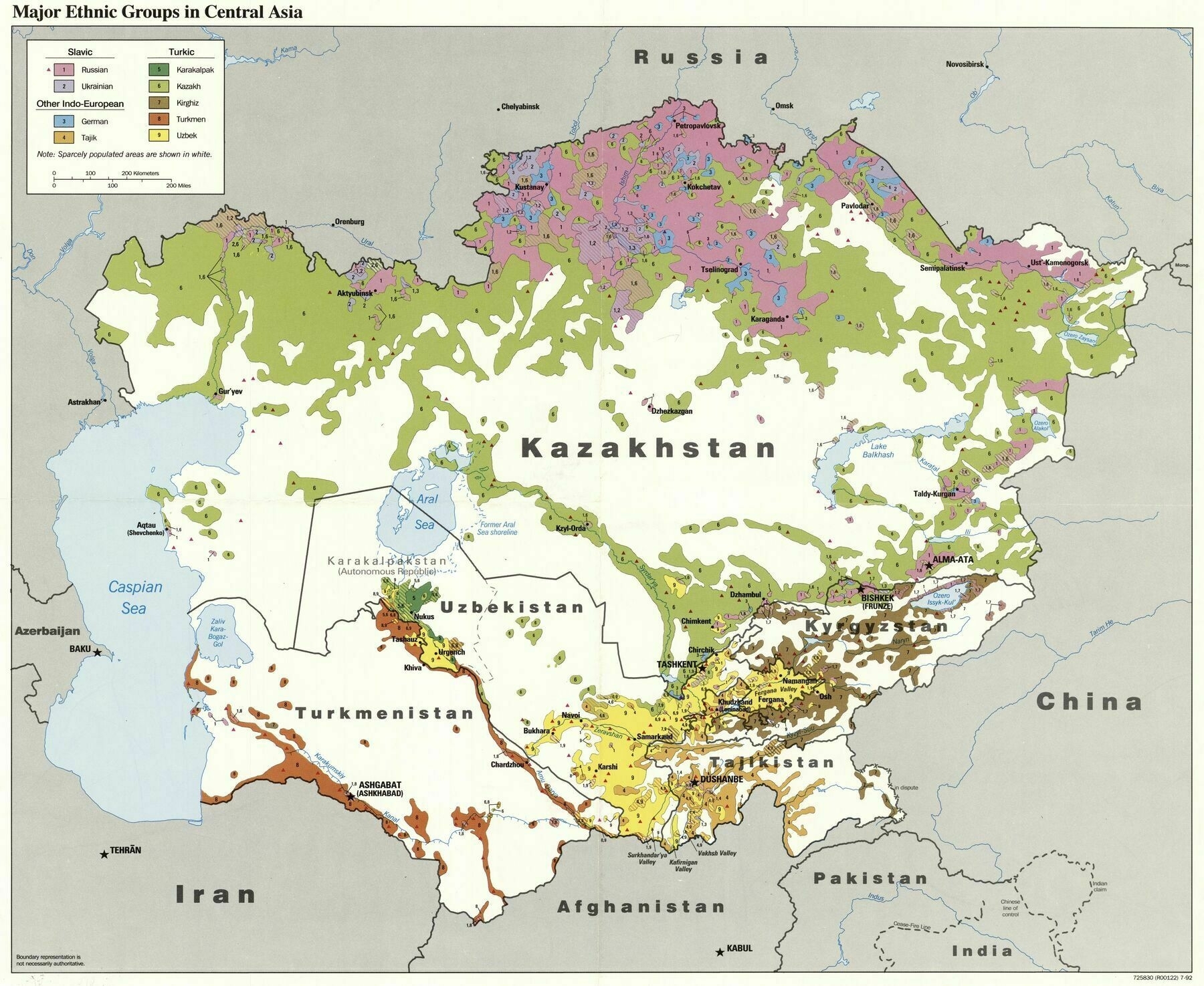
‘How did so many Germans end up so east?
Stalin had the Volga Germans deported’