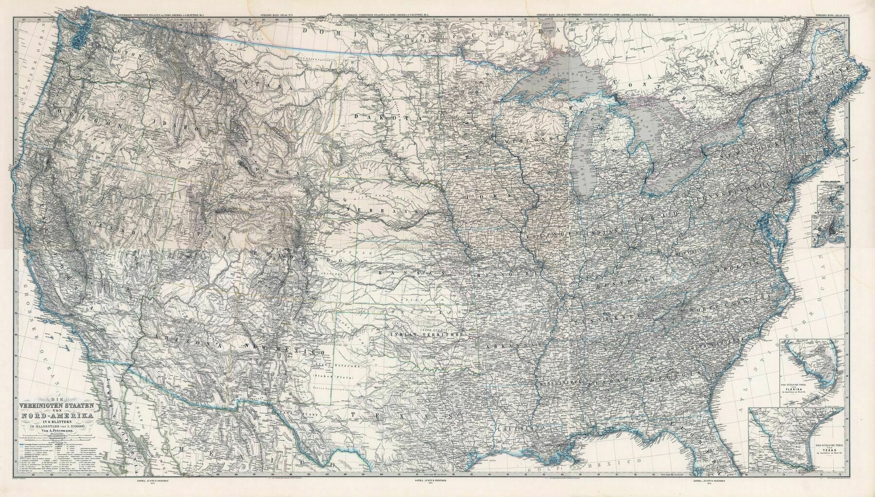
1875 map of the United States - by Adolf Steiler
1875 map of the United States - by Adolf Steiler
‘Ever notice that every adolf you hear about is pre 1930?’
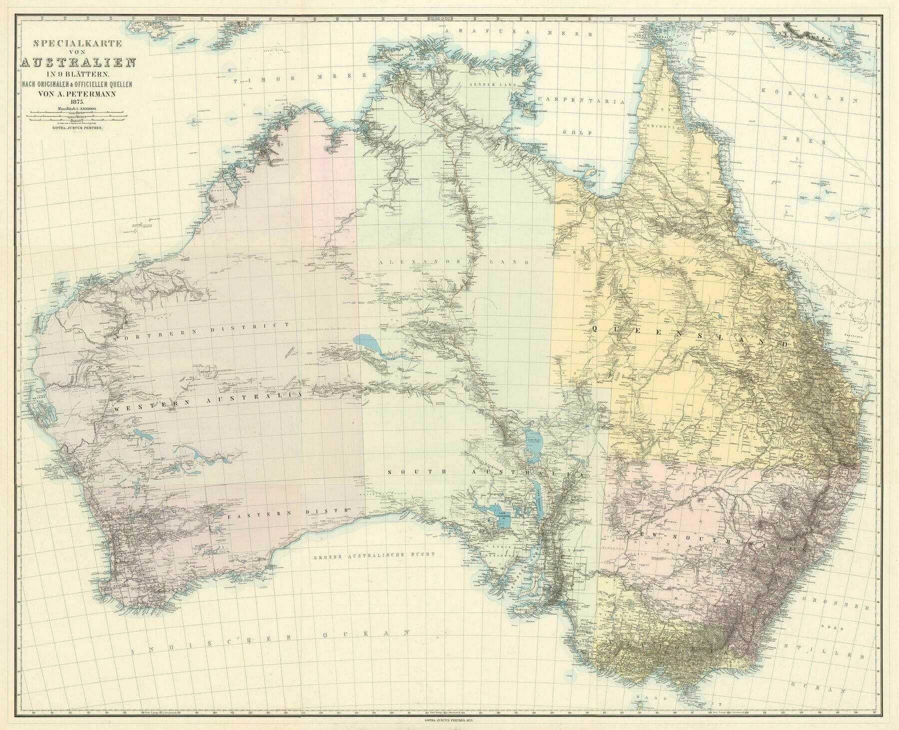
1875 map of Australia / by Adolf Stieler
1875 map of Australia / by Adolf Stieler
‘Adolf! Now there’s a name you don’t hear very often!’
1857 map of Kansas
1857 map of Kansas
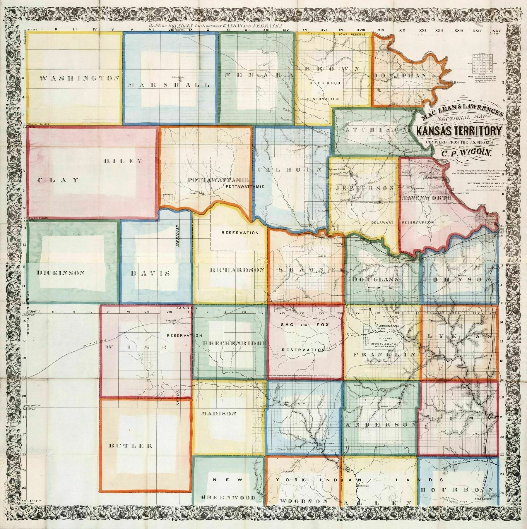
‘Squares inside of a square
It’s almost like farming works best in a square, to maximize effective space and construction of roads and fences
You’ve obviously not been in the eastern part of Kansas: it includes the Flint Hills, and the Osage cuesta ecoregion, especially the northern sections, are anything but flat. Triangles, circles, and other geometric shapes are harder to construct without there being leftover space, and let’s face it: land was money even back then. The decision to lay out the grids were simply a convenience to the surveying technologies of the day that made it much easier to lay out straight lines rather than follow the contours of the land, which probably would have made more sense as far as long term land management practices….’
1891 Japanese map of New Zealand
1904 map of Korea
1904 map of Korea
‘Besides Armenia and Korea, what other nations have a sacred mountain that they largely do not actually control?
Israel? Judaism think the Sinai is sacred and it is owned by Egypt’
1668 map of Dronthemhus, Norway
River Basins of Australia, its States, New Zealand and Papua New Guinea
Topographic map of Colorado - Joy Division style
Topographic map of Colorado - Joy Division style
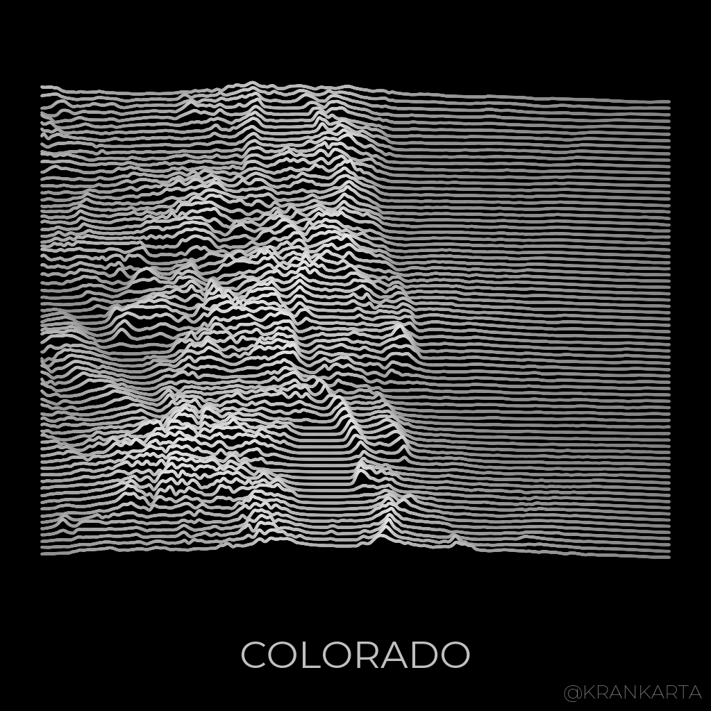
‘Is this available as a T-Shirt yet?’
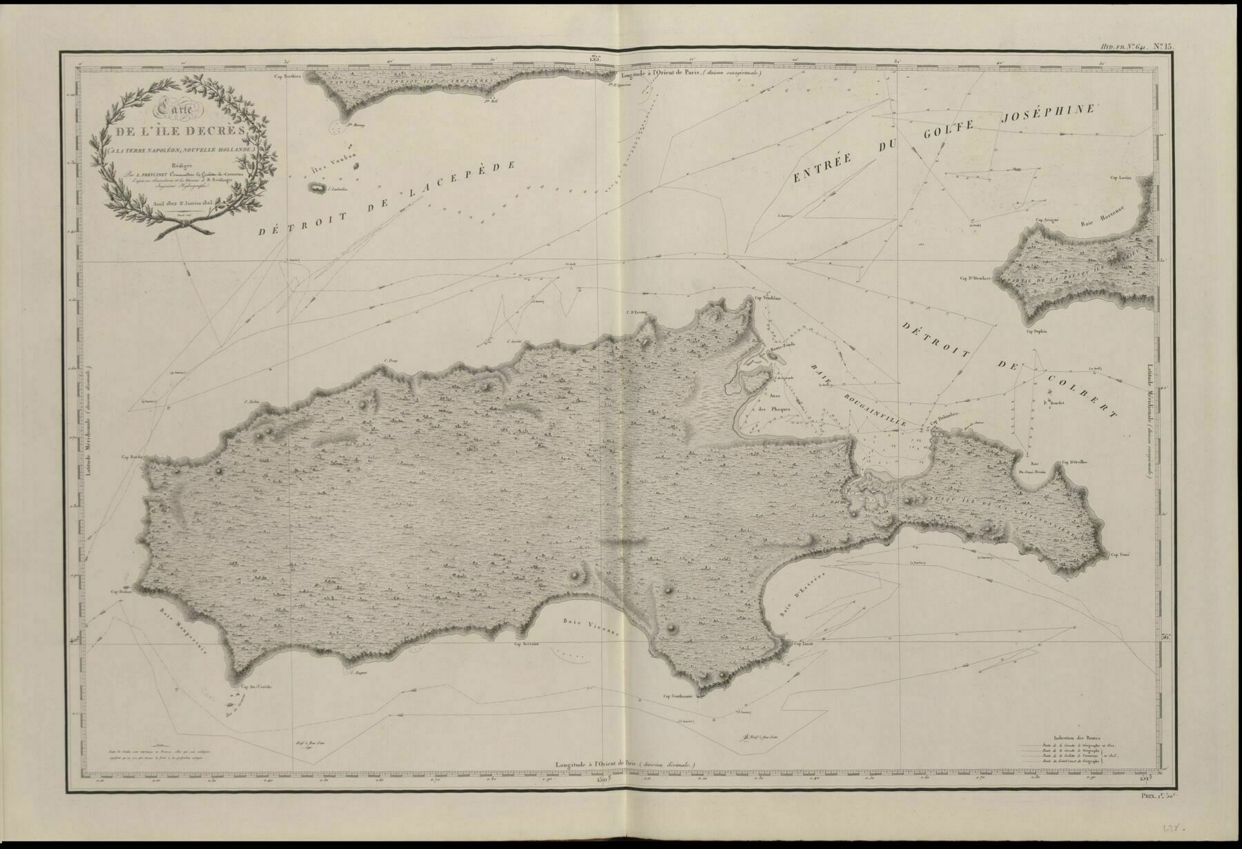
1802 map of Kangaroo Island
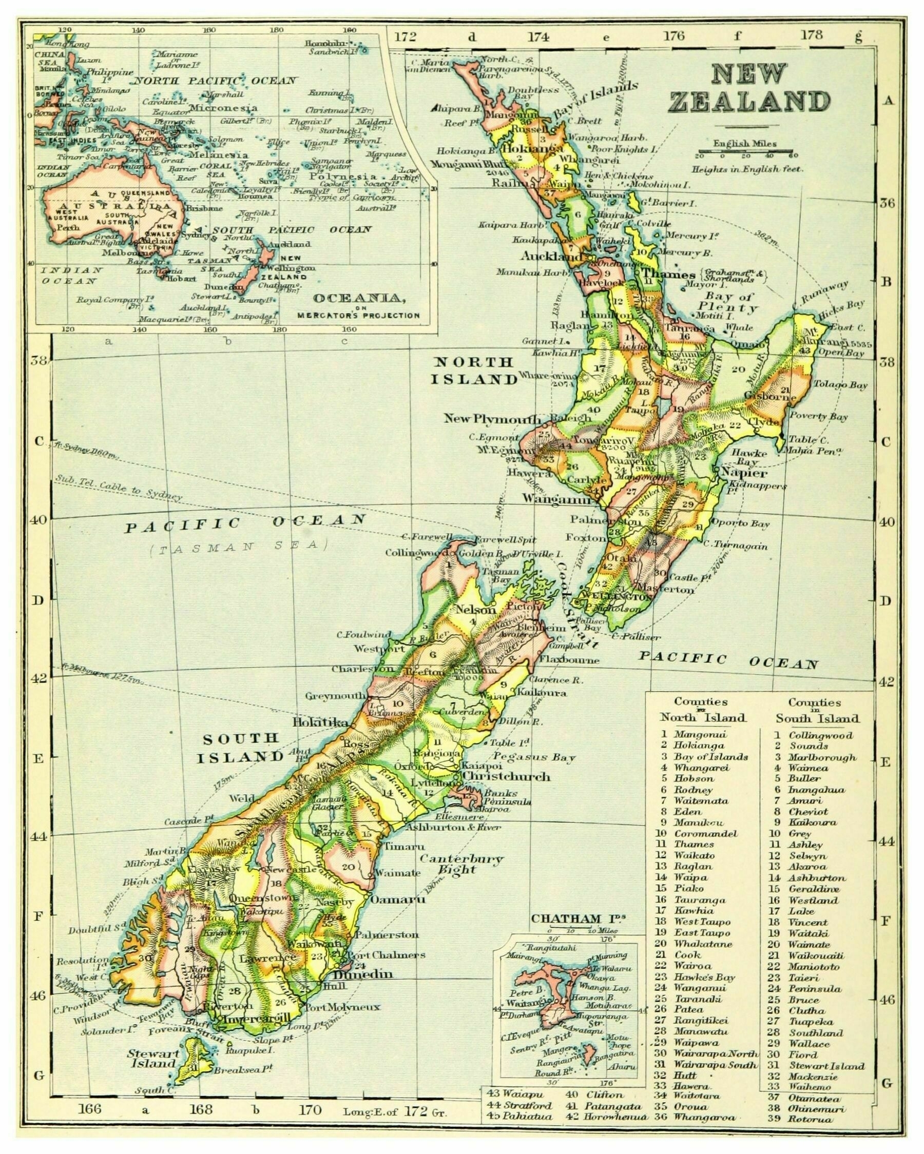
1899 map of New Zealand
Topographic map of North Macedonia
Topographic map of North Macedonia
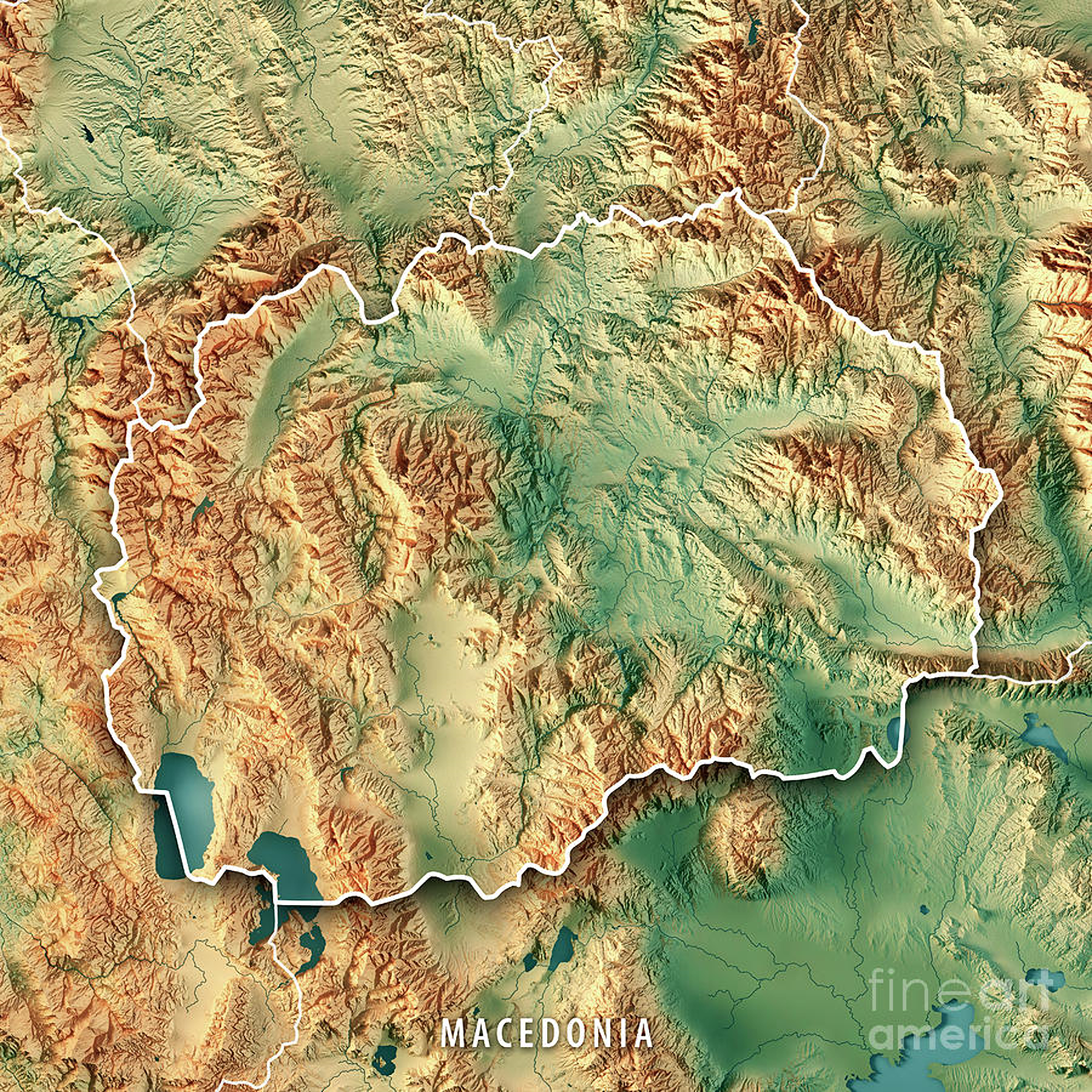
‘Will North Macedonia get a navy if they build that Aegean-Danube canal?
What would be the purpose? A canal will not give them territorial waters to protect.
At the moment they do not have an air force to patrol their airspace, NATO does that for them’
Rivers of Luxembourg
Rivers of Luxembourg
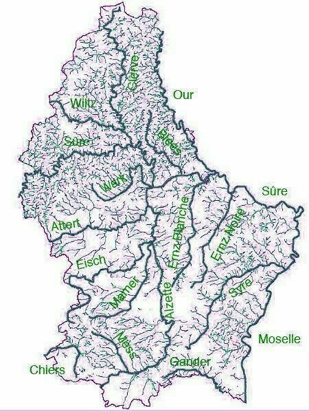
‘At first I thought one of them was called Wank
The other names aren’t much better: our, sure, mess’
1853 Birdseye view of Launceston, Tasmania from the Cataract Hill
1853 Birdseye view of Launceston, Tasmania from the Cataract Hill
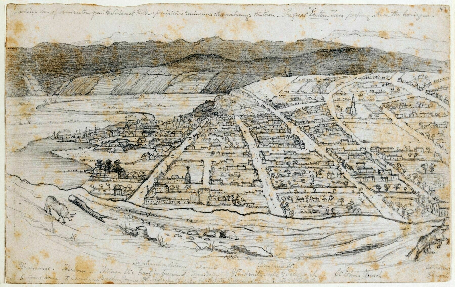
‘Looks like the view from West Launceston’
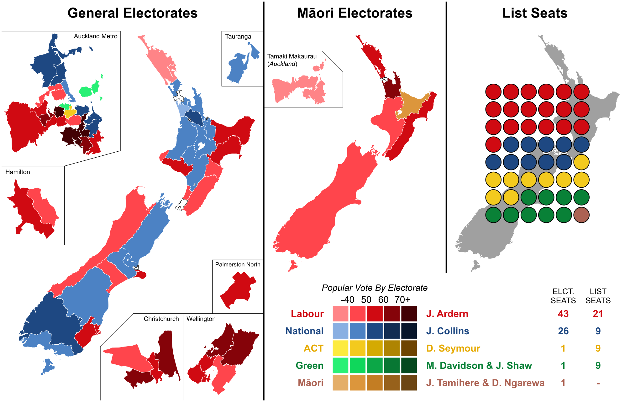
Results of the 2020 New Zealand general election
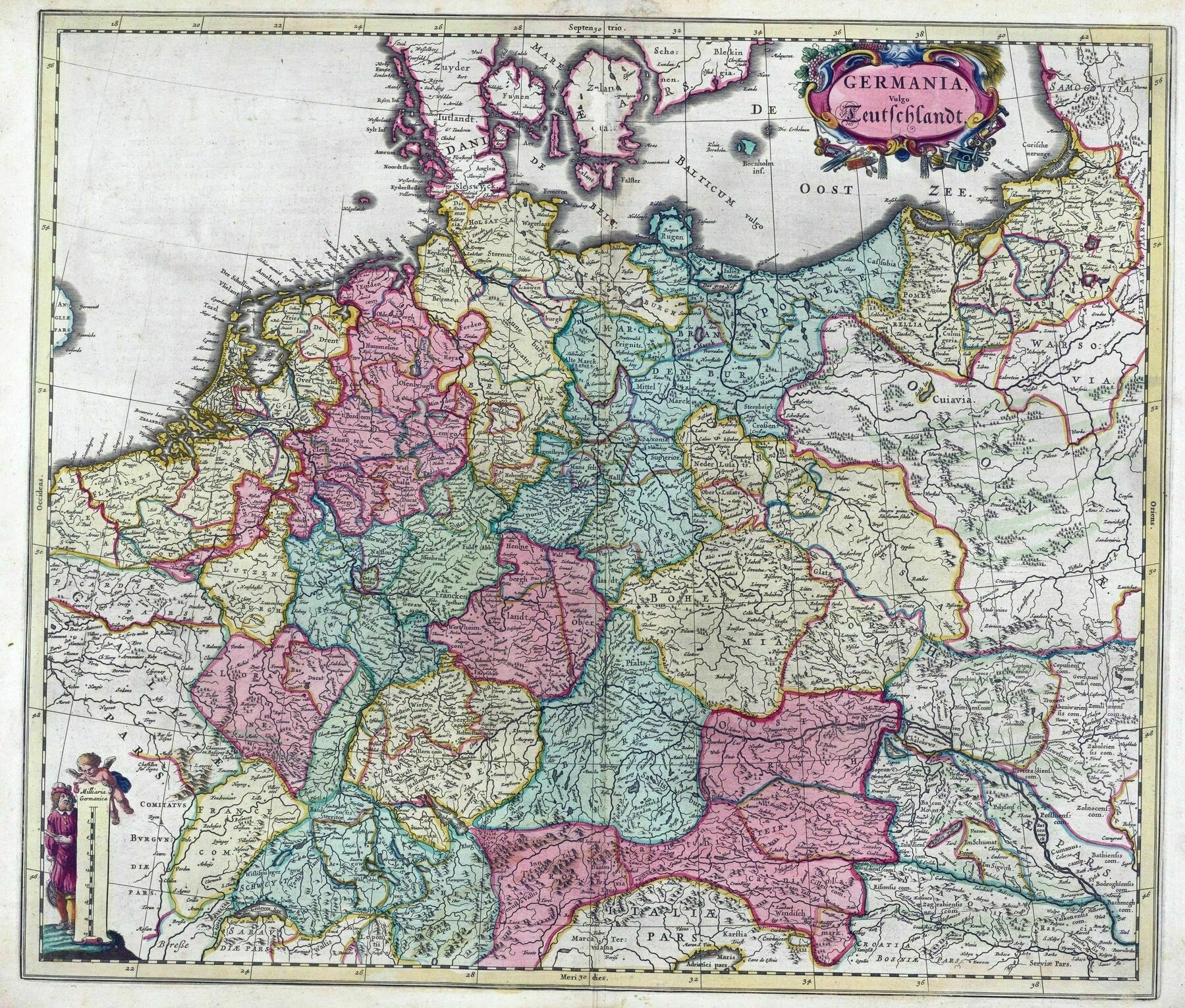
1665 map of Germany - by Joan Blaeu
Native forest in Australia, by crown cover class (2018)
Native forest in Australia, by crown cover class (2018)
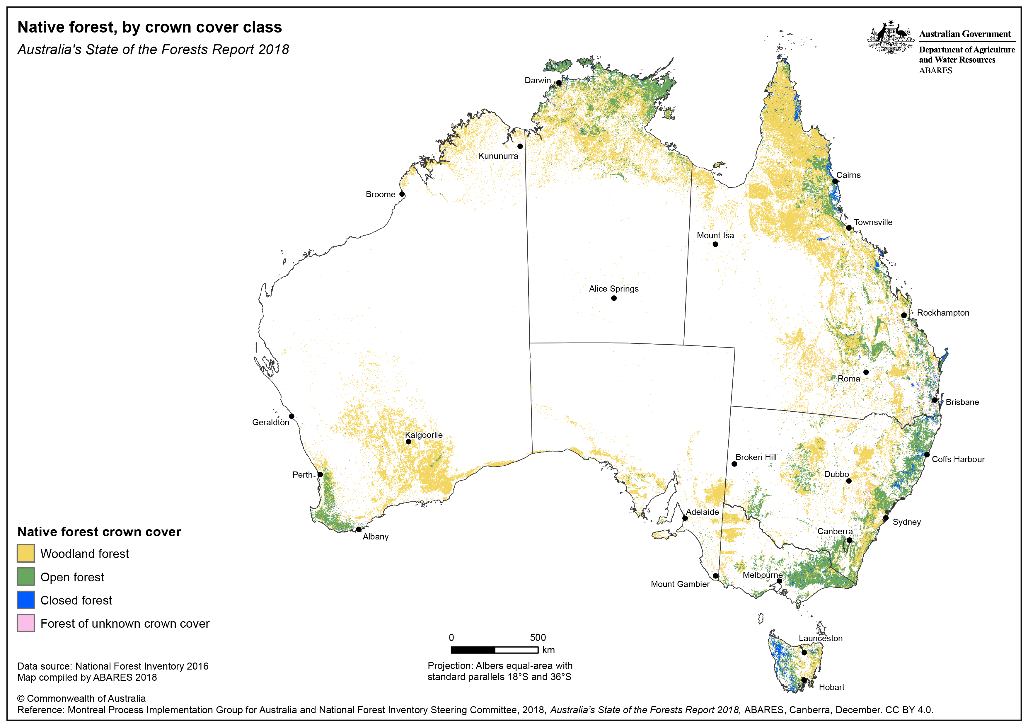
‘Woodland forest: As a National Forest Inventory cover class, native forest in which the tree crowns cover between 20% and 50% of the land area.
Open forest: As a National Forest Inventory cover class, forest in which the tree crowns cover from over 50% to 80% of the land area.
Closed forest: As a National Forest Inventory cover class, forest in which the tree crowns cover more than 80% of the land area.
-The last category has possibly been renamed, but could fall under
Other forest: A National Forest Inventory forest category that principally comprises non-commercial plantations and planted forests that are not reported through the National Plantation Inventory but that satisfy the definition of forest.
‘Other forest’ includes agroforestry plantations, sandalwood plantations, environmental plantings, plantations within the reserve system, and plantations regarded as not commercially viable. Non-planted forests dominated by introduced species are also included in this category.’
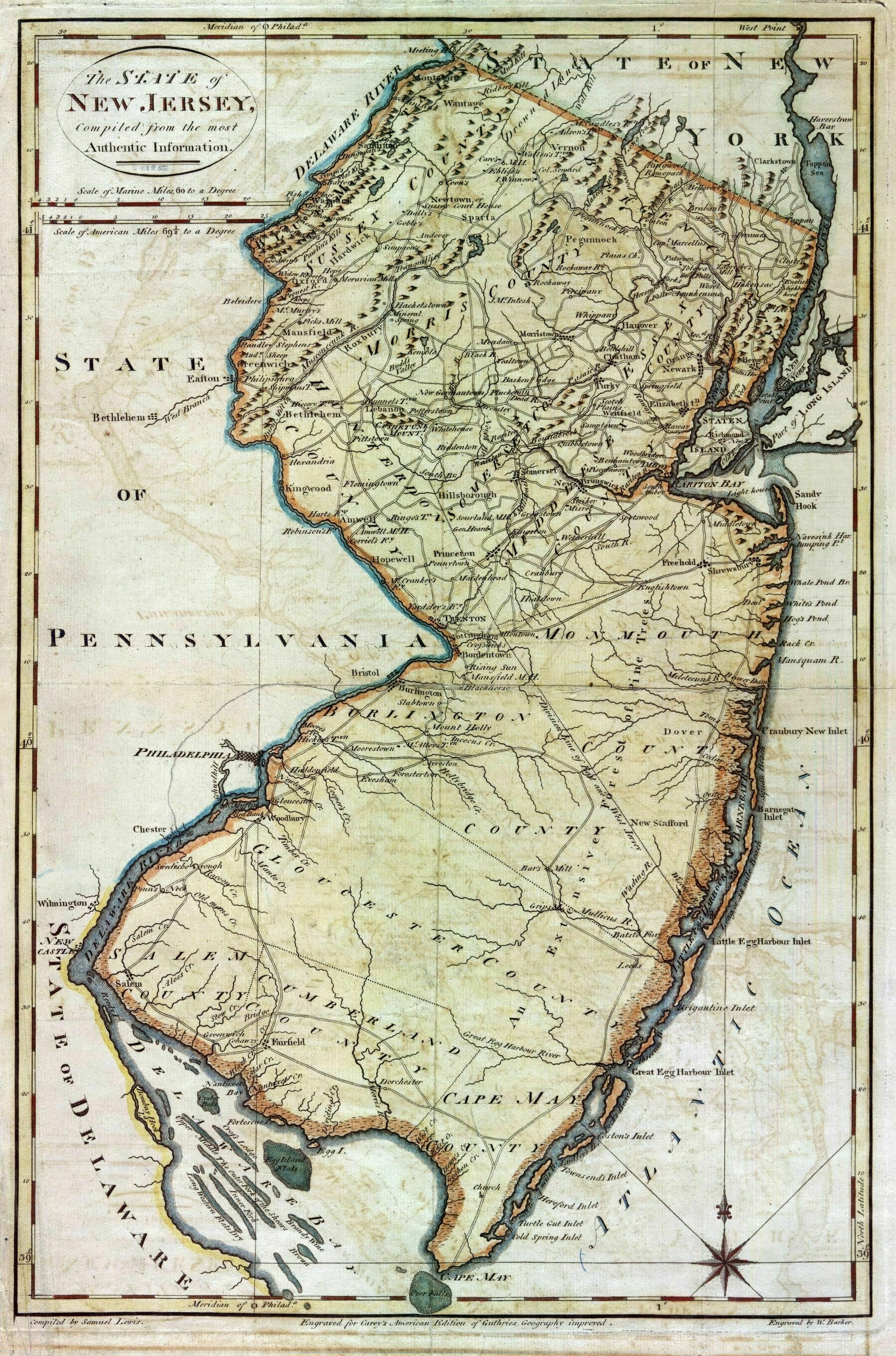
1795 map of New Jersey
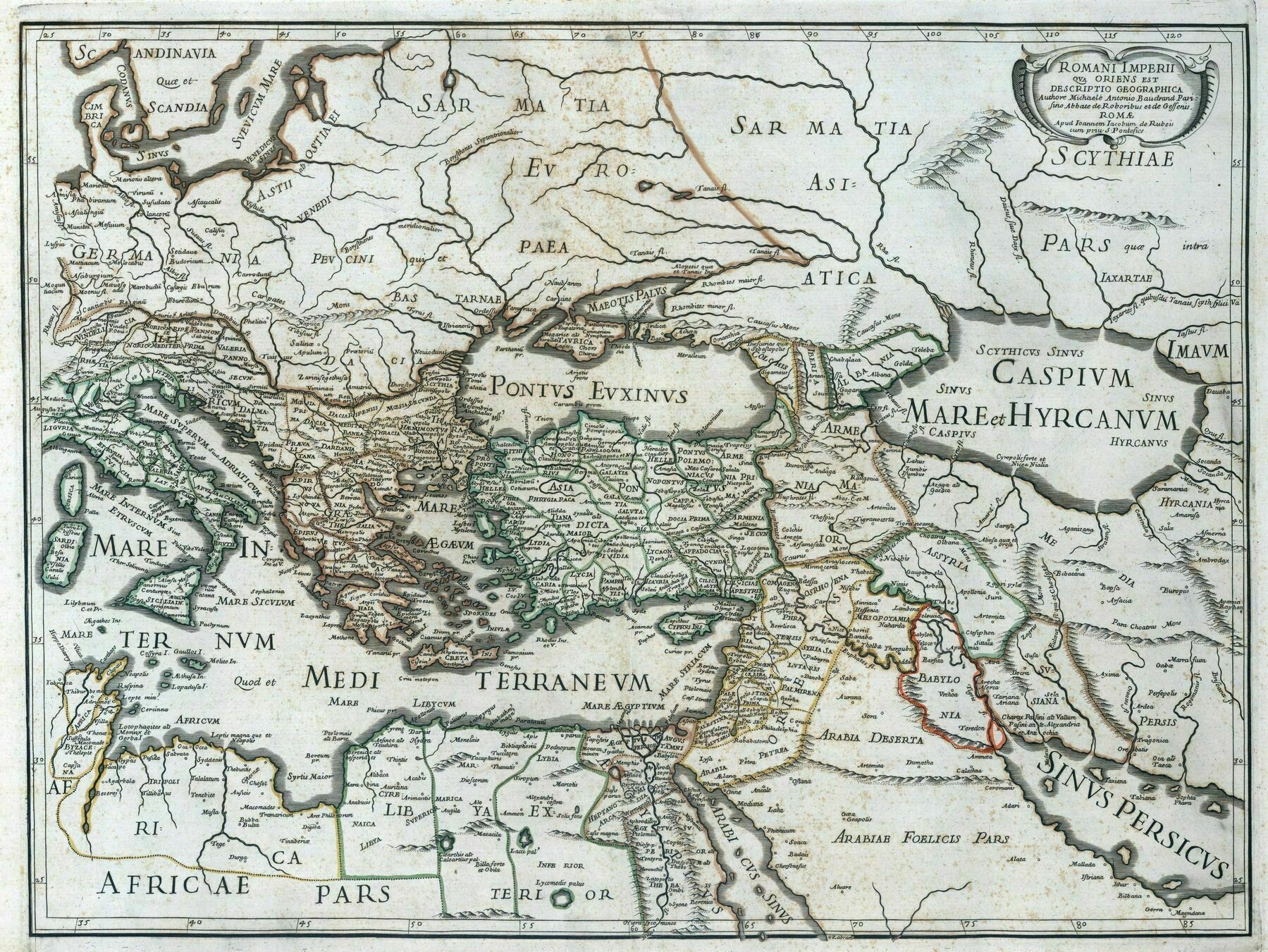
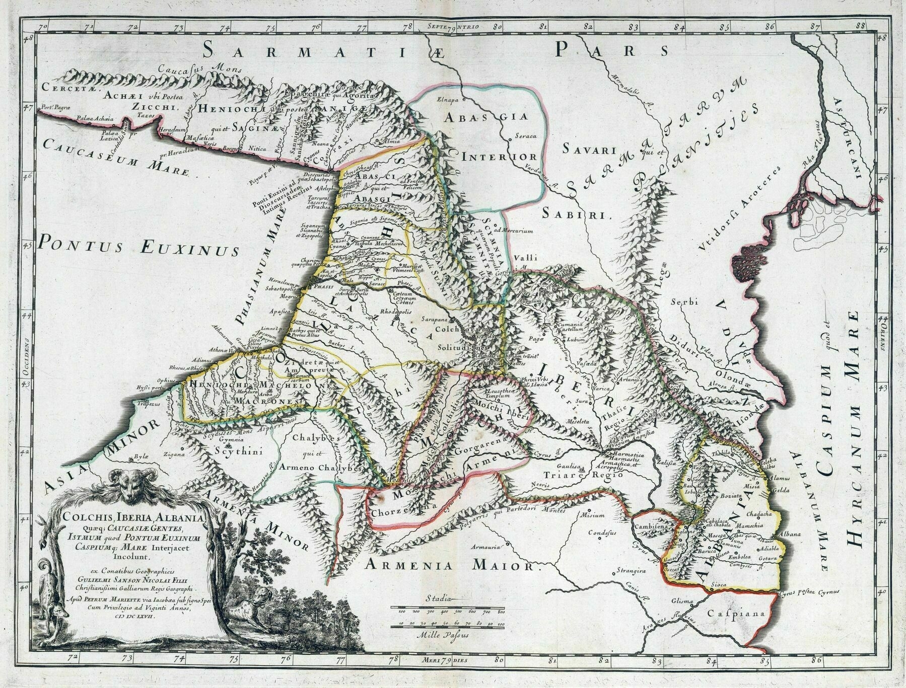
1667 map of the Caucasus / by Nicolas and Gullaume Sanson
Canberra - Federal Capital of Australia preliminary plan
Canberra - Federal Capital of Australia preliminary plan / signed by Walter Burley Griffin in 1913
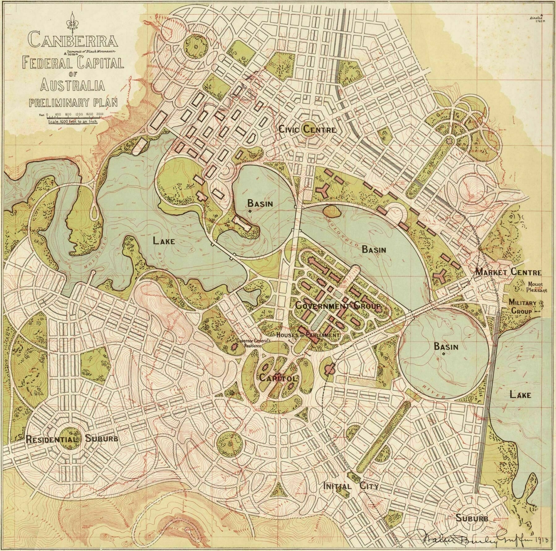
“We need more roundabouts. And make them wider!”
River basins of Thailand
River basins of Thailand. The largest river basins are the Chao Phraya basin (blue), and the Mekong River basin (pink)
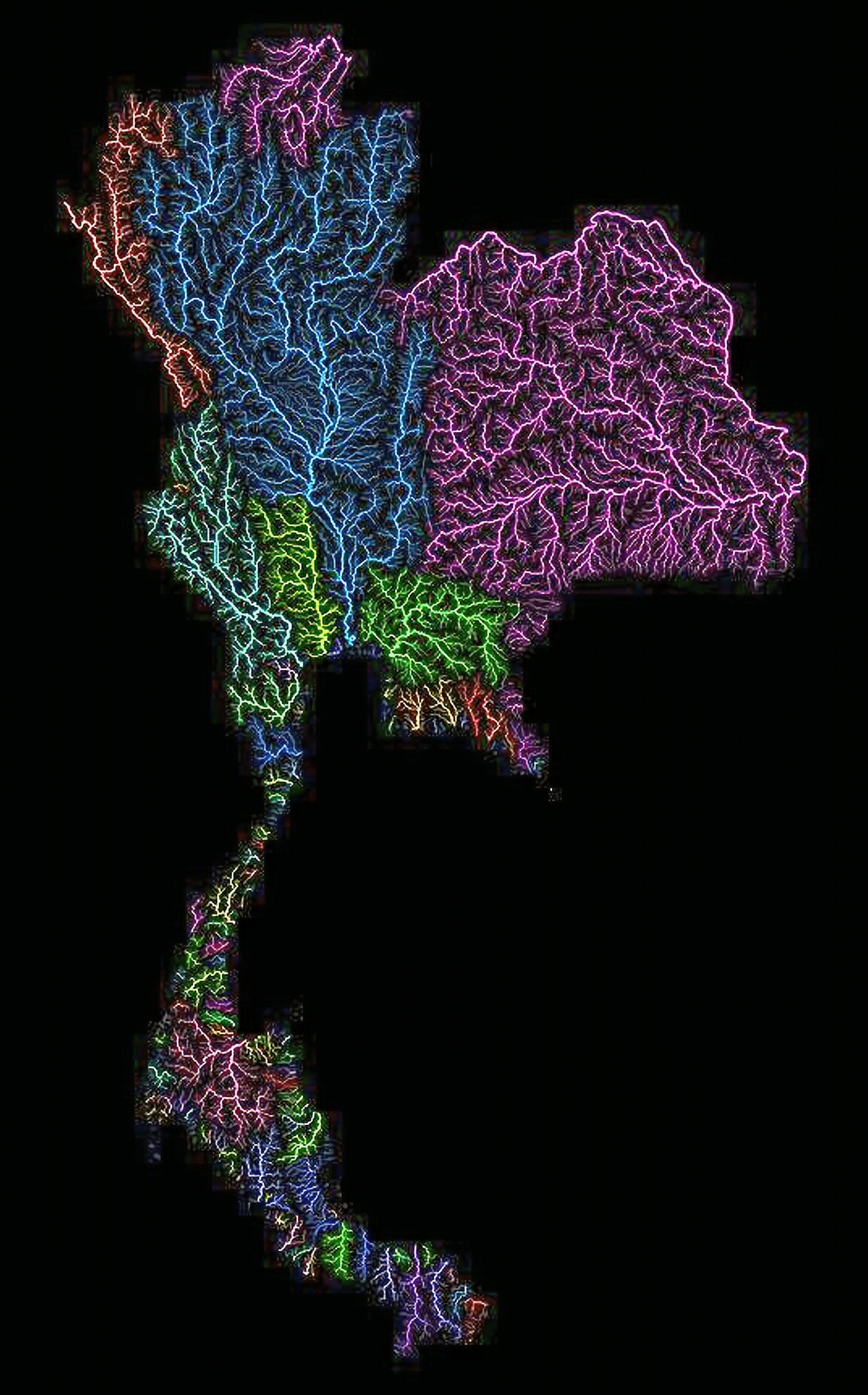
‘Woah, this is beautiful’
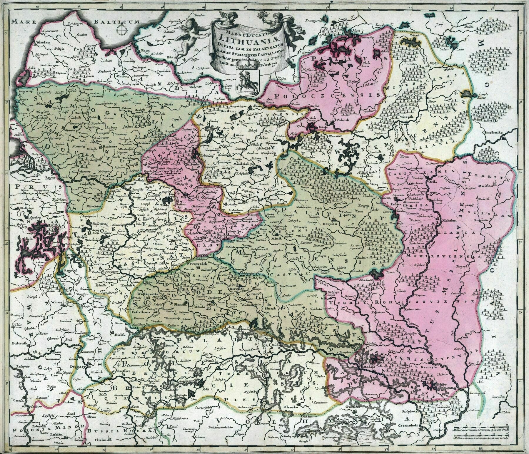
1788 map of Lithuania
A Map of England & Wales Portraying Their Agricultural Products & Fisheries (1929)
A Map of England & Wales Portraying Their Agricultural Products & Fisheries (1929) / Leslie MacDonald Gill
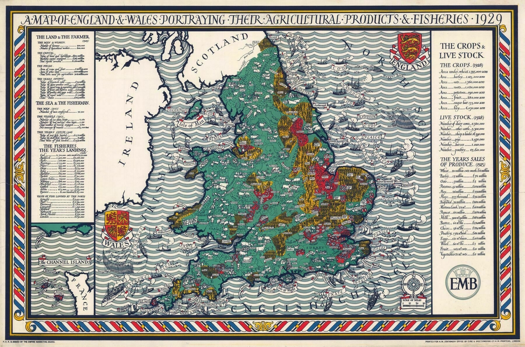
‘Beautiful! Love everything by Macdonald Gill’
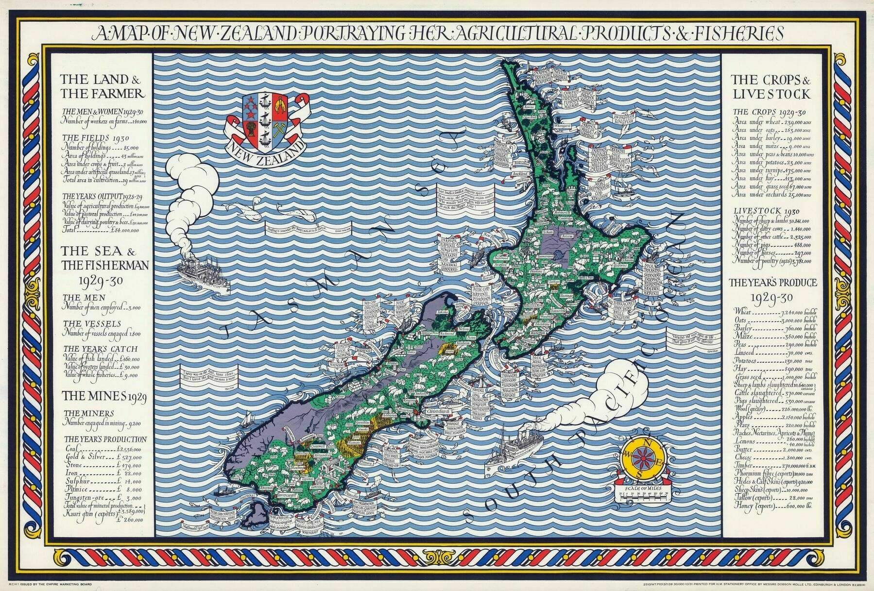
A Map of New Zealand Portraying Her Agricultural Products & Fisheries (1931)
A Map of New Zealand Portraying Her Agricultural Products & Fisheries (1931) / Leslie MacDonald Gill
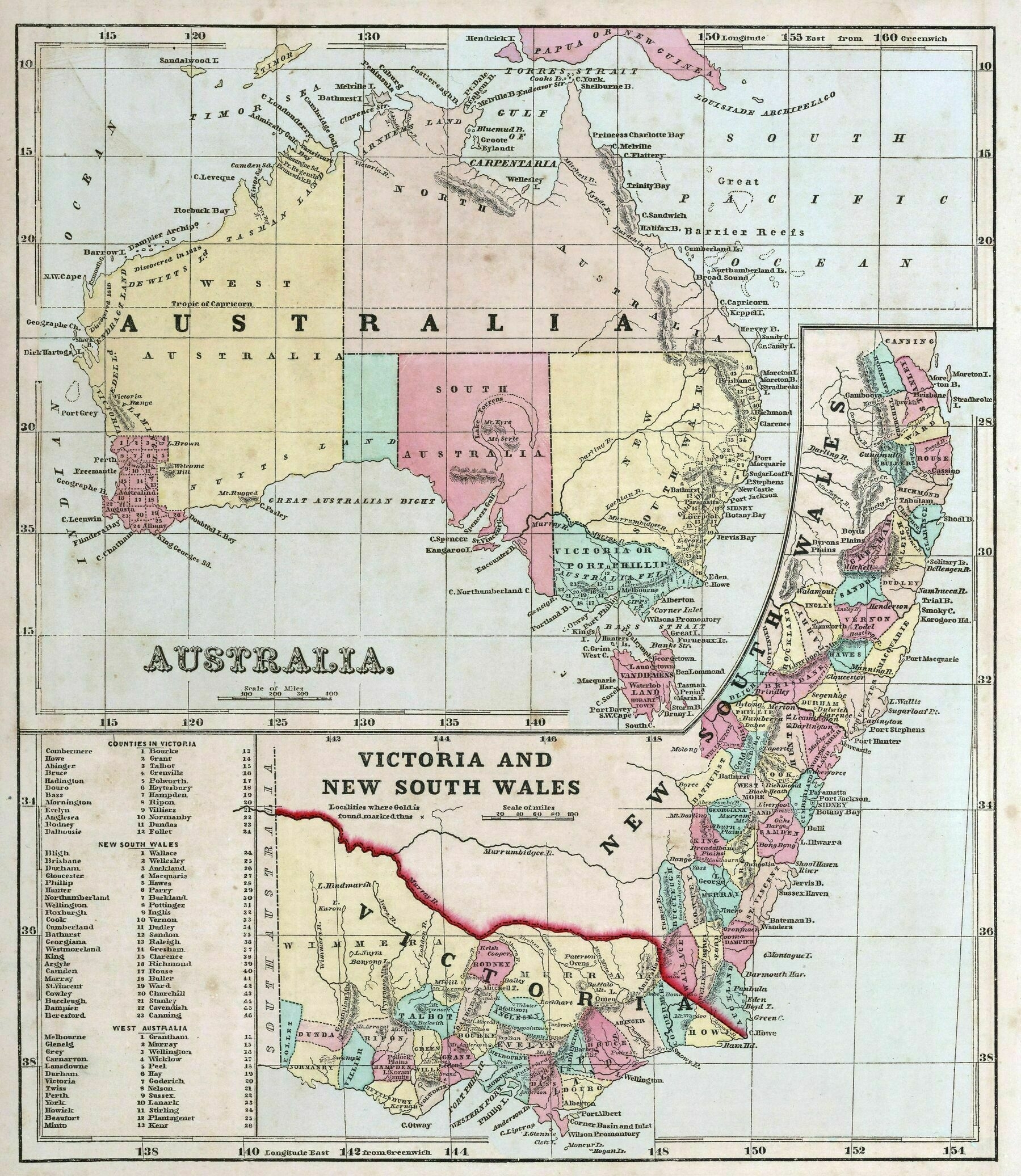
1856 map of Australia; Victoria, and New South Wales
1856 map of Australia; Victoria, and New South Wales
‘North Australia seems like it would be pretty rad!
Apparently North Queensland wants to secede from the south and become the 7th state’